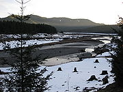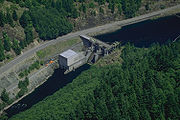
North Santiam River
Encyclopedia


Santiam River
The Santiam River is a tributary of the Willamette River, about long, in western Oregon in the United States. Through its two principal tributaries, the North Santiam and the South Santiam rivers, it drains a large area of the Cascade Range at the eastern side of the Willamette Valley east of...
in western Oregon
Oregon
Oregon is a state in the Pacific Northwest region of the United States. It is located on the Pacific coast, with Washington to the north, California to the south, Nevada on the southeast and Idaho to the east. The Columbia and Snake rivers delineate much of Oregon's northern and eastern...
in the United States
United States
The United States of America is a federal constitutional republic comprising fifty states and a federal district...
. It drains 766 mi2 of the Cascade Range
Cascade Range
The Cascade Range is a major mountain range of western North America, extending from southern British Columbia through Washington and Oregon to Northern California. It includes both non-volcanic mountains, such as the North Cascades, and the notable volcanoes known as the High Cascades...
on the eastern side of the Willamette Valley
Willamette Valley
The Willamette Valley is the most populated region in the state of Oregon of the United States. Located in the state's northwest, the region is surrounded by tall mountain ranges to the east, west and south and the valley's floor is broad, flat and fertile because of Ice Age conditions...
east of Salem
Salem, Oregon
Salem is the capital of the U.S. state of Oregon, and the county seat of Marion County. It is located in the center of the Willamette Valley alongside the Willamette River, which runs north through the city. The river forms the boundary between Marion and Polk counties, and the city neighborhood...
.
It rises in the high Cascades in eastern Linn
Linn County, Oregon
Linn County is a county located in the U.S. state of Oregon. It is named in honor of Lewis F. Linn, a U.S. Senator from Missouri who advocated the American occupation of the Oregon Country. By the 2010 US census the population of Linn county was 116,672 showing a 13.2% growth since the 2000 census...
county, northwest of Three Fingered Jack
Three Fingered Jack
Three Fingered Jack, named for its distinctive shape, is a Pleistocene volcano in the Cascade Range of Oregon. It is a deeply glaciated shield volcano and consists mainly of basaltic andesite lava...
in the Willamette National Forest
Willamette National Forest
The Willamette National Forest is a National Forest located in the central portion of the Cascade Range of US state of Oregon.It comprises 1,675,407 acres making it one of the largest national forests. Over 380,000 acres are designated wilderness which include seven major mountain peaks...
. It flows north through the mountains past Marion Forks
Marion Forks, Oregon
Marion Forks is an unincorporated community on the North Santiam Highway, 15 miles south of the city of Detroit, in Linn County, Oregon, United States....
, receiving the drainage from the western slope of Mt. Jefferson
Mount Jefferson (Oregon)
Mount Jefferson is a stratovolcano in the Cascade Volcanic Arc, part of the Cascade Range, and is the second highest mountain in Oregon. Situated in the far northeastern corner of Linn County on the Jefferson County line, about east of Corvallis, Mount Jefferson is in a rugged wilderness and is...
. Near Mt. Jefferson it turns sharply west, descending through a canyon
Canyon
A canyon or gorge is a deep ravine between cliffs often carved from the landscape by a river. Rivers have a natural tendency to reach a baseline elevation, which is the same elevation as the body of water it will eventually drain into. This forms a canyon. Most canyons were formed by a process of...
past Idanha
Idanha, Oregon
Idanha is a city on the Marion County/Linn County line in Oregon, United States, on Oregon Route 22 and the Santiam River. The population was 232 at the 2000 census....
and Detroit
Detroit, Oregon
Detroit is a city in Marion County, Oregon, United States. It was named for Detroit, Michigan in the 1890s because of the large number of people from Michigan in the community. The population was 262 at the 2000 census...
to Niagara County Park
Niagara County Park
Niagara County Park is a park located in the U.S. state of Oregon on the North Santiam River, 40 miles east of Salem on the North Santiam Highway, Oregon Route 22. It is 7 miles east of Mill City. The park protects the ruins of a rubble dam and a variety of indigenous plant species...
where the valley begins to widen and some agriculture use begins. Continuing west, the river flows past Gates
Gates, Oregon
Gates is a city on the border of Linn and Marion counties in Oregon, United States. The population was 471 at the 2000 census. The greater part of Gates' population is in Marion County and the city is primarily under Marion County's jurisdiction...
, Mill City
Mill City, Oregon
Mill City is a city in Linn and Marion counties in the U.S. state of Oregon. The population was 1,537 at the 2000 census. It is on the North Santiam River, downstream from Detroit Lake....
and Mehama
Mehama, Oregon
Mehama is an unincorporated community in Marion County, Oregon, United States, located on Oregon Route 22 and the North Santiam River. For statistical purposes, the United States Census Bureau has defined Mehama as a census-designated place . The census definition of the area may not precisely...
. It emerges through the foothills into the Willamette Valley near Stayton
Stayton, Oregon
Stayton is a city in Marion County, Oregon, United States, located southeast of the state capital, Salem, on Oregon Route 22. It is south of Sublimity and east of Aumsville. Located on the North Santiam River, Stayton is a regional agricultural and light manufacturing center. The population was...
, then flows 15 miles (24.1 km) southwest through the valley where it joins the South Santiam River
South Santiam River
The South Santiam River is a tributary of the Santiam River, about long, in western Oregon in the United States. It drains an area of the Cascade Range into the Willamette Valley east of Corvallis....
to form the Santiam River. The confluence is approximately 10 miles (16.1 km) east of the confluence of the Santiam and the Willamette River
Willamette River
The Willamette River is a major tributary of the Columbia River, accounting for 12 to 15 percent of the Columbia's flow. The Willamette's main stem is long, lying entirely in northwestern Oregon in the United States...
.
It is impounded by Detroit Dam
Detroit Dam
Detroit Dam was completed in 1953 by the U.S. Army Corp of Engineers on the North Santiam River between Linn County and Marion County, Oregon, in the Cascades...
in the mountains west of Detroit to form Detroit Lake
Detroit Lake
Detroit Lake is a reservoir impounded by the Detroit Dam on the North Santiam River southeast of Salem, Oregon, United States.The lake is adjacent to Oregon Route 22 near the city of Detroit....
for flood control. Detroit Lake State Park is located along the northern shore of the lake.
In the 19th century, the canyon of the North Santiam River provided a formidable obstacle to settlers. The construction of a railroad in 1887 opened up the canyon to settlement and logging of the surrounding mountains.
Natural history
The headwaters of Marion Creek, a tributary of the North Santiam River, originate at Marion LakeMarion Lake (Oregon)
Marion Lake is an alpine lake located in Linn County of the U.S. state of Oregon. The lake is in central Oregon's Cascades within the Mount Jefferson Wilderness Area...
, which is a location of many wildlife species. This headwaters area is a breeding location for a number of amphibian
Amphibian
Amphibians , are a class of vertebrate animals including animals such as toads, frogs, caecilians, and salamanders. They are characterized as non-amniote ectothermic tetrapods...
s including the rough-skinned newt
Rough-skinned Newt
The rough-skinned newt is a North American newt known for its strong poison.- Toxicity :Many newts produce toxins to avoid predation, but the toxins of the genus Taricha are particularly potent...
. The North Santiam river is a location chosen by a number of anglers because of its fishing quality.
Watershed
Ten cities draw their drinking water from the North Santiam watershed: DetroitDetroit, Oregon
Detroit is a city in Marion County, Oregon, United States. It was named for Detroit, Michigan in the 1890s because of the large number of people from Michigan in the community. The population was 262 at the 2000 census...
, Gates
Gates, Oregon
Gates is a city on the border of Linn and Marion counties in Oregon, United States. The population was 471 at the 2000 census. The greater part of Gates' population is in Marion County and the city is primarily under Marion County's jurisdiction...
, Indanha, Jefferson
Jefferson, Oregon
Jefferson is a city in Marion County, Oregon, United States. It is part of the Salem Metropolitan Statistical Area. The population was 2,487 at the 2000 census...
, Lyons
Lyons, Oregon
Lyons is a city in Linn County, Oregon, United States. The population was 1,008 at the 2000 census. The center of population of Oregon is located in Lyons.-Geography:...
, Mehama
Mehama, Oregon
Mehama is an unincorporated community in Marion County, Oregon, United States, located on Oregon Route 22 and the North Santiam River. For statistical purposes, the United States Census Bureau has defined Mehama as a census-designated place . The census definition of the area may not precisely...
, Mill City
Mill City, Oregon
Mill City is a city in Linn and Marion counties in the U.S. state of Oregon. The population was 1,537 at the 2000 census. It is on the North Santiam River, downstream from Detroit Lake....
, Salem
Salem, Oregon
Salem is the capital of the U.S. state of Oregon, and the county seat of Marion County. It is located in the center of the Willamette Valley alongside the Willamette River, which runs north through the city. The river forms the boundary between Marion and Polk counties, and the city neighborhood...
, Stayton
Stayton, Oregon
Stayton is a city in Marion County, Oregon, United States, located southeast of the state capital, Salem, on Oregon Route 22. It is south of Sublimity and east of Aumsville. Located on the North Santiam River, Stayton is a regional agricultural and light manufacturing center. The population was...
, and Turner
Turner, Oregon
Turner is a city in Marion County, Oregon, United States. The population was 1,199 at the 2000 census. It is part of the Salem Metropolitan Statistical Area...
.

