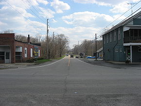
Ohio State Route 170
Encyclopedia

Columbiana County, Ohio
Columbiana County is a county located in the U.S. state of Ohio. As of 2010, the population was 107,841. It is named for Christopher Columbus and the county seat is Lisbon....
counties in northeast Ohio
Ohio
Ohio is a Midwestern state in the United States. The 34th largest state by area in the U.S.,it is the 7th‑most populous with over 11.5 million residents, containing several major American cities and seven metropolitan areas with populations of 500,000 or more.The state's capital is Columbus...
. It runs within a few miles of the Pennsylvania
Pennsylvania
The Commonwealth of Pennsylvania is a U.S. state that is located in the Northeastern and Mid-Atlantic regions of the United States. The state borders Delaware and Maryland to the south, West Virginia to the southwest, Ohio to the west, New York and Ontario, Canada, to the north, and New Jersey to...
border for much of its route as it passes though the eastern parts of the two counties. The southern terminus is at an interchange with U.S. 30, State Route 7, and State Route 11 near Calcutta
Calcutta, Ohio
Calcutta is a census-designated place in Columbiana County, Ohio, United States. The population was 3,491 at the 2000 census. Much of Calcutta is located on Ohio State Route 170.-Geography:Calcutta is located at ....
, and the northern at U.S. 62 in Youngstown
Youngstown, Ohio
Youngstown is a city in the U.S. state of Ohio and the county seat of Mahoning County; it also extends into Trumbull County. The municipality is situated on the Mahoning River, approximately southeast of Cleveland and northwest of Pittsburgh, Pennsylvania...
. ODOT
Ohio Department of Transportation
The Ohio Department of Transportation is the organization of state government responsible for developing and maintaining all state and federal roadways in the state of Ohio with exception of the Ohio Turnpike. In addition to highways, the department also helps develop public transportation and...
extended the northern terminus from the previous point of Interstate 680
Interstate 680 (Ohio)
Interstate 680 in the State of Ohio is the primary Interstate Highway passing through Youngstown, Ohio. Its northern terminus is at Interstate 80 and its southern terminus is at Interstate 76, the Ohio Turnpike.-Exit list:...
, changing signs on July 16 and 17, 2008.
History
- 1924 - Original state highway.
- 1924 - Originally routed from East Palestine to Petersburg.
- 1931 - Extended to East Liverpool along previous unnumbered road.
- 1962 - Extended to 1 miles (1.6 km) north of North Kingsville along previous route 90.
- 1970 - Truncated at 3 miles (4.8 km) north of Poland.
- 2008 - Extended 3 miles (4.8 km) to U.S. 62 in Youngstown along the former Route 625Ohio State Route 625State Route 625 is a state route in northeastern Ohio that exists entirely within Mahoning County. The western terminus of OH 625 is at US 224 in Boardman, and its eastern terminus is at US 62 in the southwestern portion of Youngstown. OH 625 is signed east–west...
.

