
Oklahoma State Highway 85
Encyclopedia
State Highway 85 is a state highway
in the northeastern part of the U.S. state
of Oklahoma
. The highway is 13.3 miles (21.4 km) long. SH-85 provides access to the northwest shore of Grand Lake
, a major recreation center for northwest Oklahoma. SH-85 has one lettered spur highway, SH-85A.
, in Craig County
. The highway travels east along Ketchum Road into the town. On the east side of Ketchum, SH-85 crosses into Delaware County
. Shortly after crossing the county line, the route turns north. The road crosses the Duck Creek arm of Grand Lake, then turns east and then northeast before returning to a due north course. SH-85 then passes through the unincorporated settlement of Cleora
. SH-85 then briefly turns east before once again heading north. SH-85 crosses Duck Creek proper near its source.
SH-85 then approaches a T intersection. The east leg of the T is SH-85A, while SH-85 follows the west leg of the T. The highway turns north again to intersect US-60/69, where SH-85 ends.
 SH-85A, a 5.68 miles (9.1 km) highway entirely in Delaware County, is the only lettered spur highway from SH-85. It begins at an intersection with SH-85 north of Cleora. The highway travels east to pass through the town of Bernice
, on the shores of Grand Lake. The highway crosses an arm of the lake just east of the town. SH-85A then ends at State Highway 125
.
State highway
State highway, state road or state route can refer to one of three related concepts, two of them related to a state or provincial government in a country that is divided into states or provinces :#A...
in the northeastern part of the U.S. state
U.S. state
A U.S. state is any one of the 50 federated states of the United States of America that share sovereignty with the federal government. Because of this shared sovereignty, an American is a citizen both of the federal entity and of his or her state of domicile. Four states use the official title of...
of Oklahoma
Oklahoma
Oklahoma is a state located in the South Central region of the United States of America. With an estimated 3,751,351 residents as of the 2010 census and a land area of 68,667 square miles , Oklahoma is the 28th most populous and 20th-largest state...
. The highway is 13.3 miles (21.4 km) long. SH-85 provides access to the northwest shore of Grand Lake
Grand Lake o' the Cherokees
Grand Lake o' the Cherokees is situated in Northeast Oklahoma, nestled in the foothills of the Ozark Mountain Range. The "o'" in the name of the lake stands for of not over. Grand Lake Of the Cherokees is the official name. It is often simply called Grand Lake...
, a major recreation center for northwest Oklahoma. SH-85 has one lettered spur highway, SH-85A.
Route description
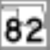
SH-85 begins at State Highway 82 west of the town of KetchumKetchum, Oklahoma
Ketchum is a town in Craig County, Oklahoma, United States. The population was 286 at the 2000 census.-History:Ketchum was named for a prominent Methodist minister named James Ketchum who helped found the town in 1898...
, in Craig County
Craig County, Oklahoma
Craig County is a county located in the U.S. state of Oklahoma. As of 2010, the population was 15,029, a gain of 0.5 percent from 14,950 in 2000. Its county seat is Vinita.Craig County was organized in 1907.-History:...
. The highway travels east along Ketchum Road into the town. On the east side of Ketchum, SH-85 crosses into Delaware County
Delaware County, Oklahoma
Delaware County is a county located in the U.S. state of Oklahoma. As of 2000, the population was 37,077 and the newest population estimate is 45,000. Its county seat is Jay. The county was named for the Delaware Indians resettled in what was then Indian Territory in the 1830s. .Delaware County...
. Shortly after crossing the county line, the route turns north. The road crosses the Duck Creek arm of Grand Lake, then turns east and then northeast before returning to a due north course. SH-85 then passes through the unincorporated settlement of Cleora
Cleora, Oklahoma
Cleora is a census-designated place in Delaware County, Oklahoma, United States, along State Highway 85. The population was 1,113 at the 2000 census. The Cleora Post Office existed from November 28, 1900 until October 15, 1954. Cleora was established in District 2 of the old Indian Territory...
. SH-85 then briefly turns east before once again heading north. SH-85 crosses Duck Creek proper near its source.
SH-85 then approaches a T intersection. The east leg of the T is SH-85A, while SH-85 follows the west leg of the T. The highway turns north again to intersect US-60/69, where SH-85 ends.
SH-85A
Bernice, Oklahoma
Bernice is a town in Delaware County, Oklahoma, United States. The population was 504 at the 2000 census.-Geography:Bernice is located at ....
, on the shores of Grand Lake. The highway crosses an arm of the lake just east of the town. SH-85A then ends at State Highway 125
State Highway 125 (Oklahoma)
State Highway 125 is a state highway in northeastern Oklahoma that is 26.3 mi long. It begins in the south at Grand Lake O' the Cherokees, running northward to meet State Highway 85A six miles later. It then crosses U.S. Highway 59 four miles later and US-60 near Fairland before ending in...
.