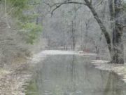
Ompompanoosuc River
Encyclopedia

River
A river is a natural watercourse, usually freshwater, flowing towards an ocean, a lake, a sea, or another river. In a few cases, a river simply flows into the ground or dries up completely before reaching another body of water. Small rivers may also be called by several other names, including...
, about 25 mi (40 km) long, in eastern Vermont
Vermont
Vermont is a state in the New England region of the northeastern United States of America. The state ranks 43rd in land area, , and 45th in total area. Its population according to the 2010 census, 630,337, is the second smallest in the country, larger only than Wyoming. It is the only New England...
in the United States
United States
The United States of America is a federal constitutional republic comprising fifty states and a federal district...
. It is a tributary
Tributary
A tributary or affluent is a stream or river that flows into a main stem river or a lake. A tributary does not flow directly into a sea or ocean...
of the Connecticut River
Connecticut River
The Connecticut River is the largest and longest river in New England, and also an American Heritage River. It flows roughly south, starting from the Fourth Connecticut Lake in New Hampshire. After flowing through the remaining Connecticut Lakes and Lake Francis, it defines the border between the...
, which flows to Long Island Sound
Long Island Sound
Long Island Sound is an estuary of the Atlantic Ocean, located in the United States between Connecticut to the north and Long Island, New York to the south. The mouth of the Connecticut River at Old Saybrook, Connecticut, empties into the sound. On its western end the sound is bounded by the Bronx...
. According to the Geographic Names Information System
Geographic Names Information System
The Geographic Names Information System is a database that contains name and locative information about more than two million physical and cultural features located throughout the United States of America and its territories. It is a type of gazetteer...
, the river has also been known by the names "Om-pom-pa-noos-uc" and "Pompanoosuc."
The Ompompanoosuc River rises in eastern Orange County in the town of Vershire
Vershire, Vermont
Vershire is a town in Orange County, Vermont, United States, created under Vermont Charter of August 3, 1781. The population was 629 at the 2000 census.-Geography:...
, and flows generally southwardly through the towns of West Fairlee
West Fairlee, Vermont
West Fairlee is a town in Orange County, Vermont, United States. The population was 726 at the 2000 census.-Geography:According to the United States Census Bureau, the town has a total area of 22.8 square miles , of which 22.6 square miles is land and 0.2 square mile is water...
and Thetford
Thetford, Vermont
Thetford is a town in Orange County, Vermont, United States in the Connecticut River Valley. The population was 2,617 at the 2000 census. Villages within the town include East Thetford, North Thetford, Thetford Hill, Thetford Center, Rices Mills and Post Mills. The town office is in Thetford...
into northeastern Windsor County, where it joins the Connecticut River in the town of Norwich
Norwich, Vermont
Norwich is a town in Windsor County, Vermont, United States, located along the Connecticut River opposite Hanover, New Hampshire. The population was 3,544 at the 2000 census....
.
In Thetford the river is dam
Dam
A dam is a barrier that impounds water or underground streams. Dams generally serve the primary purpose of retaining water, while other structures such as floodgates or levees are used to manage or prevent water flow into specific land regions. Hydropower and pumped-storage hydroelectricity are...
med by the Union Village Dam, which was completed in 1950 as part of a U.S. Army Corps of Engineers project for flood
Flood
A flood is an overflow of an expanse of water that submerges land. The EU Floods directive defines a flood as a temporary covering by water of land not normally covered by water...
control..
The West Branch Ompompanoosuc River flows generally southeastwardly through the towns of Vershire and Strafford
Strafford, Vermont
Strafford is a town in Orange County, Vermont, United States. The population was 1,045 at the 2000 census. The town of Strafford was created on August 12, 1761 by way of a royal charter which King George III of England issued to Governor Benning Wentworth of New Hampshire...
to Thetford, where it joins the main stem of the river.

