
Orléans, Ontario
Encyclopedia
Orleans also written Orléans, is a suburb
Suburb
The word suburb mostly refers to a residential area, either existing as part of a city or as a separate residential community within commuting distance of a city . Some suburbs have a degree of administrative autonomy, and most have lower population density than inner city neighborhoods...
an area within the city of Ottawa
Ottawa
Ottawa is the capital of Canada, the second largest city in the Province of Ontario, and the fourth largest city in the country. The city is located on the south bank of the Ottawa River in the eastern portion of Southern Ontario...
, Ontario
Ontario
Ontario is a province of Canada, located in east-central Canada. It is Canada's most populous province and second largest in total area. It is home to the nation's most populous city, Toronto, and the nation's capital, Ottawa....
, Canada
Canada
Canada is a North American country consisting of ten provinces and three territories. Located in the northern part of the continent, it extends from the Atlantic Ocean in the east to the Pacific Ocean in the west, and northward into the Arctic Ocean...
. It is located in the eastern part of the city along the Ottawa River
Ottawa River
The Ottawa River is a river in the Canadian provinces of Ontario and Quebec. For most of its length, it now defines the border between these two provinces.-Geography:...
, about 16 km (9.9 mi) from downtown Ottawa. The Canada 2006 Census
Canada 2006 Census
The Canada 2006 Census was a detailed enumeration of the Canadian population. Census day was May 16, 2006. The next census following will be the 2011 Census. Canada's total population enumerated by the 2006 census was 31,612,897...
gave Orleans a population of 95,491. It became a ward of the City of Ottawa
City of Ottawa
The City of Ottawa is the corporate entity of municipal government in Ottawa, Ontario, Canada. The corporation is responsible for provision of services to the public as well as enforcement of municipal by-laws...
in 2001. Prior to 2001, the community of Orleans was spread over two municipal jurisdictions, the eastern portion being in the pre-amalgamation City of Cumberland
Cumberland, Ontario
Cumberland was a township in eastern Ontario, Canada, that existed from 1800 to 1999, when it was incorporated as the City of Cumberland. It ceased to be a separate municipality in 2001, when it was amalgamated into the city of Ottawa.-History:...
, the western portion in the City of Gloucester
Gloucester, Ontario
Gloucester is a suburb of and within the City of Ottawa. Gloucester Township was established in 1792 and originally included lands east of the Rideau River from the Ottawa River south to Manotick. It was incorporated as a township in 1850 and became a city in 1981...
.
History
The community is thought to have been named by its first postmaster, Théodore Besserer, after his place of birth, the Île d'OrléansÎle d'Orléans
Île d'Orléans is located in the Saint Lawrence River about east of downtown Quebec City, Quebec, Canada. The island was one of the first parts of the province to be colonized by the French, and a large percentage of French Canadians can trace ancestry to early residents of the island...
near Quebec City
Quebec City
Quebec , also Québec, Quebec City or Québec City is the capital of the Canadian province of Quebec and is located within the Capitale-Nationale region. It is the second most populous city in Quebec after Montreal, which is about to the southwest...
. Orleans was an incorporated police village
Police village
A police village was a form of municipal government used in the province of Ontario, Canada, beginning in the early 19th century. It was used in cases where the finances or population of the area did not permit the creation of a village....
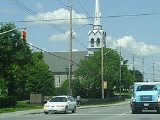
from 1922 to 1974 and was then known as St. Joseph d'Orléans. The name corresponds to the main francophone Roman Catholic Church, Paroisse St. Joseph of which the older part of Orleans is built around, along St. Joseph Boulevard.
Joan of Arc
Saint Joan of Arc, nicknamed "The Maid of Orléans" , is a national heroine of France and a Roman Catholic saint. A peasant girl born in eastern France who claimed divine guidance, she led the French army to several important victories during the Hundred Years' War, which paved the way for the...
) was a 15th century martyr who led the French army to victory in Orléans
Orléans
-Prehistory and Roman:Cenabum was a Gallic stronghold, one of the principal towns of the Carnutes tribe where the Druids held their annual assembly. It was conquered and destroyed by Julius Caesar in 52 BC, then rebuilt under the Roman Empire...
, France
France
The French Republic , The French Republic , The French Republic , (commonly known as France , is a unitary semi-presidential republic in Western Europe with several overseas territories and islands located on other continents and in the Indian, Pacific, and Atlantic oceans. Metropolitan France...
.
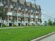
Largely a rural area for a great number of years, the first major suburban subdivision constructed in the community was the Queenswood Heights development starting in the late 1960s. Orleans has continued its steady growth as a suburban community since that time; its southern and easternmost boundaries continue to grow as more houses and businesses are built. Orleans continues to have a sizable French
French language
French is a Romance language spoken as a first language in France, the Romandy region in Switzerland, Wallonia and Brussels in Belgium, Monaco, the regions of Quebec and Acadia in Canada, and by various communities elsewhere. Second-language speakers of French are distributed throughout many parts...
-speaking population, although the proportion of francophone
Francophone
The adjective francophone means French-speaking, typically as primary language, whether referring to individuals, groups, or places. Often, the word is used as a noun to describe a natively French-speaking person....
s has been decreasing in recent years. The community's name is spelled with an acute accent in French in the relevant regulation to the City of Ottawa Act, reflective of the area's francophone heritage.
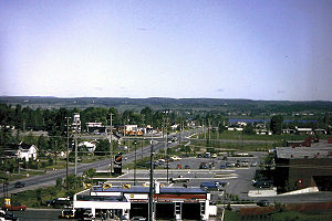
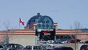
Growth has focused around the Place d'Orléans
Place d'Orleans
Place d'Orléans is a large shopping mall in the eastern end of Ottawa, Ontario, Canada, in the community of Orléans. The property is about . It currently holds three large department stores and about 175 small shops, including a food court...
shopping centre, a large shopping centre with over 175 stores situated off Regional Road 174
Regional Road 174
Ottawa Regional Road 174, commonly referred to as Highway 174, is a regionally maintained road in the city of Ottawa which serves the eastern suburbs of Orléans and Cumberland. Although the road continues through the towns of Rockland and Hawkesbury to the Quebec border, the portion east of the...
(the Queensway
Queensway (Ottawa)
The Queensway is a major controlled-access freeway running through Ottawa, Ontario, Canada, from Kanata in the west to Orleans in the east. It is the primary east-west transportation artery in the Ottawa-Gatineau area....
). Place D'Orléans was originally constructed in 1979 and underwent major expansions in 1984, 1988, and 1990 to arrive at its current size and configuration. Many new business areas along Innes Road between Tenth Line Road and Mer Bleue Road and in the vicinity of Trim Road on the eastern end of the area have also been built recently which serve to diversify the commercial districts of the community. The country-wide housing boom starting from 2000 has also seen an extremely large amount of housing and residential areas being developed in the eastern Orleans area east of Trim Road and south of Innes Road, such as the new community called Avalon
Avalon, Ottawa
Avalon is a neighbourhood located in Ottawa, Ontario It is located in the east end of the city in Orleans.This neighbourhood was non-existent until the late 1990s when the urban sprawl intensified in the east end...
. The population and business growth also forced the improvement of Innes Road from a two-lane to a four-lane road in 2005.
Recreational Facilities
The Elizabeth ManleyElizabeth Manley
Elizabeth Ann Manley, CM is a Canadian figure skater. She is the 1988 Olympic silver medalist, 1988 World silver medalist, and three-time Canadian champion.-Early life and training:...
skating rink at the Bob MacQuarrie Orléans Recreation Complex (formerly Orléans Recreation Complex) is named for Ms. Manley who trained there and who won a Silver Medal in Women's figure skating in the 1988 Calgary Winter Olympics
Figure skating at the 1988 Winter Olympics
Figure skating at the 1988 Winter OlympicsThe events took place at the Stampede Corral and the Olympic Saddledome in Calgary, Alberta, Canada.-Medal table:-Men's:-Free Skate final standings :Referee:* Sonia Bianchetti...
. It is home to the Gloucester Skating Club
Gloucester Skating Club
The Gloucester Skating Club is a non-profit skating club located at 1490 Youville Drive in Orleans, Ontario, Canada. The club has been serving skaters since 1971. The club is currently one of the 6th largest clubs in Canada with an active membership of more than 1100 skaters...
and the Canadian Academy of Skating Arts. The skating club is well known for sending skaters to national and international level competitions. The Ray Friel Recreational Complex in the more eastern part of Orleans is home to a public library, a high school, an indoor wave pool, exercising facilities, a physiotherapy clinic, a sports store, a restaurant, two soccer fields and three skating arenas making it one of the main centres for recreation in Orleans.
Along the Ottawa River in the north-east of Orleans, is the parkland of Petrie Island
Petrie Island
Petrie Island is an island situated in the Ottawa River in the eastern part of the city of Ottawa, Ontario, Canada. The island has several nearby islands and the general collection of islands is also called Petrie Island....
. The parkland is located on several small islands connected by Trim Road, a north-south roadway. The islands are sandbars developed over time in the river. There was a facility extracting sand from the islands, but this has been closed and converted into a large beach area. Petrie Island is home to turtles in some of its sheltered lagoons and has a nature centre for learning more about the local environment. One section of Petrie Island has several homes, but the area is mainly parkland. There is a marina with canoe and kayak rentals.
There are also several nature trails and paths throughout the area including the Bilberry Creek Trail and the Princess Louise Trail through which Taylor Creek runs and which results in a beautiful waterfall near St. Joseph Boulevard.
Neighbourhoods
Innes Road (Ottawa)
Innes Road is one of the most important streets in the east end of the City of Ottawa, Ontario, Canada, running through the former cities of Gloucester and Cumberland. It is the main route serving Blackburn Hamlet and south Orleans, as well as several industrial and commercial areas in east Ottawa...
, west of Portobello Boulevard and east of Tenth Line Road
Tenth Line Road (Ottawa)
Tenth Line Road is a designated arterial road in Orléans, Ontario. Its northern terminus is at Jeanne d'Arc Boulevard in Ottawa's east end. From there, it intersects or crosses with roads such as Regional Road 174, St. Joseph Boulevard, Innes Road, and further south into the rural areas of Ottawa...
.
Bilberry Creek: Located east of Jeanne d'Arc Boulevard, north of Highway 174
Queensway
-United Kingdom:*Queensway *Queensway *Queensway Tunnel, in Merseyside*Queensway tube station, in London*Queensway, Rochdale, in Greater Manchester.*Queensway , a shopping centre*Queensway , a defunct furniture retailer...
and east towards the eastern end of the development.
Chapel Hill
Chapel Hill (Gloucester)
Chapel Hill is a community in eastern Ontario, Canada in the city of Ottawa. It is considered an outer-suburb of Ottawa, and before the 2001 amalgamation of the city of Ottawa, it was part of the former City of Gloucester...
North: Located north of Innes Road in the Orleans Boulevard area and south of St. Joseph Boulevard.
Chapel Hill
Chapel Hill (Gloucester)
Chapel Hill is a community in eastern Ontario, Canada in the city of Ottawa. It is considered an outer-suburb of Ottawa, and before the 2001 amalgamation of the city of Ottawa, it was part of the former City of Gloucester...
South: Located south of Innes Road, and north of Navan Road.
Chaperal
Chaperal, Ottawa
Chaperal is a neighbourhood located in the suburban Orléans area, in the east-end of the city of Ottawa, Ontario.Part of the city's Cumberland Ward, the residential development is bordered to the north by Innes Road, to the west by Mer Bleue Road, the east by Tenth Line Road and to the south by...
: Located south of Innes Rd and north of Blackburn Hamlet Bypass, on Tenth Line Road
Tenth Line Road (Ottawa)
Tenth Line Road is a designated arterial road in Orléans, Ontario. Its northern terminus is at Jeanne d'Arc Boulevard in Ottawa's east end. From there, it intersects or crosses with roads such as Regional Road 174, St. Joseph Boulevard, Innes Road, and further south into the rural areas of Ottawa...
.
Chateauneuf
Châteauneuf
Places in France known as Châteauneuf:* Châteauneuf, Côte-d'Or* Châteauneuf, Loire* Châteauneuf, Saône-et-Loire* Châteauneuf, Savoie* Châteauneuf, Vendée-See also:Places in France known as Châteauneuf:* Châteauneuf, Côte-d'Or...
: Is bounded by St. Joseph Boulevard on the north, Innes Road on the south. The eastern border includes Jeanne D’Arc-Sunview-Des Greives-Barsona-Place Belleterre-Duford Drive, and Orleans Boulevard borders the west.
Chatelaine Village: Located north of Highway 174 toward the Ottawa River and East of Champlain Ave.
Convent Glen: Located north of Highway 174 toward the Ottawa River and west of Jeanne d'Arc Boulevard.
Orleans Wood: Located north of Highway 174 toward the Ottawa River, east of Jeanne d'Arc Boulevard and west of Champlain Street.
Eastridge http://www.ottawa.ca/calendar/ottawa/citycouncil/occ/2008/08-28/pec/ACS2008-PTE-PLA-0159.htm: Future community situated near Trim Road and Blackburn By-Pass Road south of Notting Gate community.
East Village: Located east of Trim Road, north of Innes Road, and south of Old Montreal Road (St. Joseph Boulevard).
Fallingbrook
Fallingbrook (Cumberland)
Fallingbrook is a neighbourhood in the community of Orléans, Ontario in the city of Ottawa. It is located on the east edge of Orléans and is bounded by Tenth Line Road in the west, St...
: Located south of St. Joseph Boulevard, west of Trim Road, north of Innes Road and east of Tenth Line Road.
Mer Bleue (future): This proposed neighbourhood would be located south of Innes Road between Mer Bleue and Tenth Line Road and south towards the Urban limit.
Notting Gate
Notting Gate (Ottawa)
Notting Gate, Ottawa is a neighbourhood located in Ottawa, Ontario, Canada. Located south of Innes Road, east of Portabello Boulevard, west of Trim Road, and north of Blackburn Bypass.Major streets in the neighbourhood include:* Innes Road* Trim Road...
: Located south of Innes Road, east of Portobello Boulevard, and west of Trim Road.
Notting Hill: Located south of Innes Road, east of Portobello Boulevard, and west of Trim Road.
Queenswood Heights: Located south of St. Joseph Boulevard, west of Tenth Line Road, east of the Bilberry Creek Trail ravine and north of Innes Road.
Population history
- 1971 - 6,000
- 1976 - 11,000
- 1981 - 24,000
- 1986 - 47,000
- 1991 - 70,000
- 1996 - 79,000
- 2001 - 84,695
- 2006 - 95,491
English Catholic
High school- St. Matthew High School (Ottawa, Ontario)
- St. Peter Catholic High School
Elementary
- Blessed Kateri Tekakwitha Catholic SchoolBlessed Kateri Tekakwitha Catholic SchoolBlessed Kateri Tekakwitha Catholic School is an elementary school located in Orléans, Ontario, Canada and is part of the Ottawa Catholic School Board...
- Chapel Hill Catholic Elementary School
- Convent Glen Catholic School
- Divine Infant Elementary School
- Our Lady of Wisdom Catholic SchoolOur Lady of Wisdom Catholic SchoolOur Lady of Wisdom Catholic School is a Canadian elementary school in the Orleans area of Ottawa, Ontario.-School history:The school officially opened its doors on September 4, 1972 and was the first English Roman Catholic School in Orleans. The school’s first principal was Gerard Leclair...
- St. Clare Catholic Elementary School
- St. Francis Of Assisi Elementary School
- St. Teresa Catholic Elementary School
French Catholic
High school- École secondaire catholique Béatrice-DeslogesÉcole secondaire catholique Béatrice-DeslogesÉcole secondaire catholique Béatrice-Desloges or ESCBD , is a French language high school teaching grades 7-12, which also houses a community child day care centre, in the community of Orléans in the eastern part of Ottawa, Ontario...
- École secondaire catholique GarneauÉcole secondaire catholique GarneauÉcole secondaire catholique Garneau , is a French language high school teaching grades 7–12 in the community of Orléans in the eastern end of Ottawa, Ontario .-History:...
Elementary
- École élémentaire catholique Arc-en-ciel
- École élémentaire catholique de la Découverte
- École élémentaire catholique Alain-Fortin
- École élémentaire catholique des PionniersÉcole élémentaire catholique des PionniersÉcole élémentaire catholique des Pionniers is a French first language elementary school located in Orleans, Ontario, Canada. It serves the French population of the Ottawa Region.-External links:* http://despionniers.ecolecatholique.ca/fr/*...
- École élémentaire catholique des Voyageurs
- École élémentaire catholique L’Étoile-de-l’Est - http://www.letoiledelest.ca/fr/
- École élémentaire catholique Reine-des-Bois
- École élémentaire catholique Saint-Joseph d'Orléans
- École élémentaire catholique Sainte-Marie
French Public
High school- École Secondaire Publique Gisèle-Lalonde
Elementary
- École élémentaire Des Sentiers
- École élémentaire Jeanne-Sauvé
- École élémentaire L'Odysée
- École élémentaire Le Prélude
English Public
High school- Cairine Wilson Secondary SchoolCairine Wilson Secondary SchoolCairine Wilson Secondary School is an Ottawa-Carleton District School Board high school in Ottawa, Canada. It is the main English language school in the eastern suburb of Orleans. It is located on 975 Orleans Boulevard in the northern edge of the suburb, near the Ottawa River. The school opened...
- Sir Wilfrid Laurier Secondary School (Ottawa)Sir Wilfrid Laurier Secondary School (Ottawa)Sir Wilfrid Laurier Secondary School is part of the Ottawa-Carleton District School Board and it is located in the neighbourhood of Fallingbrook, in the suburb of Orleans, in Ottawa Ontario, Canada. Since 2009, the school's principal has been Ruggles Pritchard.-History:Sir Wilfrid Laurier was...
Elementary
- Avalon Elementary School
- Convent Glen Elementary School
- Dunning-Foubert Elementary School
- Fallingbrook Community Elementary School
- Forest Valley Elementary School
- Henry Larsen Elementary School
- Maple Ridge Elementary School
- Orleans Wood Elementary School
- Terry-Fox Public Elementary School
- Trillium Public Elementary School
Queenswood Public School Closed 2008(now Coccinelle (Garderie) École La Source)
Main Roads and Streets
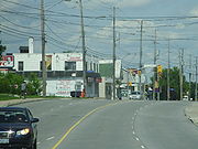
- Orleans Blvd.
- Champlain St.
- Jeanne d'Arc Blvd.
- Des Epinettes Ave.
- St.Joseph Blvd.
- Charlemagne Blvd.
- Innes Rd.
- Tenth Line Rd.
- Trim Rd.
Highway 174
The main highway linking Orleans to central Ottawa to the west is officially known as Ottawa Road 174 and is also known as the QueenswayQueensway (Ottawa)
The Queensway is a major controlled-access freeway running through Ottawa, Ontario, Canada, from Kanata in the west to Orleans in the east. It is the primary east-west transportation artery in the Ottawa-Gatineau area....
.
Highway exits
- Trim Rd.
- Tenth Line Rd.
- Jeanne D'Arc
- Place D'Orleans Dr.
External links
- Details of the future Mer Bleue community
- East End community design plan
- Team Ottawa-Orléans was established in March 2005 to aid the communities of Orleans to provide a comprehensive approach to the development of the area in particular with respect to infrastructure development.
- Orleans Online: local news, sports, classifieds and business directory online
- Friends of Petrie Island