Owyhee Dam
Encyclopedia
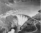
Owyhee Dam is a concrete
arch-gravity dam
on the Owyhee River
in Eastern Oregon
near Adrian, Oregon
, United States
. Completed in 1932 during the Great Depression
, the dam generates electricity and provides irrigation
water for several irrigation district
s in Oregon and neighboring Idaho
. At the time of completion, it was the tallest dam of its type in the world (it was surpassed about two years later). The dam is part of the Owyhee Dam Historic District, which is listed on the National Register of Historic Places
.
The dam impounds the river to create the Owyhee Reservoir
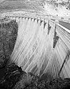
, with storage capacity of nearly 1200000 acre.ft of water. The more than 400 feet (121.9 m) tall concrete-arch gravity dam is owned by the United States Bureau of Reclamation
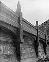
(BOR) and operated by the Owyhee Irrigation District. Haystack Rock Road is carried over the 833 feet (253.9 m) long crest of the dam.
. A project of the Bureau of Reclamation, they hired General Construction Company from Seattle to build the dam.
Former Oregonian and then United States President Herbert Hoover
dedicated what was the highest dam of its type in the world on July 17, 1932. Secretary of the Interior Ray Lyman Wilbur delivered Hoover’s message at the dam. Owyhee's construction served as a prototype for the larger Hoover Dam
on the Colorado River
, including the use of refrigeration to cool the concrete.
The dam cost $6,000,000, with the total reclamation project costing $18,000,000. Owyhee was designed by Frank A. Banks, who also designed other dams such as the Grand Coulee Dam
on the Columbia River
. In the 1980s, electricity-generating capabilities were added to the dam. From 1990 to 1993, the dam was remodeled. Built without a fish ladder
, the dam closed off the Owyhee Chinook salmon
runs that used to swim as far upstream as Nevada
. On September 23, 2010, the dam was added to the National Register of Historic Places as part of the Owyhee Dam Historic District.
. There are three hydro-power generating facilities at the reservoir added between 1985 and 1993, with seven megawatt and five megawatt turbines at the dam and power sold to the Idaho Power Company
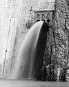
. Owyhee has a unique spillway located part way up the dam that utilizes a 60 feet (18.3 m) in diameter tunnel to send excess water to the river below during Spring run-off. The United States Bureau of Reclamation
owns the facility, and the Owyhee Irrigation District operates the dam.


 Owyhee is 833 feet (253.9 m) long at the crest, which is 30 feet (9.1 m) wide. The base of the dam is 265 feet (80.8 m) wide, with a height of 417 feet (127.1 m). The crest elevation sits at 2675 feet (815.3 m) above sea level and has a hydraulic height of 325 feet (99.1 m). Total concrete used in this arch gravity style dam
was 537500 cubic yards (410,948.2 m³).
The dam’s spillway
can allow 41790 cubic feet (1,183.4 m³) per second of water flow, while its tunnel capacity is 1100 cubic feet (31.1 m³) per second. The outlet works can allow up to 2530 cubic feet (71.6 m³) per second. If completely full, the reservoir would hold 1183300 acre.ft of water, and is 53 miles (85.3 km) long. The total drainage area of the dam and reservoir is 10900 square miles (28,230.9 km²) in Eastern Oregon and western Idaho
.
Owyhee Dam was the tallest dam in the world until the Lac du Chambon
dam was built in France in 1934 at 136.7 meters (448 feet).
Concrete
Concrete is a composite construction material, composed of cement and other cementitious materials such as fly ash and slag cement, aggregate , water and chemical admixtures.The word concrete comes from the Latin word...
arch-gravity dam
Arch-gravity dam
An arch-gravity dam, curved-gravity dam or arched dam is a dam with the characteristics of both an arch dam and a gravity dam. It is a dam that curves upstream in a narrowing curve that directs most of the water against the canyon rock walls, providing the force to compress the dam...
on the Owyhee River
Owyhee River
The Owyhee River is a tributary of the Snake River located in northern Nevada, southwestern Idaho and southeastern Oregon in the United States. It is long. The river's drainage basin is in area, one of the largest subbasins of the Columbia Basin...
in Eastern Oregon
Eastern Oregon
Eastern Oregon is the eastern part of the U.S. state of Oregon. It is not an officially recognized geographic entity, thus the boundaries of the region vary according to context. It is sometimes understood to include only the eight easternmost counties in the state; in other contexts, it includes...
near Adrian, Oregon
Adrian, Oregon
Adrian is a city in Malheur County, Oregon, United States, near the confluence of the Snake River and the Owyhee River. The population was 147 at the 2000 census and a census estimated population of 140 in 2009. It is part of the Ontario, OR–ID Micropolitan Statistical Area.-History:In 1913,...
, United States
United States
The United States of America is a federal constitutional republic comprising fifty states and a federal district...
. Completed in 1932 during the Great Depression
Great Depression
The Great Depression was a severe worldwide economic depression in the decade preceding World War II. The timing of the Great Depression varied across nations, but in most countries it started in about 1929 and lasted until the late 1930s or early 1940s...
, the dam generates electricity and provides irrigation
Irrigation
Irrigation may be defined as the science of artificial application of water to the land or soil. It is used to assist in the growing of agricultural crops, maintenance of landscapes, and revegetation of disturbed soils in dry areas and during periods of inadequate rainfall...
water for several irrigation district
Irrigation district
In the United States an irrigation district is a cooperative, self-governing public corporation set up as a subdivision of the State government, with definite geographic boundaries, organized, and having taxing power to obtain and distribute water for irrigation of lands within the district;...
s in Oregon and neighboring Idaho
Idaho
Idaho is a state in the Rocky Mountain area of the United States. The state's largest city and capital is Boise. Residents are called "Idahoans". Idaho was admitted to the Union on July 3, 1890, as the 43rd state....
. At the time of completion, it was the tallest dam of its type in the world (it was surpassed about two years later). The dam is part of the Owyhee Dam Historic District, which is listed on the National Register of Historic Places
National Register of Historic Places
The National Register of Historic Places is the United States government's official list of districts, sites, buildings, structures, and objects deemed worthy of preservation...
.
The dam impounds the river to create the Owyhee Reservoir
Owyhee Reservoir
Owyhee Reservoir or Owyhee Lake is a reservoir on the Owyhee River in Malheur County, Oregon, United States. Located in far Eastern Oregon near the Idaho border, the reservoir is Oregon's longest at . The lake is home to several species of fish, including crappie, rainbow trout, largemouth bass,...
, with storage capacity of nearly 1200000 acre.ft of water. The more than 400 feet (121.9 m) tall concrete-arch gravity dam is owned by the United States Bureau of Reclamation
United States Bureau of Reclamation
The United States Bureau of Reclamation , and formerly the United States Reclamation Service , is an agency under the U.S...
(BOR) and operated by the Owyhee Irrigation District. Haystack Rock Road is carried over the 833 feet (253.9 m) long crest of the dam.
History
In August 1927, the US Congress authorized the building of a dam in the canyon of the Owyhee River. Construction of the dam began in 1928 to provide water for irrigation projects. It was built on a foundation of massive rhyolite, massive pitchstone, and associated unmassive pitchstone agglomerate geologic formations adjacent to the Owyhee MountainsOwyhee Mountains
The Owyhee Mountains are a mountain range in Owyhee County, Idaho and Malheur County, Oregon.- References :...
. A project of the Bureau of Reclamation, they hired General Construction Company from Seattle to build the dam.
Former Oregonian and then United States President Herbert Hoover
Herbert Hoover
Herbert Clark Hoover was the 31st President of the United States . Hoover was originally a professional mining engineer and author. As the United States Secretary of Commerce in the 1920s under Presidents Warren Harding and Calvin Coolidge, he promoted partnerships between government and business...
dedicated what was the highest dam of its type in the world on July 17, 1932. Secretary of the Interior Ray Lyman Wilbur delivered Hoover’s message at the dam. Owyhee's construction served as a prototype for the larger Hoover Dam
Hoover Dam
Hoover Dam, once known as Boulder Dam, is a concrete arch-gravity dam in the Black Canyon of the Colorado River, on the border between the US states of Arizona and Nevada. It was constructed between 1931 and 1936 during the Great Depression and was dedicated on September 30, 1935, by President...
on the Colorado River
Colorado River
The Colorado River , is a river in the Southwestern United States and northwestern Mexico, approximately long, draining a part of the arid regions on the western slope of the Rocky Mountains. The watershed of the Colorado River covers in parts of seven U.S. states and two Mexican states...
, including the use of refrigeration to cool the concrete.
The dam cost $6,000,000, with the total reclamation project costing $18,000,000. Owyhee was designed by Frank A. Banks, who also designed other dams such as the Grand Coulee Dam
Grand Coulee Dam
Grand Coulee Dam is a gravity dam on the Columbia River in the U.S. state of Washington built to produce hydroelectric power and provide irrigation. It was constructed between 1933 and 1942, originally with two power plants. A third power station was completed in 1974 to increase its energy...
on the Columbia River
Columbia River
The Columbia River is the largest river in the Pacific Northwest region of North America. The river rises in the Rocky Mountains of British Columbia, Canada, flows northwest and then south into the U.S. state of Washington, then turns west to form most of the border between Washington and the state...
. In the 1980s, electricity-generating capabilities were added to the dam. From 1990 to 1993, the dam was remodeled. Built without a fish ladder
Fish ladder
A fish ladder, also known as a fishway, fish pass or fish steps, is a structure on or around artificial barriers to facilitate diadromous fishes' natural migration. Most fishways enable fish to pass around the barriers by swimming and leaping up a series of relatively low steps into the waters on...
, the dam closed off the Owyhee Chinook salmon
Chinook salmon
The Chinook salmon, Oncorhynchus tshawytscha, is the largest species in the pacific salmon family. Other commonly used names for the species include King salmon, Quinnat salmon, Spring salmon and Tyee salmon...
runs that used to swim as far upstream as Nevada
Nevada
Nevada is a state in the western, mountain west, and southwestern regions of the United States. With an area of and a population of about 2.7 million, it is the 7th-largest and 35th-most populous state. Over two-thirds of Nevada's people live in the Las Vegas metropolitan area, which contains its...
. On September 23, 2010, the dam was added to the National Register of Historic Places as part of the Owyhee Dam Historic District.
Operations
Water stored at the reservoir is used to irrigate approximately 120000 acres (485.6 km²) for use in farming. Four different irrigation district utilize the water from Owyhee ReservoirOwyhee Reservoir
Owyhee Reservoir or Owyhee Lake is a reservoir on the Owyhee River in Malheur County, Oregon, United States. Located in far Eastern Oregon near the Idaho border, the reservoir is Oregon's longest at . The lake is home to several species of fish, including crappie, rainbow trout, largemouth bass,...
. There are three hydro-power generating facilities at the reservoir added between 1985 and 1993, with seven megawatt and five megawatt turbines at the dam and power sold to the Idaho Power Company
Idaho Power Company
Idaho Power Company is a regulated electrical power utility. Its business involves the purchase, sale, generation, transmission and distribution of electricity in eastern Oregon and southern Idaho. It is a subsidiary of IDACORP, Inc...
. Owyhee has a unique spillway located part way up the dam that utilizes a 60 feet (18.3 m) in diameter tunnel to send excess water to the river below during Spring run-off. The United States Bureau of Reclamation
United States Bureau of Reclamation
The United States Bureau of Reclamation , and formerly the United States Reclamation Service , is an agency under the U.S...
owns the facility, and the Owyhee Irrigation District operates the dam.
Dimensions


Arch-gravity dam
An arch-gravity dam, curved-gravity dam or arched dam is a dam with the characteristics of both an arch dam and a gravity dam. It is a dam that curves upstream in a narrowing curve that directs most of the water against the canyon rock walls, providing the force to compress the dam...
was 537500 cubic yards (410,948.2 m³).
The dam’s spillway
Spillway
A spillway is a structure used to provide the controlled release of flows from a dam or levee into a downstream area, typically being the river that was dammed. In the UK they may be known as overflow channels. Spillways release floods so that the water does not overtop and damage or even destroy...
can allow 41790 cubic feet (1,183.4 m³) per second of water flow, while its tunnel capacity is 1100 cubic feet (31.1 m³) per second. The outlet works can allow up to 2530 cubic feet (71.6 m³) per second. If completely full, the reservoir would hold 1183300 acre.ft of water, and is 53 miles (85.3 km) long. The total drainage area of the dam and reservoir is 10900 square miles (28,230.9 km²) in Eastern Oregon and western Idaho
Idaho
Idaho is a state in the Rocky Mountain area of the United States. The state's largest city and capital is Boise. Residents are called "Idahoans". Idaho was admitted to the Union on July 3, 1890, as the 43rd state....
.
Owyhee Dam was the tallest dam in the world until the Lac du Chambon
Lac du Chambon
Lac du Chambon is a lake in Isère, Rhône-Alpes, France. At an elevation of 1040 m, its surface area is 1.4 km²....
dam was built in France in 1934 at 136.7 meters (448 feet).

