Pahranagat Valley
Encyclopedia

Tonopah Basin
The Tonopah Basin is one of the Central Nevada Desert Basins that extends from the band of arid footslopes along the north side of the Mojave Desert northward into the Big Smoky Valley and the Railroad Valley...
landform in Lincoln County, Nevada
Lincoln County, Nevada
Lincoln County is a county located in the U.S. state of Nevada. As of the 2000 census, the population was 4,165. Its county seat is Pioche.-History:...
.http://cfpub.epa.gov/surf/huc.cfm?huc_code=15010012
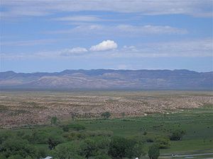
The more fertile part of Pahranagat Valley is a narrow ribbon of green (no more than 1 miles (1.6 km) wide) like an oasis in the vast Nevada desert. It is approximately 40 miles (64.4 km) long running north and south and is watered by three large natural springs of water (Hiko Springs
Hiko Springs, Nevada
Hiko Springs is located in the farming community of Hiko, Lincoln County, Nevada. Its cool waters flowing out of the desert hillside provide the basis for the very existence of a community in this extremely arid location....
, Crystal Springs
Crystal Springs, Nevada
Crystal Springs is a ghost town in the Pahranagat Valley region of Lincoln County, Nevada. The ghost town is located at the junction of SR 318 and SR 375, also known as the Extraterrestrial Highway. It is a popular destination for passersby who want to visit the towns of Hiko and Rachel...
and Ash Springs
Ash Springs, Nevada
Ash Springs is a town in the Pahranagat Valley of Lincoln County, Nevada. The town's principal industry is ranching. The town is home to naturally occurring hot springs....
) and many smaller ones as well. It has four lakes, two near the north end of the valley (Nesbitt Lake and Frenchie Lake) and two towards the south end (Upper Pahranagat Lake and Lower Pahranagat Lake). The southern half of the valley including the two lakes is home to the Pahranagat Valley National Wildlife Refuge.
Pahranagat Valley is bordered on the west by a range of mountains called the Mount Irish Range
Mount Irish Range
The Mount Irish Range is a mountain range in Lincoln County, Nevada.- References :The Mount Irish Range is a mountain range in Lincoln County, Nevada.- References :The Mount Irish Range is a mountain range in Lincoln County, Nevada....
and then the Pahranagat Range
Pahranagat Range
The Pahranagat Range is a mountain range in Lincoln County, Nevada.- See also :* Pahranagat Valley* Pahranagat National Wildlife Refuge* Alamo bolide impact...
. It is bordered on the east by the Hiko Range
Hiko Range
The Hiko Range is a mountain range in Lincoln County, Nevada....
. State Route 318
Nevada State Route 318
State Route 318 runs from U.S. Route 93 at Crystal Springs, Nevada north to a location on U.S. Route 6 approximately southwest of Ely. It is often used as a shortcut between Ely and Las Vegas....
and then U.S. Route 93 traverse the entire length of the valley.
The more inhabited areas in Pahranagat Valley include (from north to south) Hiko
Hiko, Nevada
Hiko, Nevada, is a small, agrarian community of the Tonopah Basin on State Route 318 in Lincoln County, Nevada. At one time Hiko was the county seat, and a few hundred residents lived nearby, due largely to silver mines in the area...
, Ash Springs
Ash Springs, Nevada
Ash Springs is a town in the Pahranagat Valley of Lincoln County, Nevada. The town's principal industry is ranching. The town is home to naturally occurring hot springs....
, Richardville and Alamo
Alamo, Nevada
Alamo is an unincorporated community in Lincoln County, Nevada, United States, about north of Las Vegas. Its elevation is 3,449 feet . It is named after the Spanish word for "poplar" due to the presence of that type of tree. Founded in 1901, Alamo lies in the Pahranagat Valley. Its economy is...
, the town of Alamo being the largest and where all of the schools for the valley are located. The closest town to Pahranagat Valley is over 50 miles (80.5 km) to the east at Caliente, Nevada
Caliente, Nevada
Caliente , formerly known as Culverwell and Calientes is a town in Lincoln County, Nevada, United States. Its elevation is 4,300 feet . The population was 1,123 at the 2000 census...
.
History
The Crystal SpringsCrystal Springs, Nevada
Crystal Springs is a ghost town in the Pahranagat Valley region of Lincoln County, Nevada. The ghost town is located at the junction of SR 318 and SR 375, also known as the Extraterrestrial Highway. It is a popular destination for passersby who want to visit the towns of Hiko and Rachel...
area, used as a watering spot and campsite, was a principal stop-over on the Mormon Trail
Mormon Trail
The Mormon Trail or Mormon Pioneer Trail is the 1,300 mile route that members of The Church of Jesus Christ of Latter-day Saints traveled from 1846 to 1868...
Alternate Route. In the late 1850s, the area was a haven for outlaws who pastured hundreds of head of stolen cattle and horses on its meadows.
Silver
Silver
Silver is a metallic chemical element with the chemical symbol Ag and atomic number 47. A soft, white, lustrous transition metal, it has the highest electrical conductivity of any element and the highest thermal conductivity of any metal...
ore was discovered in 1865 on Mount Irish, and Logan
Logan, Nevada
Logan, Nevada, is a ghost town located in the hills about 12 miles west of Hiko. Logan had its brief existence as a mining camp when silver ore was discovered in 1865 just to the north of it in Silver Canyon on Mount Irish....
sprang briefly into existence. A mill to process the ore was built in Hiko
Hiko, Nevada
Hiko, Nevada, is a small, agrarian community of the Tonopah Basin on State Route 318 in Lincoln County, Nevada. At one time Hiko was the county seat, and a few hundred residents lived nearby, due largely to silver mines in the area...
, the ruins of which are still in existence.
Since the late 19th century, Pahranagat Valley has been primarily an agricultural community. Presently it is also a bedroom coummunity for many who work in Las Vegas
Las Vegas, Nevada
Las Vegas is the most populous city in the U.S. state of Nevada and is also the county seat of Clark County, Nevada. Las Vegas is an internationally renowned major resort city for gambling, shopping, and fine dining. The city bills itself as The Entertainment Capital of the World, and is famous...
even though the commute is over 100 miles (160.9 km) one way.
Geology

Alamo bolide impact
The Alamo bolide impact occurred 367 million years ago, when one or more hypervelocity objects from space slammed into shallow marine waters at a site that is now the Devonian Guilmette Formation of the Worthington Mountains and Schell Creek Range of southeastern Nevada; the event is named for...
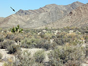
which scattered layers of impact debris across the area near Alamo.

