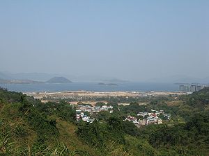
Pak Shek Kok
Encyclopedia

Tai Po District
Tai Po District is one of the 18 districts of Hong Kong. It covers the areas of Tai Po, Tai Po Kau, Ting Kok, Plover Cove and the northern part of Sai Kung Peninsula on both shores of Tolo Channel. It is located in the New Territories...
in Hong Kong
Hong Kong
Hong Kong is one of two Special Administrative Regions of the People's Republic of China , the other being Macau. A city-state situated on China's south coast and enclosed by the Pearl River Delta and South China Sea, it is renowned for its expansive skyline and deep natural harbour...
, located between Ma Liu Shui
Ma Liu Shui
Ma Liu Shui or originally Ma Niu Shui is an area in Sha Tin District, in the New Territories, Hong Kong.The area faces Tide Cove and Tolo Harbour...
and Tai Po Kau
Tai Po Kau
Tai Po Kau is an area south of the town of Tai Po in Hong Kong. There was the former Tai Po Kau Station of Kowloon-Canton Railway erected in the area. It is located at the estuary of rivers and Tai Po Hoi.-See also:* Tai Po Kau Special Area...
, close to Cheung Shue Tan (樟樹灘) and facing Tolo Harbour
Tolo Harbour
Tolo Harbour , or Tai Po Hoi is a sheltered harbour in northeast New Territories of Hong Kong.-Geography:Tide Cove aka...
(Tai Po Hoi). The Kowloon-Canton Railway
Kowloon-Canton Railway
The Kowloon–Canton Railway refers to a railway network in Hong Kong which is now combined with the MTR railway system, comprising rapid transit services, a light rail system and feeder bus routes within Hong Kong, and intercity passenger and freight train services to the rest of China...
, Tolo Highway
Tolo Highway
Tolo Highway is a major expressway on Route 9 in Hong Kong. It connects the new towns of Sha Tin and Tai Po in the eastern New Territories.The highway diverges from Tai Po Road near Sha Tin Racecourse. The following of the road runs on an embankment on the west coast of Tolo Harbour towards Yuen...
, Hong Kong Science Park
Hong Kong Science Park
The Hong Kong Science Park is a science park in Hong Kong, located in Pak Shek Kok, New Territories, on the boundary of Sha Tin District and Tai Po District...
are all situated on the reclamation outside Pak Shek Kok.
Geography
Pak Shek Kok was the estuaryEstuary
An estuary is a partly enclosed coastal body of water with one or more rivers or streams flowing into it, and with a free connection to the open sea....
of two creeks
Stream
A stream is a body of water with a current, confined within a bed and stream banks. Depending on its locale or certain characteristics, a stream may be referred to as a branch, brook, beck, burn, creek, "crick", gill , kill, lick, rill, river, syke, bayou, rivulet, streamage, wash, run or...
from nearby valleys of Cheung Shue Tau. Kok (角) in Cantonese means convex land on the shore and thus was used to describe the land formed by two creeks running in to Tai Po Hoi. Pak Shek (白石) means white
White
White is a color, the perception of which is evoked by light that stimulates all three types of color sensitive cone cells in the human eye in nearly equal amounts and with high brightness compared to the surroundings. A white visual stimulation will be void of hue and grayness.White light can be...
rock
Rock (geology)
In geology, rock or stone is a naturally occurring solid aggregate of minerals and/or mineraloids.The Earth's outer solid layer, the lithosphere, is made of rock. In general rocks are of three types, namely, igneous, sedimentary, and metamorphic...
. It is probably the feature of land but without well documentary.
The estuary was completely covered by reclamation and the mouth of creeks was redirect to a drainage
Drainage
Drainage is the natural or artificial removal of surface and sub-surface water from an area. Many agricultural soils need drainage to improve production or to manage water supplies.-Early history:...
.
Politics
The proper Pak Shek Kok and surrounding villages are within Tai Po DistrictTai Po District
Tai Po District is one of the 18 districts of Hong Kong. It covers the areas of Tai Po, Tai Po Kau, Ting Kok, Plover Cove and the northern part of Sai Kung Peninsula on both shores of Tolo Channel. It is located in the New Territories...
. As it is close to the border of Sha Tin District
Sha Tin District
Sha Tin District is one of the 18 districts of Hong Kong. One of the 9 districts located in the New Territories, it covers the areas of Sha Tin, Tai Wai, Ma On Shan, Fo Tan, Siu Lek Yuen and Ma Liu Shui . The district has the highest population...
. The reclamation off Pak Shek Kok divides. Most of Hong Kong Science Park belongs to Sha Tin and the rest belongs to Tai Po.

