
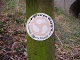
Paston Way
Encyclopedia
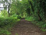
Paston Way is a footpath
is entirely within the English
county
of Norfolk
in the United Kingdom
. The footpath is twenty miles in length, the portals
to the path
are Cromer
at its northwestern end and North Walsham
at it southeastern end.
who during the Medieval and Tudor
periods were the dominant and wealthy landowners in which much of the trail
passes. The Paston Family in turn had taken their name after the north eastern coastal village of Paston
. Their origins were from Wulston, one of William the Conqueror’s men who arrived with him in 1066.
 Starting at the southeastern end, the path begins at the Parish Church of St Nicholas
in the town of North Walsham
. This is also the path's conjunction with the Weavers Way
. Leaving the church the route heads northwards along the old Mundesley
road out of the town. On the outskirts of the town the path follows the track bed of the disused Norfolk and Suffolk Joint Railway
Company which linked North Walsham to Cromer. The path crosses the North Walsham & Dilham Canal
at Swafield
.Knapton Cutting, as this part of the trail is known, is also a nature and Butterfly
reserve. This section is an area of wild flowers
, brambles, scrub and undisturbed grassy banks, which make it an ideal habitat for butterflies. Nineteen different species have been recorded. Another couple of miles through quiet lanes brings the path to Knapton
. Knapton Parish church is called St Peters and Paul’s and marks the end of the first section of the route.
.
From Knapton the path heads south east across several open fields
towards the village of Edingthorpe
. The approach to the village
is up a gently sloping farm track towards Edingthorpe
Parish church which is called All Saints.
. A little way along this section a detour can be made at church farm. Take the path north to Paston
. Visit the parish church of St Margaret’s. inside can be seen the impressive Paston Monuments to the family that gave the trail
its name. Retrace your footsteps to church farm and then continue on down the winding lane to Bacton
Church.
church is called St Andrews which is approached via an attractive avenue of trees which is in sharp contrast to the Bacton
Gas Interconnector
Terminal that dominates the horizon behind.
. The ‘Way’ passes through the church yard and out across open farm land towards the North Sea coast
at the western end of the village. The next three miles take a route along the beach passing by the Gas terminal. At Mundesley
the rout follows the main coast road to the northern tip of the village and to All Saints Church.
this part of the trail passes through the valley of the River Mun
. The countryside along this section is pleasant and very peaceful. One usual sight to the north of the ‘Trail’ is the giant white sphere which can be glimpsed occasionally. This is the Trimingham
Early warning station which is in fact part of RAF Neatishead
. The path enters the village of Gimingham
past the rebuilt old corn watermill
and the preserved steam engine
. Like Mundesley, Gimingham parish church is called All Saints. It is south down the main street from the engine. From this point there is an optional tour which takes in the villages of Trunch
, Swafield
, Bradfield
and then back on itself to Trimingham
and its unusually named church St John the Baptist’s Head.
the path heads towards Southrepps
via a lane known as Jack o' Lantern’s Lane. The lane is reputed to be the territory of the Lantern man who lure’s all travellers to their doom. The parish church of Southrepps
is called St James. Note the corbel’s and gargoyle’s
high up on this church. At this point if you wish to visit the church and village you must walk south into the village and then retrace your footsteps back to rejoin the Paston Way.
the path takes a route to the south of Frogshall
Hamlet
along the ancient farm lanes towards the coastal village of Overstrand
. There are two detour made on this section the first is to the village of Northrepps
.
parish church is called St Mary the Virgin, retrace your footstep back to Paston Way or pass through the village turning east over Hungry Hill and take the second detour.
has been forever personified as “Poppyland” having been described as such by Clement Scott In 1883. The Daily Telegraph
printed an article which Scott had written about a visit to the north Norfolk
coast. He became enamored of the district and gave it the name Poppyland. His writing was responsible for members of the London theatre set visiting and investing in homes in the area. It is in this part of the world that he is perhaps best remembered, but ironically, he was unhappy at the result of his popularization of the area. Sidestrand small parish church is called St Michael and All Angels. This church was moved stone by stone 1880 a third of a mile inland to prevent it from falling into the sea due to coastal erosion
. Previous to this date the church had already suffered the loss of its tower in 1841 when it was washed down the cliff after a heavy storm.
and then turn north towards Overstrand
down Toll’s Hill, once the site of a warning beacon
during the time of the Napoleonic wars. The route now enters the village and back to the shoreline there. Overstrand Parish church is called St Martin’s.
. The route follows the coastline here although an alternative is to follow the coast road. This part of the coastline is reputed to be the stalking ground of Legendary hellhound
Black Shuck
. And so on to Cromer
and the Parish Church of St Peter and Saint Paul. The tower of the church is 160ft high and is well worth a visit and also marks the end of Paston Way. The path links with the North Norfolk Coastal Path
/Peddars Way
and the UK National Trails Network.
Trail
A trail is a path with a rough beaten or dirt/stone surface used for travel. Trails may be for use only by walkers and in some places are the main access route to remote settlements...
is entirely within the English
England
England is a country that is part of the United Kingdom. It shares land borders with Scotland to the north and Wales to the west; the Irish Sea is to the north west, the Celtic Sea to the south west, with the North Sea to the east and the English Channel to the south separating it from continental...
county
County
A county is a jurisdiction of local government in certain modern nations. Historically in mainland Europe, the original French term, comté, and its equivalents in other languages denoted a jurisdiction under the sovereignty of a count A county is a jurisdiction of local government in certain...
of Norfolk
Norfolk
Norfolk is a low-lying county in the East of England. It has borders with Lincolnshire to the west, Cambridgeshire to the west and southwest and Suffolk to the south. Its northern and eastern boundaries are the North Sea coast and to the north-west the county is bordered by The Wash. The county...
in the United Kingdom
United Kingdom
The United Kingdom of Great Britain and Northern IrelandIn the United Kingdom and Dependencies, other languages have been officially recognised as legitimate autochthonous languages under the European Charter for Regional or Minority Languages...
. The footpath is twenty miles in length, the portals
Portal (architecture)
Portal is a general term describing an opening in the walls of a building, gate or fortification, and especially a grand entrance to an important structure. Doors, metal gates or portcullis in the opening can be used to control entry or exit. The surface surrounding the opening may be made of...
to the path
Trail
A trail is a path with a rough beaten or dirt/stone surface used for travel. Trails may be for use only by walkers and in some places are the main access route to remote settlements...
are Cromer
Cromer
Cromer is a coastal town and civil parish in north Norfolk, England. The local government authority is North Norfolk District Council, whose headquarters is in Holt Road in the town. The town is situated 23 miles north of the county town, Norwich, and is 4 miles east of Sheringham...
at its northwestern end and North Walsham
North Walsham
North Walsham is a market town and civil parish in Norfolk, England in the North Norfolk district.-Demographics:The civil parish has an area of and in the 2001 census had a population of 11,998. For the purposes of local government, the parish falls within the district of North...
at it southeastern end.
The Designation
The Paston way takes its name from the Paston FamilyPaston Letters
The Paston Letters are a collection of letters and papers from England, consisting of the correspondence of members of the gentry Paston family, and others connected with them, between the years 1422 and 1509, and also including some state papers and other important documents.- History of the...
who during the Medieval and Tudor
Tudor period
The Tudor period usually refers to the period between 1485 and 1603, specifically in relation to the history of England. This coincides with the rule of the Tudor dynasty in England whose first monarch was Henry VII...
periods were the dominant and wealthy landowners in which much of the trail
Trail
A trail is a path with a rough beaten or dirt/stone surface used for travel. Trails may be for use only by walkers and in some places are the main access route to remote settlements...
passes. The Paston Family in turn had taken their name after the north eastern coastal village of Paston
Paston, Norfolk
Paston is a village and civil parish in the English county of Norfolk. The village is north-east of North Walsham and south-east of Cromer. It is north-east of the city of Norwich. The village sits astride the coast road between Mundesley and Bacton. The nearest railway station is at North...
. Their origins were from Wulston, one of William the Conqueror’s men who arrived with him in 1066.
Section 1
St Nicholas Church, North Walsham
St Nicholas Church is a parish church in the Church of England, that can be found in the centre of North Walsham, Norfolk, England. The building is well-known for its unique tower, of which only part remains.- History :...
in the town of North Walsham
North Walsham
North Walsham is a market town and civil parish in Norfolk, England in the North Norfolk district.-Demographics:The civil parish has an area of and in the 2001 census had a population of 11,998. For the purposes of local government, the parish falls within the district of North...
. This is also the path's conjunction with the Weavers Way
Weavers Way
For the Philadelphia co-op see Weavers Way Co-opThe Weavers' Way is a long distance footpath in Norfolk, England. It is 56 miles long and runs from Cromer to Great Yarmouth...
. Leaving the church the route heads northwards along the old Mundesley
Mundesley
Mundesley is a coastal village and a civil parish in the English county of Norfolk. The village is 20.3 miles north-north east of Norwich, 7.3 miles south east of Cromer and 136 miles north east of London. The village lies 5.6 miles north-north east of the town of North Walsham. The nearest...
road out of the town. On the outskirts of the town the path follows the track bed of the disused Norfolk and Suffolk Joint Railway
Norfolk and Suffolk Joint Railway
The Norfolk and Suffolk Joint Railway was a British joint railway company.The NSJR was owned by the Great Eastern Railway and the Midland and Great Northern Joint Railway and consisted of two distinct sections: a line between North Walsham and Cromer via Mundesley, and a coastal section running...
Company which linked North Walsham to Cromer. The path crosses the North Walsham & Dilham Canal
North Walsham & Dilham Canal
The North Walsham and Dilham Canal is a waterway in the English county of Norfolk. It is accepted officially that this waterway is the only canal in Norfolk although it is the canalization of the upper reaches of the River Ant. This navigation was constructed with locks a little wider than most...
at Swafield
Swafield
Swafield is a village and a civil parish in the English county of Norfolk. The village is north north east of Norwich, south south East of Cromer and north-east of London. The village lies north of the town of North Walsham. The village sits astride the B1145 Kings Lynn to Mundesley road that...
.Knapton Cutting, as this part of the trail is known, is also a nature and Butterfly
Butterfly
A butterfly is a mainly day-flying insect of the order Lepidoptera, which includes the butterflies and moths. Like other holometabolous insects, the butterfly's life cycle consists of four parts: egg, larva, pupa and adult. Most species are diurnal. Butterflies have large, often brightly coloured...
reserve. This section is an area of wild flowers
Wild Flowers
Wild Flowers may refer to:*another spelling of wildflowers, flowers that grow wild, meaning they were not intentionally seeded or planted*Wild Flowers , a 2000 Czech film*Wild Flowers , a 1980s British rock group...
, brambles, scrub and undisturbed grassy banks, which make it an ideal habitat for butterflies. Nineteen different species have been recorded. Another couple of miles through quiet lanes brings the path to Knapton
Knapton
Knapton is a village and a civil parish in the English county of Norfolk. The village is south-east of Cromer, north-east of Norwich and north-east of London. The village lies north-east of the A149 between Kings Lynn and Great Yarmouth. The nearest railway station is at North Walsham for the...
. Knapton Parish church is called St Peters and Paul’s and marks the end of the first section of the route.
Section 2
It is worth a visit to see the roof inside Knapton Church with its ornate Double hammer beam roofHammerbeam roof
Hammerbeam roof, in architecture, is the name given to an open timber roof, typical of English Gothic architecture, using short beams projecting from the wall.- Design :...
.
From Knapton the path heads south east across several open fields
Field (agriculture)
In agriculture, the word field refers generally to an area of land enclosed or otherwise and used for agricultural purposes such as:* Cultivating crops* Usage as a paddock or, generally, an enclosure of livestock...
towards the village of Edingthorpe
Edingthorpe
Edingthorpe is a small village in the county of Norfolk, England, about 10 miles south-east of Cromer. Edingthorpe civil parish was added to Bacton civil parish under the County of Norfolk Review Order, 1935....
. The approach to the village
Village
A village is a clustered human settlement or community, larger than a hamlet with the population ranging from a few hundred to a few thousand , Though often located in rural areas, the term urban village is also applied to certain urban neighbourhoods, such as the West Village in Manhattan, New...
is up a gently sloping farm track towards Edingthorpe
Edingthorpe
Edingthorpe is a small village in the county of Norfolk, England, about 10 miles south-east of Cromer. Edingthorpe civil parish was added to Bacton civil parish under the County of Norfolk Review Order, 1935....
Parish church which is called All Saints.
Section 3
The 'way' continues on from All Saints northwest towards the coast and the village of BactonBacton, Norfolk
Bacton is a village and civil parish in Norfolk, England. It is on the Norfolk coast, some 20 km south-east of Cromer, 40 km north-west of Great Yarmouth and 30 km north of Norwich. Besides the village of Bacton, the parish includes the nearby settlements of Bacton Green, Broomholm,...
. A little way along this section a detour can be made at church farm. Take the path north to Paston
Paston, Norfolk
Paston is a village and civil parish in the English county of Norfolk. The village is north-east of North Walsham and south-east of Cromer. It is north-east of the city of Norwich. The village sits astride the coast road between Mundesley and Bacton. The nearest railway station is at North...
. Visit the parish church of St Margaret’s. inside can be seen the impressive Paston Monuments to the family that gave the trail
Trail
A trail is a path with a rough beaten or dirt/stone surface used for travel. Trails may be for use only by walkers and in some places are the main access route to remote settlements...
its name. Retrace your footsteps to church farm and then continue on down the winding lane to Bacton
Bacton, Norfolk
Bacton is a village and civil parish in Norfolk, England. It is on the Norfolk coast, some 20 km south-east of Cromer, 40 km north-west of Great Yarmouth and 30 km north of Norwich. Besides the village of Bacton, the parish includes the nearby settlements of Bacton Green, Broomholm,...
Church.
Section 4
BactonBacton, Norfolk
Bacton is a village and civil parish in Norfolk, England. It is on the Norfolk coast, some 20 km south-east of Cromer, 40 km north-west of Great Yarmouth and 30 km north of Norwich. Besides the village of Bacton, the parish includes the nearby settlements of Bacton Green, Broomholm,...
church is called St Andrews which is approached via an attractive avenue of trees which is in sharp contrast to the Bacton
Bacton, Norfolk
Bacton is a village and civil parish in Norfolk, England. It is on the Norfolk coast, some 20 km south-east of Cromer, 40 km north-west of Great Yarmouth and 30 km north of Norwich. Besides the village of Bacton, the parish includes the nearby settlements of Bacton Green, Broomholm,...
Gas Interconnector
Interconnector
The Interconnector is a natural gas pipeline between the United Kingdom and continental Europe. It crosses the North Sea between Bacton Gas Terminal in England and Zeebrugge in Belgium. Construction of the pipeline was completed in 1998. It provides bi-directional transport capability to...
Terminal that dominates the horizon behind.
. The ‘Way’ passes through the church yard and out across open farm land towards the North Sea coast
North Sea
In the southwest, beyond the Straits of Dover, the North Sea becomes the English Channel connecting to the Atlantic Ocean. In the east, it connects to the Baltic Sea via the Skagerrak and Kattegat, narrow straits that separate Denmark from Norway and Sweden respectively...
at the western end of the village. The next three miles take a route along the beach passing by the Gas terminal. At Mundesley
Mundesley
Mundesley is a coastal village and a civil parish in the English county of Norfolk. The village is 20.3 miles north-north east of Norwich, 7.3 miles south east of Cromer and 136 miles north east of London. The village lies 5.6 miles north-north east of the town of North Walsham. The nearest...
the rout follows the main coast road to the northern tip of the village and to All Saints Church.
Section 5
The route now heads back inland towards the next village of GiminghamGimingham
Gimingham is a village and civil parish in the English county of Norfolk. The village is north of North Walsham and east of Cromer. It is north of the city of Norwich. Nearby road communications with Gimingham are the A140 to Norwich, the A148 and A149 to King's Lynn, and the A149 into the...
this part of the trail passes through the valley of the River Mun
River Mun
The River Mun or Mundesley Beck is a river in the north of the county of Norfolk, England. The source of the river can be found in the Parish of Northrepps. The river finally runs into the North Sea in the village of Mundesley.-The source:...
. The countryside along this section is pleasant and very peaceful. One usual sight to the north of the ‘Trail’ is the giant white sphere which can be glimpsed occasionally. This is the Trimingham
Trimingham
Trimingham is a village and a civil parish in the English county of Norfolk. The village is north of North Walsham, east of Cromer and north of the city of Norwich. The village straddles the B1159 coastal road between Cromer and Mundesley. Near-by road communications with Gimingham are the A140...
Early warning station which is in fact part of RAF Neatishead
RAF Neatishead
RRH Neatishead, is a Royal Air Force military radar station in the English county of Norfolk, East Anglia, and was established during the Second World War. It consists of the main technical site, and a number of remote, and sometimes unmanned sites....
. The path enters the village of Gimingham
Gimingham
Gimingham is a village and civil parish in the English county of Norfolk. The village is north of North Walsham and east of Cromer. It is north of the city of Norwich. Nearby road communications with Gimingham are the A140 to Norwich, the A148 and A149 to King's Lynn, and the A149 into the...
past the rebuilt old corn watermill
Watermill
A watermill is a structure that uses a water wheel or turbine to drive a mechanical process such as flour, lumber or textile production, or metal shaping .- History :...
and the preserved steam engine
Steam engine
A steam engine is a heat engine that performs mechanical work using steam as its working fluid.Steam engines are external combustion engines, where the working fluid is separate from the combustion products. Non-combustion heat sources such as solar power, nuclear power or geothermal energy may be...
. Like Mundesley, Gimingham parish church is called All Saints. It is south down the main street from the engine. From this point there is an optional tour which takes in the villages of Trunch
Trunch
Trunch is a village and parish in Norfolk, England, situated three miles north of North Walsham and two miles from the coast at Mundesley. At the Census 2001 the village had a population of 805, and 388 households. The parish covers an area of ....
, Swafield
Swafield
Swafield is a village and a civil parish in the English county of Norfolk. The village is north north east of Norwich, south south East of Cromer and north-east of London. The village lies north of the town of North Walsham. The village sits astride the B1145 Kings Lynn to Mundesley road that...
, Bradfield
Bradfield
-Australia:* Division of Bradfield, an electoral district in the Australian House of Representatives, in New South Wales-England:* Bradfield, Berkshire, England** Bradfield College, a public school in Bradfield, Berkshire, England* Bradfield, Devon, England...
and then back on itself to Trimingham
Trimingham
Trimingham is a village and a civil parish in the English county of Norfolk. The village is north of North Walsham, east of Cromer and north of the city of Norwich. The village straddles the B1159 coastal road between Cromer and Mundesley. Near-by road communications with Gimingham are the A140...
and its unusually named church St John the Baptist’s Head.
Section 6
From GiminghamGimingham
Gimingham is a village and civil parish in the English county of Norfolk. The village is north of North Walsham and east of Cromer. It is north of the city of Norwich. Nearby road communications with Gimingham are the A140 to Norwich, the A148 and A149 to King's Lynn, and the A149 into the...
the path heads towards Southrepps
Southrepps
Southrepps is a village and a civil parish in the English county of Norfolk. The village is 5.2 miles southeast of Cromer, 21.9 miles north of Norwich and 136 miles north of London. The village lies west of the A149 between Kings Lynn and Great Yarmouth. The nearest railway station is at Gunton for...
via a lane known as Jack o' Lantern’s Lane. The lane is reputed to be the territory of the Lantern man who lure’s all travellers to their doom. The parish church of Southrepps
Southrepps
Southrepps is a village and a civil parish in the English county of Norfolk. The village is 5.2 miles southeast of Cromer, 21.9 miles north of Norwich and 136 miles north of London. The village lies west of the A149 between Kings Lynn and Great Yarmouth. The nearest railway station is at Gunton for...
is called St James. Note the corbel’s and gargoyle’s
Gargoyle
In architecture, a gargoyle is a carved stone grotesque, usually made of granite, with a spout designed to convey water from a roof and away from the side of a building thereby preventing rainwater from running down masonry walls and eroding the mortar between...
high up on this church. At this point if you wish to visit the church and village you must walk south into the village and then retrace your footsteps back to rejoin the Paston Way.
Section 7
From SouthreppsSouthrepps
Southrepps is a village and a civil parish in the English county of Norfolk. The village is 5.2 miles southeast of Cromer, 21.9 miles north of Norwich and 136 miles north of London. The village lies west of the A149 between Kings Lynn and Great Yarmouth. The nearest railway station is at Gunton for...
the path takes a route to the south of Frogshall
Frogshall
Frogshall is a small hamlet within the civil parish of Northrepps in the English county of Norfolk . The hamlet is southeast of Cromer, north of Norwich and north of London. Craft Lane runs through the hamlet between Northrepps and Southrepps. The nearest railway station is at Gunton on the...
Hamlet
Hamlet (place)
A hamlet is usually a rural settlement which is too small to be considered a village, though sometimes the word is used for a different sort of community. Historically, when a hamlet became large enough to justify building a church, it was then classified as a village...
along the ancient farm lanes towards the coastal village of Overstrand
Overstrand
Overstrand is a village on the north coast of Norfolk in England, two miles east of Cromer. It was once a modest fishing station, with all or part of the fishing station being known as Beck Hythe...
. There are two detour made on this section the first is to the village of Northrepps
Northrepps
Northrepps is a village and a civil parish in the English county of Norfolk. The village is southeast of Cromer, north of Norwich and north of London. The village lies west of the A149 which runs between Kings Lynn and Great Yarmouth. The nearest railway station is at Cromer for the Bittern...
.
Detour A
NorthreppsNorthrepps
Northrepps is a village and a civil parish in the English county of Norfolk. The village is southeast of Cromer, north of Norwich and north of London. The village lies west of the A149 which runs between Kings Lynn and Great Yarmouth. The nearest railway station is at Cromer for the Bittern...
parish church is called St Mary the Virgin, retrace your footstep back to Paston Way or pass through the village turning east over Hungry Hill and take the second detour.
Detour B
SidestrandSidestrand
Sidestrand is a village and a civil parish in the English county of Norfolk. The village is North of Norwich, South East of Cromer and north-east of London.The nearest railway station is at North Walsham for the Bittern Line which runs between Cromer and Norwich...
has been forever personified as “Poppyland” having been described as such by Clement Scott In 1883. The Daily Telegraph
The Daily Telegraph
The Daily Telegraph is a daily morning broadsheet newspaper distributed throughout the United Kingdom and internationally. The newspaper was founded by Arthur B...
printed an article which Scott had written about a visit to the north Norfolk
North Norfolk
North Norfolk is a local government district in Norfolk, United Kingdom. Its council is based in Cromer. The council headquarters can be found approximately out of the town of Cromer on the Holt Road.-History:...
coast. He became enamored of the district and gave it the name Poppyland. His writing was responsible for members of the London theatre set visiting and investing in homes in the area. It is in this part of the world that he is perhaps best remembered, but ironically, he was unhappy at the result of his popularization of the area. Sidestrand small parish church is called St Michael and All Angels. This church was moved stone by stone 1880 a third of a mile inland to prevent it from falling into the sea due to coastal erosion
Coastal erosion
Coastal erosion is the wearing away of land and the removal of beach or dune sediments by wave action, tidal currents, wave currents, or drainage...
. Previous to this date the church had already suffered the loss of its tower in 1841 when it was washed down the cliff after a heavy storm.
Section 8
Return back to Hungry Hill and to NorthreppsNorthrepps
Northrepps is a village and a civil parish in the English county of Norfolk. The village is southeast of Cromer, north of Norwich and north of London. The village lies west of the A149 which runs between Kings Lynn and Great Yarmouth. The nearest railway station is at Cromer for the Bittern...
and then turn north towards Overstrand
Overstrand
Overstrand is a village on the north coast of Norfolk in England, two miles east of Cromer. It was once a modest fishing station, with all or part of the fishing station being known as Beck Hythe...
down Toll’s Hill, once the site of a warning beacon
Beacon
A beacon is an intentionally conspicuous device designed to attract attention to a specific location.Beacons can also be combined with semaphoric or other indicators to provide important information, such as the status of an airport, by the colour and rotational pattern of its airport beacon, or of...
during the time of the Napoleonic wars. The route now enters the village and back to the shoreline there. Overstrand Parish church is called St Martin’s.
Section 9
The last section of Paston way is between Overstrand and CromerCromer
Cromer is a coastal town and civil parish in north Norfolk, England. The local government authority is North Norfolk District Council, whose headquarters is in Holt Road in the town. The town is situated 23 miles north of the county town, Norwich, and is 4 miles east of Sheringham...
. The route follows the coastline here although an alternative is to follow the coast road. This part of the coastline is reputed to be the stalking ground of Legendary hellhound
Hellhound
A hellhound is a supernatural dog, found in folklore. A wide variety of ominous or hellish supernatural dogs occur in mythologies around the world, similar to the ubiquitous dragon...
Black Shuck
Black Shuck
Black Shuck, Old Shuck, Old Shock or simply Shuck is the name given to a ghostly black dog which is said to roam the coastline and countryside of East Anglia...
. And so on to Cromer
Cromer
Cromer is a coastal town and civil parish in north Norfolk, England. The local government authority is North Norfolk District Council, whose headquarters is in Holt Road in the town. The town is situated 23 miles north of the county town, Norwich, and is 4 miles east of Sheringham...
and the Parish Church of St Peter and Saint Paul. The tower of the church is 160ft high and is well worth a visit and also marks the end of Paston Way. The path links with the North Norfolk Coastal Path
North Norfolk Coastal Path
The Norfolk Coast Path is a long distance footpath in Norfolk, running 45 miles from Hunstanton to Cromer. It was opened in 1986 and covers the North Norfolk Coast AONB ....
/Peddars Way
Peddars Way
The Peddars Way is a long distance footpath in Norfolk, England. It is 46 miles long and follows the route of a Roman road. It has been suggested by more than one writer that it was not created by the Romans but was an ancient trackway, a branch or extension of the Icknield Way, used and...
and the UK National Trails Network.