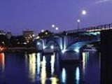
Pedro de Valdivia Bridge
Encyclopedia
Pedro de Valdivia Bridge is an arch
bridge
spanning Valdivia River
, that separates downtown Valdivia
from Isla Teja
island a residential area.
Together with Río Cruces Bridge
(built in 1987) it allows connection from Valdivia to the coastal town Niebla
.
Pedro de Valdivia Bridge is named in honour of the founder of Valdivia the Spanish conquistador Pedro de Valdivia
. It was opened in 1954 and survived the Great Chilean Earthquake
, the greatest earthquake ever recorded, while nearby buildings collapsed. After the earthquake it survived the effects of the Riñihuazo
, a flooding caused by the earthquake.
Arch bridge
An arch bridge is a bridge with abutments at each end shaped as a curved arch. Arch bridges work by transferring the weight of the bridge and its loads partially into a horizontal thrust restrained by the abutments at either side...
bridge
Bridge
A bridge is a structure built to span physical obstacles such as a body of water, valley, or road, for the purpose of providing passage over the obstacle...
spanning Valdivia River
Valdivia River
The Valdivia River or Río Valdivia, as it is known locally, is a major river in southern Chile. It is the continuation of the Calle-Calle River, from the point where it meets the Cau-Cau River in the city of Valdivia. The Valdivia river ends in Corral Bay, on the Pacific coast. Other tributaries...
, that separates downtown Valdivia
Valdivia, Chile
Valdivia is a city and commune in southern Chile administered by the Municipality of Valdivia. The city is named after its founder Pedro de Valdivia and is located at the confluence of the Calle-Calle, Valdivia and Cau-Cau Rivers, approximately east of the coastal towns of Corral and Niebla...
from Isla Teja
Isla Teja
Teja island is an island in the city of Valdivia, Chile surrounded by three rivers: Cau-Cau river to the north, Cruces river to the west and Valdivia river to the sout east...
island a residential area.
Together with Río Cruces Bridge
Río Cruces Bridge
Río Cruces Bridge is a triangular bridge spanning Cruces River that unites Isla Teja from Torobayo, a sub-urban area of Valdivia. Together with Pedro de Valdivia Bridge it allows connection from Valdivia to the coastal town Niebla. Before the opening of Río Cruces Bridge the main access to Niebla...
(built in 1987) it allows connection from Valdivia to the coastal town Niebla
Niebla, Chile
Niebla is a coastal Chilean town close to the city of Valdivia, Valdivia Province, Los Lagos Region. Niebla is located on the northern edge, at the mouth of the Valdivia River, across from Corral. Niebla's beach and folk market are popular tourist destinations during the summer, together with the...
.
Pedro de Valdivia Bridge is named in honour of the founder of Valdivia the Spanish conquistador Pedro de Valdivia
Pedro de Valdivia
Pedro Gutiérrez de Valdivia or Valdiva was a Spanish conquistador and the first royal governor of Chile. After serving with the Spanish army in Italy and Flanders, he was sent to South America in 1534, where he served as lieutenant under Francisco Pizarro in Peru, acting as his second in command...
. It was opened in 1954 and survived the Great Chilean Earthquake
Great Chilean Earthquake
The 1960 Valdivia earthquake or Great Chilean Earthquake of Sunday, 22 May 1960 is to date the most powerful earthquake ever recorded on Earth, rating 9.5 on the moment magnitude scale...
, the greatest earthquake ever recorded, while nearby buildings collapsed. After the earthquake it survived the effects of the Riñihuazo
Riñihuazo
The Riñihuazo is the name given to the damming of Riñihue Lake on 22 May 1960, after a landslide caused by the Great Chilean Earthquake blocked its outflow. According to the chronicler Mariño de Lobera a similar event occurred after the 1575 Valdivia earthquake.During the Great Chilean Earthquake,...
, a flooding caused by the earthquake.

