Piccaninnie Ponds Conservation Park
Encyclopedia
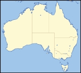
Piccaninnie Ponds Conservation Park is a 543 ha
protected area in south-eastern South Australia
. It adjoins Discovery Bay on South Australia’s Limestone Coast
and conserves a wetland
fed by freshwater
springs
in a karst
landscape. It is well known as a site for cave diving
and snorkeling
. It is 491 km south-east of Adelaide and 30 km south-east of Mount Gambier
. It is close to the border with Victoria and is part of the Discovery Bay to Piccaninnie Ponds Important Bird Area
, identified by BirdLife International
as being of global significance for several bird species.
Piccaninnie Ponds contains three main features of interest to divers. The ‘First Pond’ is an open depression about 10 m deep with a silt floor and much aquatic life, the ‘Chasm’ is a sinkhole
with a depth of over 100 m, and the ‘Cathedral’ is an enclosed area with limestone
formations and a depth of about 35 m. Underwater visibility is excellent and may exceed 40 m. Diving or snorkelling at Piccaninnie Ponds is by permit only.
The park also contains a walking track through coastal woodland to a viewing platform overlooking the wetlands.
Hectare
The hectare is a metric unit of area defined as 10,000 square metres , and primarily used in the measurement of land. In 1795, when the metric system was introduced, the are was defined as being 100 square metres and the hectare was thus 100 ares or 1/100 km2...
protected area in south-eastern South Australia
South Australia
South Australia is a state of Australia in the southern central part of the country. It covers some of the most arid parts of the continent; with a total land area of , it is the fourth largest of Australia's six states and two territories.South Australia shares borders with all of the mainland...
. It adjoins Discovery Bay on South Australia’s Limestone Coast
Limestone Coast
The Limestone Coast is a name used since the early twentyfirst century for the geographical region and tourist region of the southeast coast of South Australia from the Victoria border to the towards the city of Adelaide.-Location and description:...
and conserves a wetland
Wetland
A wetland is an area of land whose soil is saturated with water either permanently or seasonally. Wetlands are categorised by their characteristic vegetation, which is adapted to these unique soil conditions....
fed by freshwater
Freshwater
Fresh water is naturally occurring water on the Earth's surface in ice sheets, ice caps, glaciers, bogs, ponds, lakes, rivers and streams, and underground as groundwater in aquifers and underground streams. Fresh water is generally characterized by having low concentrations of dissolved salts and...
springs
Spring (hydrosphere)
A spring—also known as a rising or resurgence—is a component of the hydrosphere. Specifically, it is any natural situation where water flows to the surface of the earth from underground...
in a karst
KARST
Kilometer-square Area Radio Synthesis Telescope is a Chinese telescope project to which FAST is a forerunner. KARST is a set of large spherical reflectors on karst landforms, which are bowlshaped limestone sinkholes named after the Kras region in Slovenia and Northern Italy. It will consist of...
landscape. It is well known as a site for cave diving
Cave diving
Cave diving is a type of technical diving in which specialized equipment is used to enable the exploration of caves which are at least partially filled with water. In the United Kingdom it is an extension of the more common sport of caving, and in the United States an extension of the more common...
and snorkeling
Snorkeling
Snorkeling is the practice of swimming on or through a body of water while equipped with a diving mask, a shaped tube called a snorkel, and usually swimfins. In cooler waters, a wetsuit may also be worn...
. It is 491 km south-east of Adelaide and 30 km south-east of Mount Gambier
Mount Gambier, South Australia
Mount Gambier is the largest regional city in South Australia located approximately 450 kilometres south of the capital Adelaide and just 17 kilometres from the Victorian border....
. It is close to the border with Victoria and is part of the Discovery Bay to Piccaninnie Ponds Important Bird Area
Important Bird Area
An Important Bird Area is an area recognized as being globally important habitat for the conservation of bird populations. Currently there are about 10,000 IBAs worldwide. The program was developed and sites are identified by BirdLife International...
, identified by BirdLife International
BirdLife International
BirdLife International is a global Partnership of conservation organisations that strives to conserve birds, their habitats and global biodiversity, working with people towards sustainability in the use of natural resources...
as being of global significance for several bird species.
Piccaninnie Ponds contains three main features of interest to divers. The ‘First Pond’ is an open depression about 10 m deep with a silt floor and much aquatic life, the ‘Chasm’ is a sinkhole
Sinkhole
A sinkhole, also known as a sink, shake hole, swallow hole, swallet, doline or cenote, is a natural depression or hole in the Earth's surface caused by karst processes — the chemical dissolution of carbonate rocks or suffosion processes for example in sandstone...
with a depth of over 100 m, and the ‘Cathedral’ is an enclosed area with limestone
Limestone
Limestone is a sedimentary rock composed largely of the minerals calcite and aragonite, which are different crystal forms of calcium carbonate . Many limestones are composed from skeletal fragments of marine organisms such as coral or foraminifera....
formations and a depth of about 35 m. Underwater visibility is excellent and may exceed 40 m. Diving or snorkelling at Piccaninnie Ponds is by permit only.
The park also contains a walking track through coastal woodland to a viewing platform overlooking the wetlands.

