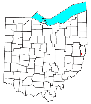
Piney Fork, Ohio
Encyclopedia

Unincorporated area
In law, an unincorporated area is a region of land that is not a part of any municipality.To "incorporate" in this context means to form a municipal corporation, a city, town, or village with its own government. An unincorporated community is usually not subject to or taxed by a municipal government...
in central Smithfield Township
Smithfield Township, Jefferson County, Ohio
Smithfield Township is one of the fourteen townships of Jefferson County, Ohio, United States. The 2000 census found 3,578 people in the township, 1,804 of whom lived in the unincorporated portions of the township.-Geography:...
, Jefferson County
Jefferson County, Ohio
Jefferson County is a county located in the state of Ohio. As of 2010, the population was 69,709. Its county seat is Steubenville and is named for Thomas Jefferson, who was at the time Vice President....
, Ohio
Ohio
Ohio is a Midwestern state in the United States. The 34th largest state by area in the U.S.,it is the 7th‑most populous with over 11.5 million residents, containing several major American cities and seven metropolitan areas with populations of 500,000 or more.The state's capital is Columbus...
, United States
United States
The United States of America is a federal constitutional republic comprising fifty states and a federal district...
. Although it is unincorporated, it has a post office
Post office
A post office is a facility forming part of a postal system for the posting, receipt, sorting, handling, transmission or delivery of mail.Post offices offer mail-related services such as post office boxes, postage and packaging supplies...
, with the ZIP code
ZIP Code
ZIP codes are a system of postal codes used by the United States Postal Service since 1963. The term ZIP, an acronym for Zone Improvement Plan, is properly written in capital letters and was chosen to suggest that the mail travels more efficiently, and therefore more quickly, when senders use the...
of 43941. The stream of Piney Fork flows southeast past the community; it meets Short Creek in far western Warren Township
Warren Township, Jefferson County, Ohio
Warren Township is one of the fourteen townships of Jefferson County, Ohio, United States. The 2000 census found 4,499 people in the township, 2,044 of whom lived in the unincorporated portions of the township.-Geography:...
, and Short Creek in turn meets the Ohio River
Ohio River
The Ohio River is the largest tributary, by volume, of the Mississippi River. At the confluence, the Ohio is even bigger than the Mississippi and, thus, is hydrologically the main stream of the whole river system, including the Allegheny River further upstream...
at Rayland
Rayland, Ohio
Rayland is a village in Jefferson County, Ohio, United States, along the Ohio River. The population was 434 at the 2000 census. It is part of the Weirton–Steubenville, WV-OH Metropolitan Statistical Area.-Geography:...
.
Piney Fork is part of the Weirton
Weirton, West Virginia
Weirton is a city located in the Northern Panhandle of West Virginia, United States. Most of the city is in Hancock County, with the remainder in Brooke County. As of the 2000 census, the city population was 20,411...
–Steubenville
Steubenville, Ohio
Steubenville is a city located along the Ohio River in Jefferson County, Ohio on the Ohio-West Virginia border in the United States. It is the political county seat of Jefferson County. It is also a principal city of the Weirton–Steubenville, WV-OH Metropolitan Statistical Area...
, WV
West Virginia
West Virginia is a state in the Appalachian and Southeastern regions of the United States, bordered by Virginia to the southeast, Kentucky to the southwest, Ohio to the northwest, Pennsylvania to the northeast and Maryland to the east...
-OH Metropolitan Statistical Area
Weirton-Steubenville metropolitan area
The Weirton-Steubenville Metropolitan Statistical Area, as defined by the United States Census Bureau, is an area consisting of two counties in the Northern Panhandle of West Virginia and one in Ohio, anchored by the cities of Weirton, West Virginia, and Steubenville, Ohio...
.
Education
Public education in the community of Piney Fork is provided by the Buckeye Local School DistrictBuckeye Local School District (Jefferson County)
The Buckeye Local School District is a public school district based in Dillonvale, Ohio, United States.The school district includes all of Mount Pleasant, Smithfield, Warren, and Wells townships in southern Jefferson County as well as very small portions of Cross Creek, Steubenville, and Wayne...
.

