Piute Range
Encyclopedia
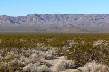
The Piute Range is located in the Mojave Desert
, primarily in northeast San Bernardino County, California
, United States
, with a north portion in Nevada
. Most of the range is the eastern border of the Mojave National Preserve
, a National Park Service
natural area and park.
and southeast of the New York Mountains
and Castle Mountains, and northeast of the Piute Mountains
. They trend in a north-south direction, and form the western perimeter of the north-south Piute Valley
which extends north past Cal-Nev-Ari
to Searchlight
.
from San Bernardino
across the Mojave Desert
to Fort Mojave
on the Colorado River
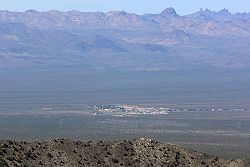
, lies at the southeastern end of the range near Piute Spring.
 The southern end of the extensive McCullough Range converges with four valleys and three mountain ranges at a water divide
point. West of the McCullough's lie the endorheic Roach and Ivanpah Dry Lake
s of Ivanpah Valley
; the valley extends north into Las Vegas' southwest, a tributary to the Las Vegas Wash
. Ivanpah Valley turns southeast to meet the water divide
point. Northeast of the water divide point is the southwest Eldorado Valley
, also endorheic with its Eldorado Dry Lake. Southwest, the Piute Valley drains south, then Piute Wash
turns east and descends steeply at the Dead Mountains
to its outfall at the Colorado River
and Needles
.
The Mojave National Preserve
is mostly endorheic with the west bordering on Baker, California
and and the twin dry lakes of Silver Dry Lake and Soda Dry Lake. The northeast preserve corner is anchored by the water divide point. The northeast borders of the New York
and smaller Castle Mountains
meet the north of the Piute Range; to the west of the Piute's, east of the New York Mountains is the southerly draining endorheic Lanfair Valley
.
The Piute Valley Watershed is the first major watershed southeast of Las Vegas to drain into the western side of the south-flowing Colorado River.
Watersheds
Mojave Desert
The Mojave Desert occupies a significant portion of southeastern California and smaller parts of central California, southern Nevada, southwestern Utah and northwestern Arizona, in the United States...
, primarily in northeast San Bernardino County, California
San Bernardino County, California
San Bernardino County is a county in the U.S. state of California. As of the 2010 census, the population was 2,035,210, up from 1,709,434 as of the 2000 census...
, United States
Southwestern United States
The Southwestern United States is a region defined in different ways by different sources. Broad definitions include nearly a quarter of the United States, including Arizona, California, Colorado, Nevada, New Mexico, Oklahoma, Texas and Utah...
, with a north portion in Nevada
Nevada
Nevada is a state in the western, mountain west, and southwestern regions of the United States. With an area of and a population of about 2.7 million, it is the 7th-largest and 35th-most populous state. Over two-thirds of Nevada's people live in the Las Vegas metropolitan area, which contains its...
. Most of the range is the eastern border of the Mojave National Preserve
Mojave National Preserve
Mojave National Preserve is located in the Mojave Desert of San Bernardino County, California, USA, between Interstate 15 and Interstate 40. The preserve was established October 31, 1994 with the passage of the California Desert Protection Act by the US Congress...
, a National Park Service
National Park Service
The National Park Service is the U.S. federal agency that manages all national parks, many national monuments, and other conservation and historical properties with various title designations...
natural area and park.
Geography
The mountains lie to the east of Lanfair ValleyLanfair Valley
Lanfair Valley is located in the Mojave Desert in southeastern California near the Nevada state line. It is bounded on the north by the New York Mountains and Castle Mountains, on the east by the Piute Range, and on the south by the Woods Mountains and Vontrigger Hills. Joshua Trees can be found in...
and southeast of the New York Mountains
New York Mountains
The New York Mountains are found in northeastern San Bernardino County in California, USA; the range's northeast lies in southeast Nevada. The range lies just south of the small community of Ivanpah, and north of the Lanfair Valley. The mountains are part of the mountain ranges, cones, mountains,...
and Castle Mountains, and northeast of the Piute Mountains
Piute Mountains
The Piute Mountains are found in southeastern California, in the Mojave Desert. The range crosses Interstate 40 at Mountain Springs Summit, 2,770 feet above sea level....
. They trend in a north-south direction, and form the western perimeter of the north-south Piute Valley
Piute Valley
The Piute Valley is a long north-south valley southeast of Las Vegas, Nevada, and northwest of Needles. The north of the valley is at Searchlight, with some of the valley extending northwest from Searchlight. At the center-north lies Cal-Nev-Ari, Nevada....
which extends north past Cal-Nev-Ari
Cal-Nev-Ari, Nevada
Cal-Nev-Ari is a census-designated place and town in Clark County, Nevada, United States, near the state's southernmost point. As of the 2000 census, the town had a total population of 278...
to Searchlight
Searchlight, Nevada
Searchlight is an unincorporated town in Clark County, Nevada, at the topographic saddle between two mountain ranges.-History:According to Nevada Senator Harry Reid, who has written extensively about his hometown, the most likely story as to how the town received its name was when George Frederick...
.
History
Fort Piute, one of a chain of military stations constructed to protect travellers on the Mojave RoadMojave Road
The Mojave Road or Mojave Trail is a historic route and present day 'four-wheel drive road' across what is now the Mojave National Preserve in the Mojave Desert of California, United States.-History:...
from San Bernardino
San Bernardino, California
San Bernardino is a city located in the Riverside-San Bernardino metropolitan area , and serves as the county seat of San Bernardino County, California, United States...
across the Mojave Desert
Mojave Desert
The Mojave Desert occupies a significant portion of southeastern California and smaller parts of central California, southern Nevada, southwestern Utah and northwestern Arizona, in the United States...
to Fort Mojave
Fort Mojave
Fort Mohave was originally named Camp Colorado when it was established on April 19, 1859 by Lieutenant Colonel William Hoffman during the Mohave War...
on the Colorado River
Colorado River
The Colorado River , is a river in the Southwestern United States and northwestern Mexico, approximately long, draining a part of the arid regions on the western slope of the Rocky Mountains. The watershed of the Colorado River covers in parts of seven U.S. states and two Mexican states...
, lies at the southeastern end of the range near Piute Spring.
4-Valley water divide, endorheic Mohave National Preserve

Water divide
A drainage divide, water divide, divide or watershed is the line separating neighbouring drainage basins...
point. West of the McCullough's lie the endorheic Roach and Ivanpah Dry Lake
Ivanpah Dry Lake
Ivanpah Lake is a dry lake bed in the Mojave Desert of San Bernardino County, California on the border of California and Nevada. Nestled in the Ivanpah Valley near Primm on Interstate 15, the lake is almost entirely within California. At the north edge of the lake lie the Nevada Welcome Center ...
s of Ivanpah Valley
Ivanpah Valley
The Ivanpah Valley is in southeastern California and southern Nevada in the United States. The valley is between the New York Mountains and the Ivanpah Mountains in San Bernardino County on the California side, and in Clark County on the Nevada side. The communities of Cima, California, Nipton,...
; the valley extends north into Las Vegas' southwest, a tributary to the Las Vegas Wash
Las Vegas Wash
Las Vegas Wash is a 12 mile-long channel which feeds most of Las Vegas Valley's excess water into Lake Mead. The wash is sometimes called an urban river, and it exists in its present capacity because of an urban population. The wash also works in a systemic conjunction with the pre-existing...
. Ivanpah Valley turns southeast to meet the water divide
Water divide
A drainage divide, water divide, divide or watershed is the line separating neighbouring drainage basins...
point. Northeast of the water divide point is the southwest Eldorado Valley
Eldorado Valley
Eldorado Valley, or El Dorado Valley, is a Great Basin valley in the Mojave Desert southeast of Las Vegas and southwest of Boulder City, Nevada...
, also endorheic with its Eldorado Dry Lake. Southwest, the Piute Valley drains south, then Piute Wash
Piute Wash
The Piute Wash of extreme southeastern Nevada and northeast San Bernardino County California is the south-flowing drainage of the Piute Valley. The wash and valley are located northwest of Needles, California....
turns east and descends steeply at the Dead Mountains
Dead Mountains
The Dead Mountains are a mountain range in the southeastern Mojave Desert, in San Bernardino County, California. The range borders the tri-state intersection of Nevada, Arizona and California, and the Mohave Valley, with the Fort Mojave Indian Reservation bordering the range foothills on the east...
to its outfall at the Colorado River
Colorado River
The Colorado River , is a river in the Southwestern United States and northwestern Mexico, approximately long, draining a part of the arid regions on the western slope of the Rocky Mountains. The watershed of the Colorado River covers in parts of seven U.S. states and two Mexican states...
and Needles
Needles, California
Needles is a city located in the Mojave Desert on the western banks of the Colorado River in San Bernardino County, California. It is located in the Mohave Valley, which straddles the California–Arizona border. The city is accessible via Interstate 40 and U.S. Route 95...
.
The Mojave National Preserve
Mojave National Preserve
Mojave National Preserve is located in the Mojave Desert of San Bernardino County, California, USA, between Interstate 15 and Interstate 40. The preserve was established October 31, 1994 with the passage of the California Desert Protection Act by the US Congress...
is mostly endorheic with the west bordering on Baker, California
Baker, California
Baker is a census-designated place located in San Bernardino County, California, USA. As of the 2010 census, the town had a total population of 735.Baker was founded as a station on the Tonopah and Tidewater Railroad in 1908,...
and and the twin dry lakes of Silver Dry Lake and Soda Dry Lake. The northeast preserve corner is anchored by the water divide point. The northeast borders of the New York
New York Mountains
The New York Mountains are found in northeastern San Bernardino County in California, USA; the range's northeast lies in southeast Nevada. The range lies just south of the small community of Ivanpah, and north of the Lanfair Valley. The mountains are part of the mountain ranges, cones, mountains,...
and smaller Castle Mountains
Castle Mountains (Nevada)
for the continuation of the range in CaliforniaThe Castle Mountains are a mountain range in Clark County, Nevada....
meet the north of the Piute Range; to the west of the Piute's, east of the New York Mountains is the southerly draining endorheic Lanfair Valley
Lanfair Valley
Lanfair Valley is located in the Mojave Desert in southeastern California near the Nevada state line. It is bounded on the north by the New York Mountains and Castle Mountains, on the east by the Piute Range, and on the south by the Woods Mountains and Vontrigger Hills. Joshua Trees can be found in...
.
The Piute Valley Watershed is the first major watershed southeast of Las Vegas to drain into the western side of the south-flowing Colorado River.
External links
Watersheds
- Piute Wash Watershed, Nevada to California - (Piute Valley)
- Las Vegas Wash Watershed - (Ivanpah Valley, in southwest)

