

Plato, Missouri
Encyclopedia
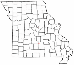
Plato is an incorporated village
Village
A village is a clustered human settlement or community, larger than a hamlet with the population ranging from a few hundred to a few thousand , Though often located in rural areas, the term urban village is also applied to certain urban neighbourhoods, such as the West Village in Manhattan, New...
in northwestern Texas County
Texas County, Missouri
Texas County is a county located in South Central Missouri in the United States. As of the 2010 census, the county's population was 26,008. It's county seat is Houston. The county was organized in 1843 as Ashley County, changing its name in 1845 to Texas, after the Republic of Texas. The 2010 U.S...
, Missouri
Missouri
Missouri is a US state located in the Midwestern United States, bordered by Iowa, Illinois, Kentucky, Tennessee, Arkansas, Oklahoma, Kansas and Nebraska. With a 2010 population of 5,988,927, Missouri is the 18th most populous state in the nation and the fifth most populous in the Midwest. It...
, United States
United States
The United States of America is a federal constitutional republic comprising fifty states and a federal district...
. It is located about twenty miles northwest of Houston, Missouri
Houston, Missouri
Houston is a city in Texas County, Missouri, United States. The population was 1,992 at the 2000 census. It is the county seat of Texas County.-Geography:...
and ten miles south of Fort Leonard Wood
Fort Leonard Wood, Missouri
Fort Leonard Wood is a census-designated place in Pulaski County, Missouri, United States. The population was 13,667 at the 2000 census. It is named in honor of Major General Leonard Wood, who was awarded the Medal of Honor...
on Route 32. Plato had an estimated population of 1,430 in 2000.
The community was founded in 1874 and is named after the ancient Greek philosopher Plato
Plato
Plato , was a Classical Greek philosopher, mathematician, student of Socrates, writer of philosophical dialogues, and founder of the Academy in Athens, the first institution of higher learning in the Western world. Along with his mentor, Socrates, and his student, Aristotle, Plato helped to lay the...
. It is the birthplace of screenwriter Josh Senter
Josh Senter
Joshua Ray Senter is an American screenwriter best known for his work on the television series Desperate Housewives.-Career:Senter's first Hollywood ambition was to become a Disney animator...
who is known for his work on Desperate Housewives
Desperate Housewives
Desperate Housewives is an American television comedy-drama series created by Marc Cherry and produced by ABC Studios and Cherry Productions. Executive producer Cherry serves as Showrunner. Other executive producers since the fourth season include Marc Cherry, Bob Daily, George W...
. As of the 2010 U.S. Census Plato is the Mean center of United States population of the distribution of the U.S. population.
Mean center of the United States
In March 2011 Plato was declared the 2010 Mean center of United States population based on 2010 Census data.The report of Plato as being the mean center was first reported on the Wikipedia mean center page in December 21, 2010 (added via an i.p. address registered to Middlesex, New Jersey) – nearly 3 months before the Census officially declared it. The report got quite wide coverage after being reported in the Houston, Missouri
Houston, Missouri
Houston is a city in Texas County, Missouri, United States. The population was 1,992 at the 2000 census. It is the county seat of Texas County.-Geography:...
Herald article and a Connecticut Public Radio
Connecticut Public Radio
Additionally, WECS, Eastern Connecticut State University's campus station, simulcasts the network's feeds of Morning Edition, All Things Considered and Car Talk.-External links:*...
broadcast. Reports subsequently said that Alex Zakrewsky, a planner from Middlesex County, New Jersey
Middlesex County, New Jersey
-Demographics:As of the census of 2000, there were 750,162 people, 265,815 households, and 190,855 families residing in the county. The population density was 2,422 people per square mile . There were 273,637 housing units at an average density of 884 per square mile...
claimed to have been the source for the Wikipedia article. Zakrewsky said he had plugged the 2010 numbers into a spreadsheet he developed using year 2000 data to calculate the center. He said that a colleague posted it to Wikipedia. His calculation placed it to the west of the community on Robidoux Creek, 3.2 miles off the official Census report which placed it on the east side of the community (37.517534°N 92.173096°W).
The mean center has been moving southwest through Missouri about 20 to 30 miles per decade since 1980 when it was near DeSoto, Missouri. In 2000 it was near Edgar Springs, Missouri.
Transportation
Waynesville Regional Airport at Forney FieldWaynesville Regional Airport at Forney Field
Waynesville-St. Robert Regional Airport , also known as Forney Field, is a public and military use airport located at Fort Leonard Wood in Pulaski County, Missouri, United States. The airport's passenger terminal is operated under the control of the U.S. Army and general aviation is under the...
serves the community with air service. Even though it's on Fort Leonard Wood
Fort Leonard Wood (military base)
Fort Leonard Wood is a United States Army installation located in the Missouri Ozarks. The main gate is located on the southern boundary of St. Robert. The post was created in December 1940 and named in honor of General Leonard Wood, former Chief of Staff, in January 1941...
, it is jointly run by the cities of Waynesville
Waynesville, Missouri
-Registered historic places:* Old Stagecoach Stop * Pulaski County Courthouse-Transportation:Waynesville Regional Airport at Forney Field serves the community with air service; even though it's on Fort Leonard Wood, it is jointly run by the cities of Waynesville and St...
and St. Robert
St. Robert, Missouri
St. Robert is a city in Pulaski County, Missouri, United States. The population was 2,760 at the 2000 census. It is a gateway community to the United States Army Maneuver Support Center of Excellence Fort Leonard Wood. It is named after the local Catholic parish, whose patron saint was an...
and is available for civilian use by private pilots and scheduled commercial passenger service.
-
 Route 17 is the major north-south route which crosses Interstate 44Interstate 44Interstate 44 is a major highway in the central United States. Its western terminus is in Wichita Falls, Texas at a concurrency with US 277, US 281 and US 287; its eastern terminus is at the Illinois state line on the Poplar Street Bridge over the Mississippi River in St...
at exit 153 at BuckhornBuckhorn, MissouriBuckhorn, Missouri is a former community on Route 17 at its junction with Interstate 44 in Pulaski County. It is also on historic U.S. Route 66. In 2003, it was annexed by nearby Waynesville...
, runs east through WaynesvilleWaynesville, Missouri-Registered historic places:* Old Stagecoach Stop * Pulaski County Courthouse-Transportation:Waynesville Regional Airport at Forney Field serves the community with air service; even though it's on Fort Leonard Wood, it is jointly run by the cities of Waynesville and St...
, turns north to CrockerCrocker, MissouriCrocker is a city in Pulaski County, Missouri, United States. The population was 1,433 at the 2006 census.-Geography:Crocker is located at .According to the United States Census Bureau, the city has a total area of , all of it land....
, and then runs north out of the county to Iberia. South of Interstate 44Interstate 44Interstate 44 is a major highway in the central United States. Its western terminus is in Wichita Falls, Texas at a concurrency with US 277, US 281 and US 287; its eastern terminus is at the Illinois state line on the Poplar Street Bridge over the Mississippi River in St...
, Highway 17 hugs the western edge of Fort Leonard Wood, passes near LaqueyLaquey, MissouriLaquey is an unincorporated community in Pulaski County, Missouri. It is about six miles southwest of Waynesville. It was founded in 1900 and named for the Laquey family.The community has a school, post office and zip code...
, and circles south of the post until it runs out of the county and eventually joins Highway 32 in RobyRoby, MissouriRoby is an unincorporated community in northwestern Texas County, Missouri, United States. It is located about sixteen miles northwest of Houston and ten miles south of Fort Leonard Wood at the northern junction of Routes 17 and 32...
.
-
 Highway 32 runs west from Route 17 through Plato and continues west through LynchburgLynchburg, MissouriLynchburg is an unincorporated community in southeastern Laclede County, Missouri, United States, located 30 miles south of Lebanon. It is home to about 400 people. The post office was closed in 2004, but the town does have a volunteer fire department and a store...
.
Media
The Fort Leonard WoodFort Leonard Wood (military base)
Fort Leonard Wood is a United States Army installation located in the Missouri Ozarks. The main gate is located on the southern boundary of St. Robert. The post was created in December 1940 and named in honor of General Leonard Wood, former Chief of Staff, in January 1941...
area has one daily and three weekly print newspapers, as well as an online internet daily newspaper. South of the post, the Houston Herald http://www.houstonherald.com/ covers Texas County
Texas County, Missouri
Texas County is a county located in South Central Missouri in the United States. As of the 2010 census, the county's population was 26,008. It's county seat is Houston. The county was organized in 1843 as Ashley County, changing its name in 1845 to Texas, after the Republic of Texas. The 2010 U.S...
issues but doesn't regularly cover Plato village or school issues.
KFBD-FM
KFBD-FM
KFBD-FM is a radio station licensed to Waynesville, Missouri, USA. The station is currently owned by Waynesville/ Lebanon License Co, LLC....
and its AM sister station, KJPW
KJPW
KJPW is a radio station broadcasting a news talk information format. Licensed to Waynesville, Missouri, USA, the station is currently owned by Waynesville/Lebanon License Co, LLC and features programing from Fox News Radio....
, are the news radio providers in the Pulaski County
Pulaski County, Missouri
Pulaski County is a county located in the U.S. state of Missouri. The county was organized in 1833 and named for Kazimierz Pułaski, Polish patriot who died fighting in the American Revolution. As of 2010, the population was 52,274, an increase of 27% from the 2000 Census count of 41,165. Its...
area, which includes Fort Leonard Wood
Fort Leonard Wood (military base)
Fort Leonard Wood is a United States Army installation located in the Missouri Ozarks. The main gate is located on the southern boundary of St. Robert. The post was created in December 1940 and named in honor of General Leonard Wood, former Chief of Staff, in January 1941...
as well as northern Texas County. These stations compete with the only other station broadcasting from Pulaski County, KFLW Radio, owned by the Lebanon Daily Record http://www.lebanondailyrecord.com/ and working locally from the St. Robert
St. Robert, Missouri
St. Robert is a city in Pulaski County, Missouri, United States. The population was 2,760 at the 2000 census. It is a gateway community to the United States Army Maneuver Support Center of Excellence Fort Leonard Wood. It is named after the local Catholic parish, whose patron saint was an...
offices of the Pulaski County Mirror http://www.pulaskicountymirror.com/ weekly newspaper.
The Daily Guide, commonly known as the Waynesville Daily Guide http://www.waynesvilledailyguide.com/ but based in St. Robert
St. Robert, Missouri
St. Robert is a city in Pulaski County, Missouri, United States. The population was 2,760 at the 2000 census. It is a gateway community to the United States Army Maneuver Support Center of Excellence Fort Leonard Wood. It is named after the local Catholic parish, whose patron saint was an...
and serving all of Pulaski County, is owned by Gatehouse Media http://www.gatehousemedia.com/ and is the central printing plant for three other Gatehouse newspapers in nearby counties, the daily Camden Lake Sun Leader http://www.lakesunleader.com/ and Rolla Daily News http://www.therolladailynews.com/ as well as the weekly St. James Leader-Journal.http://www.leaderjournal.com/ The Daily Guide covers school sports and the occasional big story in Plato.
The content of the weekly Fort Leonard Wood Guidon http://www.myguidon.com is produced under the auspices of Army Public Affairs at Fort Leonard Wood
Fort Leonard Wood (military base)
Fort Leonard Wood is a United States Army installation located in the Missouri Ozarks. The main gate is located on the southern boundary of St. Robert. The post was created in December 1940 and named in honor of General Leonard Wood, former Chief of Staff, in January 1941...
but printed under contract by the Springfield News-Leader,http://www.news-leader.com a Gannett-owned http://www.gannett.com/ newspaper which produces and sells advertisements in the Fort Leonard Wood Guidon. The military contract to produce the Guidon was held by the Lebanon Daily Record until the end of 2002, and before the Lebanon Daily Record had been held by the Waynesville Daily Guide for many years.
School Districts
The areas south of Fort Leonard WoodFort Leonard Wood (military base)
Fort Leonard Wood is a United States Army installation located in the Missouri Ozarks. The main gate is located on the southern boundary of St. Robert. The post was created in December 1940 and named in honor of General Leonard Wood, former Chief of Staff, in January 1941...
, including the unincorporated Pulaski County
Pulaski County, Missouri
Pulaski County is a county located in the U.S. state of Missouri. The county was organized in 1833 and named for Kazimierz Pułaski, Polish patriot who died fighting in the American Revolution. As of 2010, the population was 52,274, an increase of 27% from the 2000 Census count of 41,165. Its...
communities of Big Piney
Big Piney, Missouri
Big Piney is an unincorporated community in Pulaski County, Missouri on the southeastern edge of Fort Leonard Wood and sixteen miles northwest of Licking...
and Palace, are served by the Plato R-V School District,http://www.plato.k12.mo.us/ which is based in the northern Texas County
Texas County, Missouri
Texas County is a county located in South Central Missouri in the United States. As of the 2010 census, the county's population was 26,008. It's county seat is Houston. The county was organized in 1843 as Ashley County, changing its name in 1845 to Texas, after the Republic of Texas. The 2010 U.S...
village of Plato but also includes parts of Pulaski
Pulaski County, Missouri
Pulaski County is a county located in the U.S. state of Missouri. The county was organized in 1833 and named for Kazimierz Pułaski, Polish patriot who died fighting in the American Revolution. As of 2010, the population was 52,274, an increase of 27% from the 2000 Census count of 41,165. Its...
, Laclede
Laclede County, Missouri
Laclede County is a county located in the U.S. state of Missouri. As of 2000, the population was 32,513. Its county seat is Lebanon. The county was organized February 24, 1849, and was named after Pierre Laclède, founder of St...
and Wright
Wright County, Missouri
Wright County is a county located in South Central Missouri in the United States. As of the 2010 U.S. Census, the county's population was 18,815. Its county seat is Hartville. The county was officially organized on January 29, 1841, and is named after Silas Wright , a former Congressman, U.S...
counties.
Nearby school districts in Success, Manes and Gasconade, are K-8 districts which don't have a high school. Some students from those districts attend Plato High School after finishing school in their own district.
Fort Leonard Wood
Fort Leonard Wood (military base)
Fort Leonard Wood is a United States Army installation located in the Missouri Ozarks. The main gate is located on the southern boundary of St. Robert. The post was created in December 1940 and named in honor of General Leonard Wood, former Chief of Staff, in January 1941...
is in Pulaski County
Pulaski County, Missouri
Pulaski County is a county located in the U.S. state of Missouri. The county was organized in 1833 and named for Kazimierz Pułaski, Polish patriot who died fighting in the American Revolution. As of 2010, the population was 52,274, an increase of 27% from the 2000 Census count of 41,165. Its...
and a high percentage of military personnel live off post in surrounding communities, especially St. Robert
St. Robert, Missouri
St. Robert is a city in Pulaski County, Missouri, United States. The population was 2,760 at the 2000 census. It is a gateway community to the United States Army Maneuver Support Center of Excellence Fort Leonard Wood. It is named after the local Catholic parish, whose patron saint was an...
and Waynesville
Waynesville, Missouri
-Registered historic places:* Old Stagecoach Stop * Pulaski County Courthouse-Transportation:Waynesville Regional Airport at Forney Field serves the community with air service; even though it's on Fort Leonard Wood, it is jointly run by the cities of Waynesville and St...
but also the farther-out cities of Richland
Richland, Missouri
Richland is a city in Camden, Laclede, and Pulaski counties in the U.S. state of Missouri. The population was 1,805 at the 2000 census.-Geography:Richland is located at ....
, Crocker
Crocker, Missouri
Crocker is a city in Pulaski County, Missouri, United States. The population was 1,433 at the 2006 census.-Geography:Crocker is located at .According to the United States Census Bureau, the city has a total area of , all of it land....
, and Dixon
Dixon, Missouri
Dixon is a city in Pulaski County, Missouri, United States. The population was 1,570 at the 2000 census. Dixon, MO is the hometown of NBA Basketball Player John Brown and State Representative David A...
, and the unincorporated communities of Laquey
Laquey, Missouri
Laquey is an unincorporated community in Pulaski County, Missouri. It is about six miles southwest of Waynesville. It was founded in 1900 and named for the Laquey family.The community has a school, post office and zip code...
, Swedeborg
Swedeborg, Missouri
Swedeborg is an unincorporated community in northwestern Pulaski County, Missouri. It is about five miles northeast of Richland on Route 133.Swedeborg was a Swedish immigrant settlement on the railroad road between Crocker and Richland...
and Devil's Elbow, all of which have a lower housing cost than nearer housing in St. Robert
St. Robert, Missouri
St. Robert is a city in Pulaski County, Missouri, United States. The population was 2,760 at the 2000 census. It is a gateway community to the United States Army Maneuver Support Center of Excellence Fort Leonard Wood. It is named after the local Catholic parish, whose patron saint was an...
and Waynesville
Waynesville, Missouri
-Registered historic places:* Old Stagecoach Stop * Pulaski County Courthouse-Transportation:Waynesville Regional Airport at Forney Field serves the community with air service; even though it's on Fort Leonard Wood, it is jointly run by the cities of Waynesville and St...
. Military personnel assigned to training areas on the south end of the post sometimes choose to live in the unincorporated areas of Big Piney
Big Piney, Missouri
Big Piney is an unincorporated community in Pulaski County, Missouri on the southeastern edge of Fort Leonard Wood and sixteen miles northwest of Licking...
and Palace in Pulaski County
Pulaski County, Missouri
Pulaski County is a county located in the U.S. state of Missouri. The county was organized in 1833 and named for Kazimierz Pułaski, Polish patriot who died fighting in the American Revolution. As of 2010, the population was 52,274, an increase of 27% from the 2000 Census count of 41,165. Its...
, or the northern Texas County
Texas County, Missouri
Texas County is a county located in South Central Missouri in the United States. As of the 2010 census, the county's population was 26,008. It's county seat is Houston. The county was organized in 1843 as Ashley County, changing its name in 1845 to Texas, after the Republic of Texas. The 2010 U.S...
communities of Plato and Roby
Roby, Missouri
Roby is an unincorporated community in northwestern Texas County, Missouri, United States. It is located about sixteen miles northwest of Houston and ten miles south of Fort Leonard Wood at the northern junction of Routes 17 and 32...
.
Seven main school districts are fully or partly within the borders of Pulaski County
Pulaski County, Missouri
Pulaski County is a county located in the U.S. state of Missouri. The county was organized in 1833 and named for Kazimierz Pułaski, Polish patriot who died fighting in the American Revolution. As of 2010, the population was 52,274, an increase of 27% from the 2000 Census count of 41,165. Its...
, not counting two small districts which are mostly within other counties and only have only a few dozen residents within Pulaski County
Pulaski County, Missouri
Pulaski County is a county located in the U.S. state of Missouri. The county was organized in 1833 and named for Kazimierz Pułaski, Polish patriot who died fighting in the American Revolution. As of 2010, the population was 52,274, an increase of 27% from the 2000 Census count of 41,165. Its...
. All seven school districts have a high percentage of Fort Leonard Wood
Fort Leonard Wood (military base)
Fort Leonard Wood is a United States Army installation located in the Missouri Ozarks. The main gate is located on the southern boundary of St. Robert. The post was created in December 1940 and named in honor of General Leonard Wood, former Chief of Staff, in January 1941...
military dependents, and over two-thirds of Waynesville
Waynesville School District
The Waynesville RVI Reorganized School District is a school district in the Missouri Ozarks and the largest school district in Pulaski County. The school district current provides education services to the communities of Fort Leonard Wood, St...
students fall into that category.
External links
- Texas County, Missouri – Official site.
- Plato R-V School District – Official site.