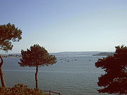
Poole Harbour
Encyclopedia
Dorset
Dorset , is a county in South West England on the English Channel coast. The county town is Dorchester which is situated in the south. The Hampshire towns of Bournemouth and Christchurch joined the county with the reorganisation of local government in 1974...
, southern England, with the town of Poole
Poole
Poole is a large coastal town and seaport in the county of Dorset, on the south coast of England. The town is east of Dorchester, and Bournemouth adjoins Poole to the east. The Borough of Poole was made a unitary authority in 1997, gaining administrative independence from Dorset County Council...
on its shores. The harbour is a drowned valley formed at the end of the last ice age
Ice age
An ice age or, more precisely, glacial age, is a generic geological period of long-term reduction in the temperature of the Earth's surface and atmosphere, resulting in the presence or expansion of continental ice sheets, polar ice sheets and alpine glaciers...
and is the estuary
Estuary
An estuary is a partly enclosed coastal body of water with one or more rivers or streams flowing into it, and with a free connection to the open sea....
of several rivers, the largest being the Frome
River Frome, Dorset
The River Frome is a river in Dorset in the south of England. At 30 miles long it is the major chalkstream in southwest England. It is navigable upstream from Poole Harbour as far as the town of Wareham.-Geography:...
. The harbour has a long history of human settlement stretching to pre-Roman times. The harbour is extremely shallow (average depth: 48 cm), with one main dredged channel through the harbour, from the mouth to Holes Bay.
Poole Harbour has an area of approximately 36 sqkm and is one of several which lay claim to the title of the world's largest or second largest natural harbour (including Cork Harbour
Cork Harbour
Cork Harbour is a natural harbour and river estuary at the mouth of the River Lee in County Cork, Ireland. It is one of several which lay claim to the title of "second largest natural harbour in the world by navigational area" . Other contenders include Halifax Harbour in Canada, and Poole Harbour...
in Ireland and Halifax Harbour
Halifax Harbour
Halifax Harbour is a large natural harbour on the Atlantic coast of Nova Scotia, Canada, located in the Halifax Regional Municipality.-Harbour description:The harbour is called Jipugtug by the Mi'kmaq first nation, anglisized as Chebucto...
in Canada). There are many significantly larger natural harbours, however, such as New Zealand's 947 sqkm Kaipara Harbour
Kaipara Harbour
Kaipara Harbour is a large enclosed harbour estuary complex on the north western side of the North Island of New Zealand. The northern part of the harbour is administered by the Kaipara District and the southern part is administered by the Rodney District...
or San Francisco Bay
San Francisco Bay
San Francisco Bay is a shallow, productive estuary through which water draining from approximately forty percent of California, flowing in the Sacramento and San Joaquin rivers from the Sierra Nevada mountains, enters the Pacific Ocean...
in California with a conservative estimate of 1040 sqkm covered.
History
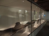
York Archaeological Trust
The York Archaeological Trust for Excavation and Research Limited is an educational charity, established in 1972 in the City of York. It carries out archaeological investigations, fieldwork, excavation and research in York, Yorkshire and throughout Britain and beyond.It also created and now runs...
, the fortified remains of a 2000 year old Iron Age
Iron Age
The Iron Age is the archaeological period generally occurring after the Bronze Age, marked by the prevalent use of iron. The early period of the age is characterized by the widespread use of iron or steel. The adoption of such material coincided with other changes in society, including differing...
longboat were found preserved in the mud off Brownsea Island
Brownsea Island
Brownsea Island is the largest of the islands in Poole Harbour in the county of Dorset, England. The island is owned by the National Trust. Much of the island is open to the public and includes areas of woodland and heath with a wide variety of wildlife, together with cliff top views across Poole...
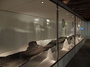
. Dated at 295 BC, the 10 metres (32.8 ft) Poole Logboat
Poole Logboat
The Poole Logboat is an ancient logboat made from a single oak tree. It was excavated in the town of Poole, Dorset, England. The boat is over 2,200 years old and is estimated through carbon dating to have been constructed around 300–200 BCE. The Iron Age vessel was unearthed in 1964 during dredging...
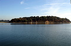
is the earliest known artifact from the harbour. It would have been based at Green Island in the harbour, and carried up to 18 people. It is thought to have been used for continental trade and was estimated to have weighed 14 tonne
Tonne
The tonne, known as the metric ton in the US , often put pleonastically as "metric tonne" to avoid confusion with ton, is a metric system unit of mass equal to 1000 kilograms. The tonne is not an International System of Units unit, but is accepted for use with the SI...
s.
Poole was used by the Romans as an invasion port for the conquest of southern England, who established the settlement at Hamworthy
Hamworthy
Hamworthy is a parish and inner suburb of Poole in Dorset, England. Hamworthy lies on a peninsula of approximately and is bounded by Upton to the north, Poole Harbour to the west and Holes Bay to the east. Poole Bridge, the southern terminus of the A350 road, connects the suburb with the town centre...
, now the western half of Poole. A Roman Road
Roman road
The Roman roads were a vital part of the development of the Roman state, from about 500 BC through the expansion during the Roman Republic and the Roman Empire. Roman roads enabled the Romans to move armies and trade goods and to communicate. The Roman road system spanned more than 400,000 km...
ran north from Hamworthy to Badbury Rings
Badbury Rings
Badbury Rings is an Iron Age hill fort in east Dorset, England, dating from 800 BC and in use until the Roman occupation of 43 AD.-Iron Age:...
, a Roman transport hub. At the time of the Norman Conquest Poole was a small fishing village.
The port grew and in 1433 Poole was made Dorset's Port of the Staple for the export of wool. Medieval Poole had trading links from the Baltics to Italy. In the 17th century the town began trading with North America, in particular Newfoundland, and the town became very wealthy. In the 18th century Poole was the principal British
Kingdom of Great Britain
The former Kingdom of Great Britain, sometimes described as the 'United Kingdom of Great Britain', That the Two Kingdoms of Scotland and England, shall upon the 1st May next ensuing the date hereof, and forever after, be United into One Kingdom by the Name of GREAT BRITAIN. was a sovereign...
port trading with North America. At the start of the 19th century 90% of Poole's population's employment was directly dependent on the harbour, but this dropped to 20% during the century as the railways reached the town, and deep hulled boats moved up the coast to Southampton
Southampton
Southampton is the largest city in the county of Hampshire on the south coast of England, and is situated south-west of London and north-west of Portsmouth. Southampton is a major port and the closest city to the New Forest...
, which had a deeper harbour and is closer to London. With regular dredging of a channel through the harbour it has regained some importance.
The largest ship to enter the harbour is Brittany Ferries 29,438 tonne Armorique on 2 February 2010 with the second largest being the 24,534 tonne Bretagne
MV Bretagne
MV Bretagne is a ferry operated by Brittany Ferries. She was built at Chantiers de l'Atlantique shipyard in Saint-Nazaire, France and has been sailing for Brittany Ferries since 1989...
which arrived in the port for the first time on 27 February 2007. The previous holder of that title was the 20,133 tonne Barfleur
MV Barfleur
MV Barfleur is a ferry operated by Brittany Ferries. She was built at Masa Yards in Finland for the Brittany Ferries subsidiary Truckline and entered service in 1992. In 1999 she was repainted in Brittany Ferries standard livery. She sails under the French flag and is registered in Cherbourg...
which began operating from the port in 1992.
Geography and islands
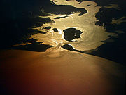
Poole Bay
Poole Bay is a bay in the English Channel, off the coast of Dorset in southern England, which runs from the mouth of Poole Harbour in the west to Hengistbury Head in the east. It consists of steep sandstone cliffs and several 'chines' that allow easy access to the sandy beaches below...
and the English Channel
English Channel
The English Channel , often referred to simply as the Channel, is an arm of the Atlantic Ocean that separates southern England from northern France, and joins the North Sea to the Atlantic. It is about long and varies in width from at its widest to in the Strait of Dover...
. Entering the harbour, heading west, on either side are the shores of Studland
Studland
Studland is a small village on the Isle of Purbeck in the English county of Dorset. It is famous for its beaches and nature reserve. In 2001 Studland had a population of 480, the lowest in 50 years...
beach (south west) and Sandbanks
Sandbanks
Sandbanks is a small peninsula or spit crossing the mouth of Poole Harbour on the English Channel coast at Poole in Dorset, England. It is well-known for the highly regarded Sandbanks Beach and property value; Sandbanks has, by area, the fourth highest land value in the world...
(in particular, the Haven Hotel
Haven Hotel
The Haven Hotel is an AA four star hotel in Sandbanks, near Poole, Dorset on the south coast of England.-History:The first hotel built on this location was the North Haven Inn in 1838. The Inn was demolished and replaced with the present Haven Hotel in 1887...
and the peninsula, north east). Directly ahead are several islands, the largest of which is Brownsea Island
Brownsea Island
Brownsea Island is the largest of the islands in Poole Harbour in the county of Dorset, England. The island is owned by the National Trust. Much of the island is open to the public and includes areas of woodland and heath with a wide variety of wildlife, together with cliff top views across Poole...
.
Following the harbour counter clockwise, heading north-east passes the built up residential settlements of Poole
Poole
Poole is a large coastal town and seaport in the county of Dorset, on the south coast of England. The town is east of Dorchester, and Bournemouth adjoins Poole to the east. The Borough of Poole was made a unitary authority in 1997, gaining administrative independence from Dorset County Council...
including Lilliput
Lilliput, Poole
Lilliput is a district of Poole, Dorset. It borders on Lower Parkstone, Whitecliff, Canford Cliffs, and Sandbanks, and has a shoreline within Poole Harbour. Lilliput also has a sub area called Salterns Marina, which has views of Sandbanks, Brownsea Island, and in the distance, Whitecliff...
and Parkstone
Parkstone
Parkstone is an area of Poole, Dorset. It is divided into 'Lower' and 'Upper' Parkstone. Upper Parkstone - "Up-on-'ill" as it used to be known in local parlance - is so-called because it is largely on higher ground slightly to the north of the lower-lying area of Lower Parkstone - "The Village" -...
(east). About 4 miles (6.4 km) north-west of the entrance of the harbour is the entrance to Poole Quay and the Holes Bay (see below). Directly west of the main part of Poole
Poole
Poole is a large coastal town and seaport in the county of Dorset, on the south coast of England. The town is east of Dorchester, and Bournemouth adjoins Poole to the east. The Borough of Poole was made a unitary authority in 1997, gaining administrative independence from Dorset County Council...
is Hamworthy
Hamworthy
Hamworthy is a parish and inner suburb of Poole in Dorset, England. Hamworthy lies on a peninsula of approximately and is bounded by Upton to the north, Poole Harbour to the west and Holes Bay to the east. Poole Bridge, the southern terminus of the A350 road, connects the suburb with the town centre...
. Continuing anti-clockwise, heading west around the Harbour are the settlements of Upton
Upton, Dorset
Upton is a village in south east Dorset, England. It is the second largest village in Purbeck-Geography:The village is built around a road junction where the Blandford to Hamworthy road crosses the main Poole to Dorchester road. The Poole suburbs of Hamworthy and Turlin Moor adjoin the village to...
and Wareham
Wareham, Dorset
Wareham is an historic market town and, under the name Wareham Town, a civil parish, in the English county of Dorset. The town is situated on the River Frome eight miles southwest of Poole.-Situation and geography:...
, as well as the outlet of the River Piddle
River Piddle
The River Piddle or Trent or North River is a small rural Dorset river which rises next to Alton Pancras church and flows south and then south-easterly more or less parallel with its bigger neighbour, the River Frome, to Wareham, where they both enter Poole Harbour via...
. This area of water within the Harbour is known as Wareham Channel and includes other places such as Rockley Sands.
Continuing anti-clockwise, now heading south are the majority of the islands within the Harbour as well as several small channels and inlets. To the east is Arne Bay and the Wych channel. The majority of land in this area is heathland and there are few settlements, as opposed to western part of the Harbour. Directly south is Long Island
Long Island (Dorset)
Long Island is an uninhabited island in Poole Harbour in the English county of Dorset. It lies just off the shore of the Arne Peninsular in the south-west of the harbour, and is separated from the nearby, and inhabited, Round Island by a narrow channel only a few feet wide. The island covers...
, Round Island
Round Island
Round Island may refer to:Australia:* Round Island , Frankland Islands* Round Island , Hogan Group, northern Bass StraitCanada:* Round Island, Nova Scotia* Round Island Hong Kong:...
and Ower Bay. Green Island
Green Island (Dorset)
Green Island is an island in Poole Harbour in the English county of Dorset. It lies in the central south part of the harbour, south of Brownsea Island and Furzey Island...
, Furzey Island
Furzey Island
Furzey Island is an island in Poole Harbour in the English county of Dorset. The island lies to the south of the larger Brownsea Island. Seen from the water, or adjoining land, the island looks like another wild pineclad island. However, hidden in the trees is an oil well and gathering station for...
and Brownsea Island
Brownsea Island
Brownsea Island is the largest of the islands in Poole Harbour in the county of Dorset, England. The island is owned by the National Trust. Much of the island is open to the public and includes areas of woodland and heath with a wide variety of wildlife, together with cliff top views across Poole...
(in that order) are to the east, with Newton Bay and Brands Bay (this area has several oil wells) to the south. This area of water is known as the South Deep. Continuing anti-clockwise comes back to the entrance to the Harbour and to Poole Bay
Poole Bay
Poole Bay is a bay in the English Channel, off the coast of Dorset in southern England, which runs from the mouth of Poole Harbour in the west to Hengistbury Head in the east. It consists of steep sandstone cliffs and several 'chines' that allow easy access to the sandy beaches below...
, with Studland
Studland
Studland is a small village on the Isle of Purbeck in the English county of Dorset. It is famous for its beaches and nature reserve. In 2001 Studland had a population of 480, the lowest in 50 years...
beach is immediately south east.
Holes Bay
Holes Bay is a tidal inland lake which lies to the north of Poole Harbour. The entrance to the bay is a small inlet from the main harbour, designated as a harbour quiet area. Access for vessels with a draft greater than 2 metres (6.6 ft) is only possible when Poole BridgePoole Bridge
Poole Bridge is a bascule bridge in Poole, Dorset, England. Constructed in 1927, the bridge provides a road link across a busy boating channel.-Location:...
is lifted, which occurs at several fixed times every day and sometimes on request. Although it is a separate bay
Bay
A bay is an area of water mostly surrounded by land. Bays generally have calmer waters than the surrounding sea, due to the surrounding land blocking some waves and often reducing winds. Bays also exist as an inlet in a lake or pond. A large bay may be called a gulf, a sea, a sound, or a bight...
, Holes Bay is often considered part of the Poole harbour area. To the north of the bay is Upton Country Park, Pergin's Island and the South Western railway line
South Western Main Line
The South Western Main Line is a railway line between London Waterloo and Weymouth on the Dorset coast, in the south of England. It is a major railway which serves many important commuter areas, as well as the major settlements of Southampton and Bournemouth...
, which runs west to east on a causeway
Causeway
In modern usage, a causeway is a road or railway elevated, usually across a broad body of water or wetland.- Etymology :When first used, the word appeared in a form such as “causey way” making clear its derivation from the earlier form “causey”. This word seems to have come from the same source by...
across the bay.
Holes Bay is the location of the Royal National Lifeboat Institution (RNLI)
Royal National Lifeboat Institution
The Royal National Lifeboat Institution is a charity that saves lives at sea around the coasts of Great Britain, Ireland, the Channel Islands and the Isle of Man, as well as on selected inland waterways....
training school, attached to their Poole headquarters. Uses of the bay include fishing, kayaking and small leisure craft. A large marina known as Cobbs Quay is on the west side of the bay. On its east side the bay runs parallel to the A350.
Islands of Poole Harbour
Poole Harbour is the location of a number of islands, of various sizes. These islands include:- Brownsea IslandBrownsea IslandBrownsea Island is the largest of the islands in Poole Harbour in the county of Dorset, England. The island is owned by the National Trust. Much of the island is open to the public and includes areas of woodland and heath with a wide variety of wildlife, together with cliff top views across Poole...
is near the sea entrance at SandbanksSandbanksSandbanks is a small peninsula or spit crossing the mouth of Poole Harbour on the English Channel coast at Poole in Dorset, England. It is well-known for the highly regarded Sandbanks Beach and property value; Sandbanks has, by area, the fourth highest land value in the world...
. - Furzey IslandFurzey IslandFurzey Island is an island in Poole Harbour in the English county of Dorset. The island lies to the south of the larger Brownsea Island. Seen from the water, or adjoining land, the island looks like another wild pineclad island. However, hidden in the trees is an oil well and gathering station for...
is south of Brownsea Island. - Green IslandGreen Island (Dorset)Green Island is an island in Poole Harbour in the English county of Dorset. It lies in the central south part of the harbour, south of Brownsea Island and Furzey Island...
is directly south of Furzey island. - Long IslandLong Island (Dorset)Long Island is an uninhabited island in Poole Harbour in the English county of Dorset. It lies just off the shore of the Arne Peninsular in the south-west of the harbour, and is separated from the nearby, and inhabited, Round Island by a narrow channel only a few feet wide. The island covers...
is near the Arne PeninsulaArne, DorsetArne is a large village and civil parish in the Purbeck district of Dorset, England; situated east of Wareham. The local travel links are located from the village to Holton Heath railway station and to Bournemouth International Airport. The main road through the village is Arne Road connecting...
. - Round IslandRound Island (Dorset)Round Island is an island in Poole Harbour in the English county of Dorset. It lies just off the shore of the Arne Peninsula in the south-west of the harbour, and is separated from the nearby uninhabited Long Island by a narrow channel only a few feet wide....
- Gigger's Island is in the west of the Harbour near the River Piddle outlet.
- Drove Island is in the south of the Harbour in Brands Bay.
- Pergin's Island is in the north of the Harbour in Holes Bay.
- Stone Island lies between Brownsea and Studland. It is a ridge of gravel and sand, possibly the remains of an old recurved shingle spit, which is only visible between high tides, and as such is a danger to sailors. It is now gradually being submerged by rising sea-level.
Geology
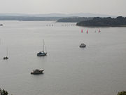
Erosion
Erosion is when materials are removed from the surface and changed into something else. It only works by hydraulic actions and transport of solids in the natural environment, and leads to the deposition of these materials elsewhere...
by the rivers and sea. This band is bordered by two bands of chalk
Chalk
Chalk is a soft, white, porous sedimentary rock, a form of limestone composed of the mineral calcite. Calcite is calcium carbonate or CaCO3. It forms under reasonably deep marine conditions from the gradual accumulation of minute calcite plates shed from micro-organisms called coccolithophores....
, the Purbeck Hills
Purbeck Hills
The Purbeck Hills and South Dorset Downs are a ridge of chalk downs in Dorset, England. The hills extend from the Dorset Downs west of Dorchester, where the River Frome begins to form a valley dividing them from the larger area of downland to the north. The ridge then runs east through the Isle...
and Isle of Wight
Isle of Wight
The Isle of Wight is a county and the largest island of England, located in the English Channel, on average about 2–4 miles off the south coast of the county of Hampshire, separated from the mainland by a strait called the Solent...
to the south, and the Dorset Downs
Dorset Downs
The Dorset Downs are an area of Chalk downland in the centre of the county Dorset in south west England. The downs are the most western part of a larger Chalk Formation which also includes Cranborne Chase, Salisbury Plain, Hampshire Downs, Chiltern Hills, North Downs and South Downs.The Dorset...
and South Downs
South Downs
The South Downs is a range of chalk hills that extends for about across the south-eastern coastal counties of England from the Itchen Valley of Hampshire in the west to Beachy Head, near Eastbourne, East Sussex, in the east. It is bounded on its northern side by a steep escarpment, from whose...
to the north. The clay extends west up the Frome valley to Dorchester, and would originally have extended east beyond Portsmouth
Portsmouth
Portsmouth is the second largest city in the ceremonial county of Hampshire on the south coast of England. Portsmouth is notable for being the United Kingdom's only island city; it is located mainly on Portsea Island...
in Hampshire
Hampshire
Hampshire is a county on the southern coast of England in the United Kingdom. The county town of Hampshire is Winchester, a historic cathedral city that was once the capital of England. Hampshire is notable for housing the original birthplaces of the Royal Navy, British Army, and Royal Air Force...
. Before the last ice age
Ice age
An ice age or, more precisely, glacial age, is a generic geological period of long-term reduction in the temperature of the Earth's surface and atmosphere, resulting in the presence or expansion of continental ice sheets, polar ice sheets and alpine glaciers...
the River Frome continued to flow east through what is now the Solent
Solent
The Solent is a strait separating the Isle of Wight from the mainland of England.The Solent is a major shipping route for passengers, freight and military vessels. It is an important recreational area for water sports, particularly yachting, hosting the Cowes Week sailing event annually...
, joining the Stour
River Stour, Dorset
The River Stour is a 60.5 mile long river which flows through Wiltshire and Dorset in southern England, and drains into the English Channel. It is sometimes called the Dorset Stour to distinguish it from rivers of the same name...
, Beaulieu
Beaulieu River
The Beaulieu River , formerly known as the River Exe, is a small river flowing south through the New Forest in the county of Hampshire in southern England. The river is some long, of which the last are tidal...
, Test
River Test
The River Test is a river in Hampshire, England. The river has a total length of 40 miles and it flows through downland from its source near Ashe, 10 km to the west of Basingstoke , to the sea at the head of Southampton Water...
, Itchen
River Itchen, Hampshire
The River Itchen is a river in Hampshire, England. It flows from mid-Hampshire to join with Southampton Water below the Itchen Bridge in the city of Southampton. The river has a total length of , and is noted as one of England's - if not one of the World's - premier chalk streams for fly fishing,...
and Hamble
River Hamble
The River Hamble is a river in Hampshire, England. It rises near Bishop's Waltham and flows for some 7.5 miles through Botley, Bursledon and Swanwick before entering Southampton Water near Hamble-le-Rice and Warsash....
, before flowing into the English Channel
English Channel
The English Channel , often referred to simply as the Channel, is an arm of the Atlantic Ocean that separates southern England from northern France, and joins the North Sea to the Atlantic. It is about long and varies in width from at its widest to in the Strait of Dover...
to the east of the present day Isle of Wight
Isle of Wight
The Isle of Wight is a county and the largest island of England, located in the English Channel, on average about 2–4 miles off the south coast of the county of Hampshire, separated from the mainland by a strait called the Solent...
. A relatively resistant chalk ridge ran continuously from the Purbeck Hills to the Isle of Wight, which the rivers could not break through. When the glacier
Glacier
A glacier is a large persistent body of ice that forms where the accumulation of snow exceeds its ablation over many years, often centuries. At least 0.1 km² in area and 50 m thick, but often much larger, a glacier slowly deforms and flows due to stresses induced by its weight...
s of the north of the island of Great Britain melted, the south of England sank slightly, flooding the Solent valley and Southampton Water
Southampton Water
Southampton Water is a tidal estuary north of the Solent and the Isle of Wight in England. The city of Southampton lies at its most northerly point. Along its salt marsh-fringed western shores lie the New Forest villages of Hythe and "the waterside", Dibden Bay, and the Esso oil refinery at Fawley...
to form their characteristic ria
Ria
A ria is a coastal inlet formed by the partial submergence of an unglaciated river valley. It is a drowned river valley that remains open to the sea. Typically, rias have a dendritic, treelike outline although they can be straight and without significant branches. This pattern is inherited from the...
s (flooded estuaries). About 7,000 years ago, increased erosion from the sea and the increased flow caused by the change in climate broke through the chalk hills, cutting the Isle of Wight off from the Isle of Purbeck and flooding what is now the Solent and Christchurch Bay, leaving Poole Harbour as the estuary of the Frome.
Marine activity
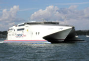
English Channel
The English Channel , often referred to simply as the Channel, is an arm of the Atlantic Ocean that separates southern England from northern France, and joins the North Sea to the Atlantic. It is about long and varies in width from at its widest to in the Strait of Dover...
passenger ferries with Britanny Ferries offering a passenger and freight service to Cherbourg as well as a freight only route to Santander twice a week on the MV Cotentin
MV Cotentin
M/V Cotentin is a freight ferry operated by Brittany Ferries and built by Aker Finnyards in Finland. Cotentin is named after the Cotentin Peninsula of France of which Cherbourg is its largest town. Cotentin was also the name of one of the original Truckline vessels to sail between Poole and...
. Condor Ferries operate to the Channel Islands and St Malo as well as joint high speed service with Brittany Ferries to Cherbourg.
Coastal trading vessel
Coastal trading vessel
Coastal trading vessels, also known as coasters, are shallow-hulled ships used for trade between locations on the same island or continent. Their shallow hulls mean that they can get through reefs where deeper-hulled sea-going ships usually cannot....
s are also frequent visitors, unloading various cargos on the quaysides at Hamworthy
Hamworthy
Hamworthy is a parish and inner suburb of Poole in Dorset, England. Hamworthy lies on a peninsula of approximately and is bounded by Upton to the north, Poole Harbour to the west and Holes Bay to the east. Poole Bridge, the southern terminus of the A350 road, connects the suburb with the town centre...
, and fleet of fishing vessel
Fishing vessel
A fishing vessel is a boat or ship used to catch fish in the sea, or on a lake or river. Many different kinds of vessels are used in commercial, artisanal and recreational fishing....
s operates from the south end of Poole Quay. There is considerable leisure usage of the harbour, by a combination of yacht
Yacht
A yacht is a recreational boat or ship. The term originated from the Dutch Jacht meaning "hunt". It was originally defined as a light fast sailing vessel used by the Dutch navy to pursue pirates and other transgressors around and into the shallow waters of the Low Countries...
s and other private craft, cruise boats
Cruising (maritime)
Cruising by boat is a lifestyle that involves living for extended time on a boat while traveling from place to place for pleasure. Cruising generally refers to trips of a few days or more, and can extend to round-the-world voyages.- History :...
that ply the harbour, and ferries
Ferry
A ferry is a form of transportation, usually a boat, but sometimes a ship, used to carry primarily passengers, and sometimes vehicles and cargo as well, across a body of water. Most ferries operate on regular, frequent, return services...
that provide a passenger link to Brownsea Island
Brownsea Island
Brownsea Island is the largest of the islands in Poole Harbour in the county of Dorset, England. The island is owned by the National Trust. Much of the island is open to the public and includes areas of woodland and heath with a wide variety of wildlife, together with cliff top views across Poole...
. The harbour is managed by the Poole Harbour Commissioners (PHC) who represent all aspects of commercial and leisure activity in the harbour. Their duties include maintaining the shipping channels for the ferries and cargo vessels, enforcing harbour speed limits, improving port facilities and assisting with nature conservation.
In November 2005 the main shipping channels into the harbour and the Port of Poole were dredged in order to accommodate modern ferries at all states of the tide. The project was carried out by Van Oord
Van Oord
Van Oord is a Dutch contracting company that specializes in dredging and land reclamation. Van Oord has undertaken many projects throughout the world, including land reclamation, dredging and beach nourishment.-History:...
, and on completion the depth had been increased from 6 metres (19.7 ft) to 7.5 metres (24.6 ft). Approximately 1.8 million cubic metres of sand and silt were dredged from the approach channels to the Harbour and port, and 1.1 million m3 was made available to the local beaches of Poole, Bournemouth and Purbeck
Isle of Purbeck
The Isle of Purbeck, not a true island but a peninsula, is in the county of Dorset, England. It is bordered by the English Channel to the south and east, where steep cliffs fall to the sea; and by the marshy lands of the River Frome and Poole Harbour to the north. Its western boundary is less well...
for beach replenishment
Beach nourishment
Beach nourishment— also referred to as beach replenishment—describes a process by which sediment lost through longshore drift or erosion is replaced from sources outside of the eroding beach...
.
Poole Harbour Commissioners define the main shipping channels, in which leisure craft should take care, as :
- The Swash Channel from the Bar Buoy to the Chain Ferry
- The Haven Channel from the Chain Ferry to 16 buoy
- The Middle Ship Channel, from 16 buoy to Stakes
- The Turning Basin, off the Ferry Port
- The Little Channel from Stakes to Poole Bridge.
Ecology and nature conservation
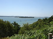
Poole
Poole is a large coastal town and seaport in the county of Dorset, on the south coast of England. The town is east of Dorchester, and Bournemouth adjoins Poole to the east. The Borough of Poole was made a unitary authority in 1997, gaining administrative independence from Dorset County Council...
, and the conurbation
Conurbation
A conurbation is a region comprising a number of cities, large towns, and other urban areas that, through population growth and physical expansion, have merged to form one continuous urban and industrially developed area...
which continues 10 miles (16.1 km) eastwards along the coast. The west and south sides of the harbour and part of the Purbeck Heritage Coast are important wildlife havens, as are the five large islands in the harbour which are home to the endangered Red Squirrel
Red Squirrel
The red squirrel or Eurasian red squirrel is a species of tree squirrel in the genus Sciurus common throughout Eurasia...
. The harbour is an area of international importance for wildlife conservation and borders three National Nature Reserves
National Nature Reserves in England
National Nature Reserves in England are managed by Natural England and are key places for wildlife and natural features in England. They were established to protect the most important areas of habitat and of geological formations...
, including the internationally important Studland and Godlingston Heath NNR
Studland and Godlingston Heath NNR
The Studland and Godlingston Heaths NNR is located on the Isle of Purbeck bordering Studland Bay on the South Side of Poole Harbour, between Swanage and Sandbanks. Extending to 631ha, it is owned and managed by the National Trust following the Bankes bequest of the Kingston Lacy estate...
, and a number of local and non-statutory nature reserves run by organisations such as the National Trust
National Trust for Places of Historic Interest or Natural Beauty
The National Trust for Places of Historic Interest or Natural Beauty, usually known as the National Trust, is a conservation organisation in England, Wales and Northern Ireland...
and RSPB, notably Arne
Arne RSPB reserve
Arne RSPB reserve is a 500 hectare nature reserve, run by the RSPB, overlooking Poole Harbour and adjacent to the village of Arne, in Dorset, England....
. The mouth of the harbour is partially blocked by Sandbanks
Sandbanks
Sandbanks is a small peninsula or spit crossing the mouth of Poole Harbour on the English Channel coast at Poole in Dorset, England. It is well-known for the highly regarded Sandbanks Beach and property value; Sandbanks has, by area, the fourth highest land value in the world...
, a spit
Spit (landform)
A spit or sandspit is a deposition landform found off coasts. At one end, spits connect to land, and extend into the sea. A spit is a type of bar or beach that develops where a re-entrant occurs, such as at cove's headlands, by the process of longshore drift...
on the north, which is built up and part of Poole, and by Studland
Studland
Studland is a small village on the Isle of Purbeck in the English county of Dorset. It is famous for its beaches and nature reserve. In 2001 Studland had a population of 480, the lowest in 50 years...
to the south, which is another important wildlife area.
Four rivers drain into Poole harbour, the largest being the River Frome
River Frome, Dorset
The River Frome is a river in Dorset in the south of England. At 30 miles long it is the major chalkstream in southwest England. It is navigable upstream from Poole Harbour as far as the town of Wareham.-Geography:...
, which flows from the west through Dorchester and Wareham
Wareham, Dorset
Wareham is an historic market town and, under the name Wareham Town, a civil parish, in the English county of Dorset. The town is situated on the River Frome eight miles southwest of Poole.-Situation and geography:...
. The harbour is very shallow in places and has extensive mud flat and salt marsh
Salt marsh
A salt marsh is an environment in the upper coastal intertidal zone between land and salt water or brackish water, it is dominated by dense stands of halophytic plants such as herbs, grasses, or low shrubs. These plants are terrestrial in origin and are essential to the stability of the salt marsh...
habitats, as well as muddy and sandy shores and seagrass
Seagrass
Seagrasses are flowering plants from one of four plant families , all in the order Alismatales , which grow in marine, fully saline environments.-Ecology:...
meadows. The area is an extremely popular recreation
Recreation
Recreation is an activity of leisure, leisure being discretionary time. The "need to do something for recreation" is an essential element of human biology and psychology. Recreational activities are often done for enjoyment, amusement, or pleasure and are considered to be "fun"...
and tourism
Tourism
Tourism is travel for recreational, leisure or business purposes. The World Tourism Organization defines tourists as people "traveling to and staying in places outside their usual environment for not more than one consecutive year for leisure, business and other purposes".Tourism has become a...
area, and local authorities and organisations have to carefully manage the tourism to prevent damage to the habitats.
The south shore of the harbour, including Wytch Heath and Godlingstone Heath, is open heathland of little agricultural use. During the 20th century there has been some afforestation
Afforestation
Afforestation is the establishment of a forest or stand of trees in an area where there was no forest. Reforestation is the reestablishment of forest cover, either naturally or artificially...
with conifer plantations. Around Wareham Forest
Wareham Forest
Wareham Forest is a large coniferous plantation beside the A35 road near Wareham, between Poole and Dorchester, in Dorset, England. The forest is managed by the Forestry Commission for conservation and recreation....
in the west this has been for commercial forestry, but on the southern shore the plantations conceal the Wytch Farm
Wytch Farm
Wytch Farm is an oil field and processing facility in the Purbeck district of Dorset, England. It is the largest onshore oil field in western Europe. The facility, operated by BP, is hidden in a coniferous forest on Wytch Heath on the southern shore of Poole Harbour, two miles north of Corfe Castle...
oil wells.
Three bird species occur in internationally-important numbers: Common Shelduck
Common Shelduck
The Common Shelduck is a waterfowl species shelduck genus Tadorna. It is widespread and common in Eurasia, mainly breeding in temperate and wintering in subtropical regions; in winter, it can also be found in the Maghreb...
, Pied Avocet
Pied Avocet
The Pied Avocet, Recurvirostra avosetta, is a large black and white wader in the avocet and stilt family, Recurvirostridae. They breed in temperate Europe and western and Central Asia. It is a migratory species and most winter in Africa or southern Asia...
and Black-tailed Godwit
Black-tailed Godwit
The Black-tailed Godwit, Limosa limosa, is a large, long-legged, long-billed shorebird first described by Carolus Linnaeus in 1758. It is a member of the Limosa genus, the godwits...
. Other notable visitors include Spoonbill
Spoonbill
Spoonbills are a group of large, long-legged wading birds in the family Threskiornithidae, which also includes the Ibises.All have large, flat, spatulate bills and feed by wading through shallow water, sweeping the partly opened bill from side to side...
, Sandwich Tern and Whimbrel
Whimbrel
The Whimbrel Numenius phaeopus, is a wader in the large family Scolopacidae. It is one of the mostwidespread of the curlews, breeding across much of subarctic North America, Europe and Asia as far south as Scotland....
. Once rare, Little Egret
Little Egret
The Little Egret is a small white heron. It is the Old World counterpart to the very similar New World Snowy Egret.-Subspecies:Depending on authority, two or three subspecies of Little Egret are currently accepted....
s are now seen regularly and in increasing numbers.
Urbanisation and development
Marina
A marina is a dock or basin with moorings and supplies for yachts and small boats.A marina differs from a port in that a marina does not handle large passenger ships or cargo from freighters....
s around the harbour. Due to this increase, Poole has seen a rise in the number of maritime-oriented businesses.
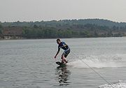
With the popularity of watersports such as Water skiing
Water skiing
thumb|right|A slalom skier making a turn on a slalom waterski.Waterskiing is a sport where an individual is pulled behind a boat or a cable ski installation on a body of water, skimming the surface.-History:...
, Wakeboarding
Wakeboarding
Wakeboarding is a surface water sport which involves riding a wakeboard over the surface of a body of water. It was developed from a combination of water skiing, snow boarding and surfing techniques....
, Windsurfing
Windsurfing
Windsurfing or sailboarding is a surface water sport that combines elements of surfing and sailing. It consists of a board usually two to four metres long, powered by the orthogonal effect of the wind on a sail. The rig is connected to the board by a free-rotating universal joint and comprises a...
and Kitesurfing
Kitesurfing
Kitesurfing or Kiteboarding is an adventure surface water sport that has been described as combining wakeboarding, windsurfing, surfing, paragliding, and gymnastics into one extreme sport. Kitesurfing harnesses the power of the wind to propel a rider across the water on a small surfboard or a...
, Poole Harbour Commissioners have designated areas within the harbour almost exclusively for sport participation - virtually unrestricted from most regular harbour rules. Poole is also fortunate in that wind conditions are variable; wind conditions can be calm for sports such as Wakeboarding
Wakeboarding
Wakeboarding is a surface water sport which involves riding a wakeboard over the surface of a body of water. It was developed from a combination of water skiing, snow boarding and surfing techniques....
, and a short while later strong for sports such as Windsurfing
Windsurfing
Windsurfing or sailboarding is a surface water sport that combines elements of surfing and sailing. It consists of a board usually two to four metres long, powered by the orthogonal effect of the wind on a sail. The rig is connected to the board by a free-rotating universal joint and comprises a...
. Most of these sports benefit from the harbour's generally flat water conditions. As a result, local watersport businesses operate around the harbour.
General
- Clark, G & Thompson, W.H., 1935. The Dorest Landscape. London: A & C Black.
- Cochrane, C, 1970. Poole Bay and Purbeck, 300BC to AD1660. Dorchester, Longmans.
- Hutchings, M., 1965. Inside Dorset. Sherborne: Abbey Press.
- Poole Harbour Commission, The history of Poole Harbour (accessed 9 November 2004)
External links
- Poole Harbour Commissioners official web site
- Online Admiralty Chart of Poole Harbour
- UK Harbours Directory: Poole
- Poole Harbour Study Group
- Poole Harbour Webcam
- Poole Harbour Weather
Photographs:

