Powell River Regional District, British Columbia
Encyclopedia
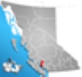
The Regional District of Powell River is a regional district in the Canadian province of British Columbia
. It includes the City of Powell River
and a number of unincorporated areas. The District encompasses a land area of 5,092.06 km² (1,966.06 sq mi).
The District is bounded by the mainland portion of the Strathcona Regional District
to the north, and to the east by the Squamish-Lillooet
and Sunshine Coast
Regional Districts. On the mainland, this includes the area southeast of Powell River to the ferry terminal at Saltery Bay and northwest of Powell River to Desolation Sound
and the terminus of Highway 101 in Lund
. Lasqueti Island
and Texada Island
, along with the southernmost Discovery Islands
(including Hernando
and Savary
), are included as are the largely uninhabited lands to the north and west of this area.
As of the 2006 census
, 19,599 people lived in the District. Its head offices are located in Powell River. The District is governed by a board of seven directors representing the municipality, along with five others representing the unincorporated areas.
British Columbia
British Columbia is the westernmost of Canada's provinces and is known for its natural beauty, as reflected in its Latin motto, Splendor sine occasu . Its name was chosen by Queen Victoria in 1858...
. It includes the City of Powell River
Powell River, British Columbia
Powell River is a city on the northern Sunshine Coast of southwestern British Columbia, Canada. Most of its population lives near the eastern shores of Malaspina Strait, that part of the larger Georgia Strait between Texada Island and the Mainland...
and a number of unincorporated areas. The District encompasses a land area of 5,092.06 km² (1,966.06 sq mi).
The District is bounded by the mainland portion of the Strathcona Regional District
Strathcona Regional District, British Columbia
The Strathcona Regional District is a regional district in British Columbia, Canada. It was created on February 15, 2008, encompassing the northern and western portions of the former Regional District of Comox-Strathcona. The partition left the new Strathcona Regional District with 91.6 percent of...
to the north, and to the east by the Squamish-Lillooet
Squamish-Lillooet Regional District, British Columbia
The Squamish-Lillooet Regional District is a quasi-municipal administrative area in British Columbia, Canada. It stretches from Britannia Beach in the south to Pavilion in the north. Lillooet, Pemberton, Whistler and Squamish are the four municipalities in the regional district...
and Sunshine Coast
Sunshine Coast Regional District, British Columbia
The Sunshine Coast Regional District of British Columbia is located on the southern mainland coast, across Georgia Strait from Vancouver Island. It borders on the Powell River Regional District to the north, the Squamish-Lillooet Regional District to the east, and, across Howe Sound, the Metro...
Regional Districts. On the mainland, this includes the area southeast of Powell River to the ferry terminal at Saltery Bay and northwest of Powell River to Desolation Sound
Desolation Sound
Desolation Sound is a deep water sound in British Columbia, Canada.It is a favourite destination for boaters because of its spectacular fjords, mountains, and wildlife. It is part of the Sunshine Coast....
and the terminus of Highway 101 in Lund
Lund, British Columbia
Lund is a small craft harbour and unincorporated village in Powell River District, British Columbia, Canada. It is located along the northern part of the Strait of Georgia on the mainland BC coast. The main landmark in the village is the Lund Hotel, established in 1905...
. Lasqueti Island
Lasqueti Island
Lasqueti Island is an island off the east coast of Vancouver Island in the Strait of Georgia, Powell River Regional District, British Columbia, Canada. A passenger-only ferry connects the island to the community of French Creek, near Parksville...
and Texada Island
Texada Island
Texada Island is the largest island in the Strait of Georgia of British Columbia, Canada. Its northern tip is located about southwest of the city of Powell River and west of the Sechelt Peninsula on the Sunshine Coast. A former mining and logging area, the island still has a few quarries and old...
, along with the southernmost Discovery Islands
Discovery Islands
The Discovery Islands are the islands in the Discovery Passage between Vancouver Island and the mainland in British Columbia. These islands are sometimes considered to be part of the Northern Gulf Islands....
(including Hernando
Hernando Island
Hernando Island is one of the Discovery Islands near Powell River, British Columbia, Canada. Along with the nearby Cortes Island, it was presumably named in 1792 by Valdés and Galiano after Hernán Cortés, the Spanish conqueror of Mexico....
and Savary
Savary Island
Savary Island is an island in British Columbia, Canada. Located in the northern part of the Strait of Georgia, it is northwest of Vancouver. It is approximately 0.8-1.5 km wide and long. It has a permanent population of 100...
), are included as are the largely uninhabited lands to the north and west of this area.
As of the 2006 census
Canada 2006 Census
The Canada 2006 Census was a detailed enumeration of the Canadian population. Census day was May 16, 2006. The next census following will be the 2011 Census. Canada's total population enumerated by the 2006 census was 31,612,897...
, 19,599 people lived in the District. Its head offices are located in Powell River. The District is governed by a board of seven directors representing the municipality, along with five others representing the unincorporated areas.

