Puyehue National Park
Encyclopedia
Puyehue National Park is located in the Andes
, in Los Ríos
and Los Lagos Region
of Chile
. It covers 1068 sqkm. The Route 215 passes through the park. It connects with the Argentine
Route 231 via Cardenal Antonio Samoré Pass
.
The park is dominated by Puyehue volcano, Cordón Caulle and Antillanca Group
.
Its flora and fauna in the lower parts is that one of Valdivian temperate rain forest and is similar to that of its southern neighbor, the Vicente Pérez Rosales National Park
.
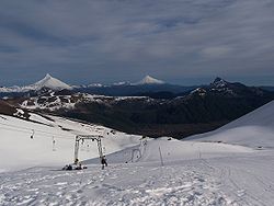
Another attraction is Antillanca ski resort.
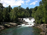
The rivers Gol-Gol and Chanleufú flow through the park, whereas the major lakes within it are Gris and Constancia. The park features numerous waterfalls. Among them is 'Salto del Indio.

Andes
The Andes is the world's longest continental mountain range. It is a continual range of highlands along the western coast of South America. This range is about long, about to wide , and of an average height of about .Along its length, the Andes is split into several ranges, which are separated...
, in Los Ríos
Los Ríos Region
The XIV Los Ríos Region is one of Chile's 15 first order administrative divisions. Its capital is Valdivia. Pop. 356,396 . It began to operate as region on October 2, 2007. It was created by subdividing the Los Lagos Region in southern Chile...
and Los Lagos Region
Los Lagos Region
Los Lagos Region is one of Chile's 15 regions, which are first order administrative divisions, and comprises four provinces: Chiloé, Llanquihue, Osorno and Palena. The region contains the country's second largest island, Chiloé, and the second largest lake, Llanquihue.Its capital is Puerto Montt;...
of Chile
Chile
Chile ,officially the Republic of Chile , is a country in South America occupying a long, narrow coastal strip between the Andes mountains to the east and the Pacific Ocean to the west. It borders Peru to the north, Bolivia to the northeast, Argentina to the east, and the Drake Passage in the far...
. It covers 1068 sqkm. The Route 215 passes through the park. It connects with the Argentine
Argentina
Argentina , officially the Argentine Republic , is the second largest country in South America by land area, after Brazil. It is constituted as a federation of 23 provinces and an autonomous city, Buenos Aires...
Route 231 via Cardenal Antonio Samoré Pass
Cardenal Antonio Samoré Pass
Cardenal Antonio Samoré Pass it is one of the main mountain pass through the southern Andes along the border between Argentina and Chile.Together with Paso Libertadores, it is one of the easiest of the Argentina-Chile passes, and one of the few with asphalted roads in the region...
.
The park is dominated by Puyehue volcano, Cordón Caulle and Antillanca Group
Antillanca Group
Antillanca Group is a volcanic group of scoria cones, maars and small stratovolcanoes. Casablanca stratovolcano is the tallest volcano of the group, which shelters the Antillanca ski resort on its west flank. Aguas Calientes and Puyehue Hot springs also form part of this volcanic group...
.
Its flora and fauna in the lower parts is that one of Valdivian temperate rain forest and is similar to that of its southern neighbor, the Vicente Pérez Rosales National Park
Vicente Pérez Rosales National Park
Vicente Pérez Rosales National Park is located in Los Lagos Region, Llanquihue Province, of Chile. Its western entrance is close to the Ensenada locality, northeast of the provincial capital of Puerto Montt, and from Puerto Varas along Ruta CH-225. This national park covers about and is almost...
.
Another attraction is Antillanca ski resort.
The rivers Gol-Gol and Chanleufú flow through the park, whereas the major lakes within it are Gris and Constancia. The park features numerous waterfalls. Among them is 'Salto del Indio.


