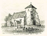
Pyecombe
Encyclopedia
Pyecombe is a village and civil parish
in the Mid Sussex
District of West Sussex
, England
. It is located 7 miles (11 km) to the north of Brighton
. The civil parish covers an area of 887 hectares (2,191.8 acre) and has a population of 200 (2001 census).
The parish church, the Church of the Transfiguration
, was largely built in 1170. The village inn is the Plough; and there is Pyecombe Golf Club just to the north of the village. There is also a riding school The Three Greys and a stud
Brendon Stud in the locality.
The word 'Pyecombe' is thought to derive from the Saxon
name "peac cumb" which means 'the peak valley'. Actually the parish of Pyecombe comprises two settlements, one called 'Pyecombe' and the other 'Pyecombe Street'. These are about a quarter of a mile apart. The reason for the gap between the two parts of the village is unsure but it is generally thought to be a consequence of plague in the 17th century which necessitated the temporary abandonment of the main settlement and its 13th century Saxo-Norman church.
The village lies on the London to Brighton Way
Roman road, as well as on 18th and 19th century turnpike roads over Clayton Hill.
is a chalk prominence located within the parish, owned and maintained by the National Trust
, is listed as a Scheduled Monument and a Site of Special Scientific Interest
.
Civil parish
In England, a civil parish is a territorial designation and, where they are found, the lowest tier of local government below districts and counties...
in the Mid Sussex
Mid Sussex
Mid Sussex is a local government district in the English county of West Sussex. It contains the towns of East Grinstead, Haywards Heath and Burgess Hill....
District of West Sussex
West Sussex
West Sussex is a county in the south of England, bordering onto East Sussex , Hampshire and Surrey. The county of Sussex has been divided into East and West since the 12th century, and obtained separate county councils in 1888, but it remained a single ceremonial county until 1974 and the coming...
, England
England
England is a country that is part of the United Kingdom. It shares land borders with Scotland to the north and Wales to the west; the Irish Sea is to the north west, the Celtic Sea to the south west, with the North Sea to the east and the English Channel to the south separating it from continental...
. It is located 7 miles (11 km) to the north of Brighton
Brighton
Brighton is the major part of the city of Brighton and Hove in East Sussex, England on the south coast of Great Britain...
. The civil parish covers an area of 887 hectares (2,191.8 acre) and has a population of 200 (2001 census).
The parish church, the Church of the Transfiguration
Church of the Transfiguration, Pyecombe
The Church of the Transfiguration is an Anglican church in the village of Pyecombe, in the Mid Sussex district of West Sussex, England. The mostly 12th- and 13th-century building, in an isolated setting facing the South Downs, has been listed at Grade I by English Heritage: this status is given to...
, was largely built in 1170. The village inn is the Plough; and there is Pyecombe Golf Club just to the north of the village. There is also a riding school The Three Greys and a stud
Stud farm
A stud farm or stud in animal husbandry, is an establishment for selective breeding of livestock. The word "stud" comes from the Old English stod meaning "herd of horses, place where horses are kept for breeding" Historically, documentation of the breedings that occur on a stud farm leads to the...
Brendon Stud in the locality.
The word 'Pyecombe' is thought to derive from the Saxon
Saxons
The Saxons were a confederation of Germanic tribes originating on the North German plain. The Saxons earliest known area of settlement is Northern Albingia, an area approximately that of modern Holstein...
name "peac cumb" which means 'the peak valley'. Actually the parish of Pyecombe comprises two settlements, one called 'Pyecombe' and the other 'Pyecombe Street'. These are about a quarter of a mile apart. The reason for the gap between the two parts of the village is unsure but it is generally thought to be a consequence of plague in the 17th century which necessitated the temporary abandonment of the main settlement and its 13th century Saxo-Norman church.
The village lies on the London to Brighton Way
London to Brighton Way (Roman road)
The London to Brighton Way, sometimes called the London to Portslade Way is a Roman road between Stane Street at Kennington Park and Brighton in Sussex. The road passes through Streatham and Croydon, then through the Caterham Valley gap in the North Downs...
Roman road, as well as on 18th and 19th century turnpike roads over Clayton Hill.
Landmarks
Wolstonbury HillWolstonbury Hill
Wolstonbury Hill is a chalk prominence in the South Downs National Park, approximately north of Brighton and west of Clayton, in the parish of Pyecombe, West Sussex, England...
is a chalk prominence located within the parish, owned and maintained by the National Trust
National Trust for Places of Historic Interest or Natural Beauty
The National Trust for Places of Historic Interest or Natural Beauty, usually known as the National Trust, is a conservation organisation in England, Wales and Northern Ireland...
, is listed as a Scheduled Monument and a Site of Special Scientific Interest
Site of Special Scientific Interest
A Site of Special Scientific Interest is a conservation designation denoting a protected area in the United Kingdom. SSSIs are the basic building block of site-based nature conservation legislation and most other legal nature/geological conservation designations in Great Britain are based upon...
.

