Railroad Valley
Encyclopedia

Tonopah Basin
The Tonopah Basin is one of the Central Nevada Desert Basins that extends from the band of arid footslopes along the north side of the Mojave Desert northward into the Big Smoky Valley and the Railroad Valley...
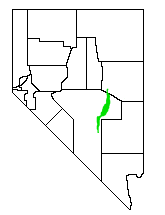
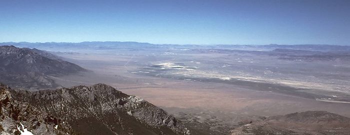
and is ~80 miles (130 km) long north-south and up to 20 miles (32 km) wide, with some southern areas running southwest to northeast. The southern end of the valley begins near Gray Top Mountain (7,036 feet) and stretches north all the way to Mount Hamilton (10,745 feet). To the east are the Quinn Canyon
Quinn Canyon Range
The Quinn Canyon Range is a remote group of mountains in northeastern Nye County, in central Nevada in the western United States.It is closely associated with the Grant Range, which meets it at Cherry Creek Summit . From there, the range runs for approximately 33 miles to the southwest...
, Grant
Grant Range
The Grant Range is a mountain chain in east-central Nevada in the western United States. It runs for approximately 30 miles in a generally north-south direction in northeastern Nye County. It is located south of the Horse Range and northeast of the closely associated Quinn Canyon Range. To the...
, and White Pine
White Pine Range
The White Pine Range is a group of mountains in southern White Pine County, in eastern Nevada. The range runs for approximately 51 miles from Beck Pass in the north to Currant Pass in the south. To the west of the range are the Duckwater tribal lands and the northern arm of large Railroad Valley...
Ranges, while to the west are the Pancake
Pancake Range
The Pancake Range is located in east-central Nevada in the United States. The mountains lie in a generally north-south direction in Nye County and White Pine County. The Lunar Crater Volcanic Field lies at the southwestern end of the chain...
and Reveille Range
Reveille Range
The Reveille Range is the Nye County, Nevada mountain range that is the location of the Reveille Range volcanic field....
s. Most of the valley lies in Nye County, but it crosses into White Pine County at its northern end. The valley includes numerous springs including Kate Springs and Blue Eagle Springs,http://nas.er.usgs.gov/queries/CollectionInfo.aspx?SpeciesID=508&State=NV ranches such as the Blue Eagle Ranch, and 2 Tonopah Playas
Tonopah Basin
The Tonopah Basin is one of the Central Nevada Desert Basins that extends from the band of arid footslopes along the north side of the Mojave Desert northward into the Big Smoky Valley and the Railroad Valley...
.
The valley has 4 separate Wildlife Management Area
Wildlife Management Area
Wildlife Management Areas are protected areas set aside in for the conservation of wildlife and for recreational activities involving wildlife.-United States:In the U.S., WMAs exist in the following states:* Alabama* Florida* Georgia* Louisiana...
s ("Railroad Valley WMA"), and valley communities include Currant
Currant, Nevada
Currant is a small town in Nye County, Nevada. Settled in 1868, it was first a farming town with a small population. Its current population is 65.-Transportation:Currant is located on U.S. Route 6 at the junction of State Route 379...
, Crows Nest, Green Springs, Lockes, and Nyala. Most of Nevada's oil production (totalling about 553,000 barrels during 2002) comes from several small oil fields in Railroad Valley, including Eagle Springs, Trap Spring, and Grant Canyon oil fields.
The valley is the ancestral home of the Tsaidüka band of Western Shoshone
Western Shoshone
Western Shoshone comprises several Shoshone tribes that are indigenous to the Great Basin and have lands identified in the Treaty of Ruby Valley 1863. They resided in Idaho, Nevada, California, and Utah. The tribes are very closely related culturally to the Paiute, Goshute, Bannock, Ute, and...
, who are now enrolled in the Duckwater Shoshone Tribe of the Duckwater Reservation
Duckwater Shoshone Tribe of the Duckwater Reservation
The Duckwater Shoshone Tribe of the Duckwater Reservation is a federally recognized tribe of Western Shoshone in central Nevada. Their autonym is Tsaidüka, meaning "Eaters of tule."-Reservation:...
.


