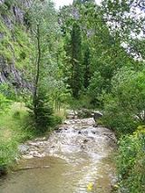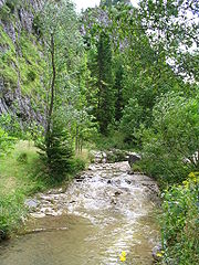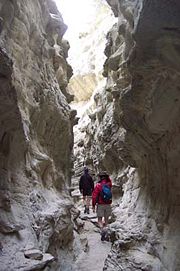
Ravine
Encyclopedia


Landform
A landform or physical feature in the earth sciences and geology sub-fields, comprises a geomorphological unit, and is largely defined by its surface form and location in the landscape, as part of the terrain, and as such, is typically an element of topography...
narrower than a canyon
Canyon
A canyon or gorge is a deep ravine between cliffs often carved from the landscape by a river. Rivers have a natural tendency to reach a baseline elevation, which is the same elevation as the body of water it will eventually drain into. This forms a canyon. Most canyons were formed by a process of...
and is often the product of stream
Stream
A stream is a body of water with a current, confined within a bed and stream banks. Depending on its locale or certain characteristics, a stream may be referred to as a branch, brook, beck, burn, creek, "crick", gill , kill, lick, rill, river, syke, bayou, rivulet, streamage, wash, run or...
cutting erosion
Erosion
Erosion is when materials are removed from the surface and changed into something else. It only works by hydraulic actions and transport of solids in the natural environment, and leads to the deposition of these materials elsewhere...
. Ravines are typically classified as larger in scale than gullies
Gully
A gully is a landform created by running water, eroding sharply into soil, typically on a hillside. Gullies resemble large ditches or small valleys, but are metres to tens of metres in depth and width...
, although smaller than valley
Valley
In geology, a valley or dale is a depression with predominant extent in one direction. A very deep river valley may be called a canyon or gorge.The terms U-shaped and V-shaped are descriptive terms of geography to characterize the form of valleys...
s. A ravine is generally a fluvial
Fluvial
Fluvial is used in geography and Earth science to refer to the processes associated with rivers and streams and the deposits and landforms created by them...
slope landform of relatively steep (cross-sectional) sides, on the order of twenty to seventy percent in gradient. Ravines may or may not have active streams flowing along the downslope channel which originally formed them; moreover, often they are characterized by intermittent streams, since their geographic scale may not be sufficiently large to support a perennial
Perennial stream
A perennial stream or perennial river is a stream or river that has continuous flow in parts of its bed all year round during years of normal rainfall. "Perennial" streams are contrasted with "intermittent" streams which normally cease flowing for weeks or months each year, and with "ephemeral"...
watercourse
Watercourse
A watercourse is any flowing body of water. These include rivers, streams, anabranches, and so forth.-See also:* physical geography* Environmental flow* Waterway* Hydrology* Wadi-External links:...
.
Other terms
Other terms for ravine include- cleuch
- dell
- gill
- glenGlenA glen is a valley, typically one that is long, deep, and often glacially U-shaped; or one with a watercourse running through such a valley. Whittow defines it as a "Scottish term for a deep valley in the Highlands" that is "narrower than a strath."...
- kloof (South AfricaSouth AfricaThe Republic of South Africa is a country in southern Africa. Located at the southern tip of Africa, it is divided into nine provinces, with of coastline on the Atlantic and Indian oceans...
)
See also
- Arroyo (creek)Arroyo (creek)An arroyo , a Spanish word translated as brook, and also called a wash is usually a dry creek or stream bed—gulch that temporarily or seasonally fills and flows after sufficient rain. Wadi is a similar term in Africa. In Spain, a rambla has a similar meaning to arroyo.-Types and processes:Arroyos...
- Canyon / GorgeCanyonA canyon or gorge is a deep ravine between cliffs often carved from the landscape by a river. Rivers have a natural tendency to reach a baseline elevation, which is the same elevation as the body of water it will eventually drain into. This forms a canyon. Most canyons were formed by a process of...
- ChineChineA chine is a steep-sided river valley where the river flows through coastal cliffs to the sea. Typically these are soft eroding cliffs such as sandstone or clays. The word chine originates from the Saxon "Cinan" meaning a gap or yawn....
- Defile (geography)
- Draw (terrain)Draw (terrain)A draw a terrain feature formed by two parallel ridges or spurs with low ground in between them. The area of low ground itself is the draw, and it is defined by the spurs surrounding it...
- Riparian zoneRiparian zoneA riparian zone or riparian area is the interface between land and a river or stream. Riparian is also the proper nomenclature for one of the fifteen terrestrial biomes of the earth. Plant habitats and communities along the river margins and banks are called riparian vegetation, characterized by...

