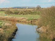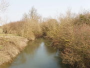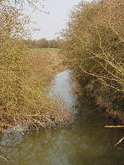
River Ray
Encyclopedia


Buckinghamshire
Buckinghamshire is a ceremonial and non-metropolitan home county in South East England. The county town is Aylesbury, the largest town in the ceremonial county is Milton Keynes and largest town in the non-metropolitan county is High Wycombe....
and Oxfordshire
Oxfordshire
Oxfordshire is a county in the South East region of England, bordering on Warwickshire and Northamptonshire , Buckinghamshire , Berkshire , Wiltshire and Gloucestershire ....
, England
England
England is a country that is part of the United Kingdom. It shares land borders with Scotland to the north and Wales to the west; the Irish Sea is to the north west, the Celtic Sea to the south west, with the North Sea to the east and the English Channel to the south separating it from continental...
. It rises at Quainton
Quainton
Quainton is a village and civil parish in Aylesbury Vale district in Buckinghamshire, England, north west of Aylesbury. The population is 1290, of which 1000 are adults. The village has two churches , a school and two public houses...
Hill and flows west through a flat countryside for around 25 km or 15 miles. It passes the village of Ambrosden
Ambrosden
Ambrosden is a village and civil parish in Cherwell, Oxfordshire, England, southwest of Bicester to which it is linked by the A41 road, and from Oxford. The 2001 Census recorded a parish population of 1,749 people. The parish is bounded by the River Ray to the south, its tributary the River Bure...
and then flows through Otmoor
Otmoor
Otmoor or Ot Moor is an area of wetland and wet grassland in Oxfordshire, England, located halfway between Oxford and Bicester. It is about above sea level, and has an area of approximately ....
. It joins the River Cherwell
River Cherwell
The River Cherwell is a river which flows through the Midlands of England. It is a major tributary of the River Thames.The general course of the River Cherwell is north to south and the 'straight-line' distance from its source to the Thames is about...
near Islip
Islip, Oxfordshire
Islip is a village and civil parish on the River Ray, just above its confluence with the River Cherwell in Oxfordshire, England. It is about east of Kidlington and about north of Oxford. This village in Oxfordshire is not related to Islip, New York...
.
In 1815 a new channel was cut between Charlton-on-Otmoor
Charlton-on-Otmoor
Charlton-on-Otmoor is a village and civil parish about south of Bicester in Oxfordshire, England. The village is close to the River Ray on the northern edge of Otmoor.-Church of England:Charlton had a parish church by the 11th century...
and Oddington
Oddington, Oxfordshire
Oddington is a village and civil parish about south of Bicester in Oxfordshire, England. The village is close to the River Ray on the northern edge of Otmoor.-History:...
, known as the New River Ray, to divert much of the water flow around the northern and western edge of Otmoor.

