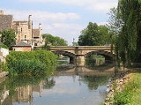
River Welland
Overview
The River Welland is a river in the east of England
, some 65 miles (104.6 km) long. It rises in the Hothorpe Hills, at Sibbertoft
in Northamptonshire
, then flows generally northeast to Market Harborough
, Stamford
and Spalding
, to reach The Wash
near Fosdyke
. For much of its length it forms the county boundary between Northamptonshire and Leicestershire
, Rutland
, Lincolnshire
and Cambridgeshire
. It is a major waterway across the part of The Fens
called South Holland
, and is one of the Fenland rivers which were laid out with washlands.
England
England is a country that is part of the United Kingdom. It shares land borders with Scotland to the north and Wales to the west; the Irish Sea is to the north west, the Celtic Sea to the south west, with the North Sea to the east and the English Channel to the south separating it from continental...
, some 65 miles (104.6 km) long. It rises in the Hothorpe Hills, at Sibbertoft
Sibbertoft
Sibbertoft is a village and civil parish in the Daventry district of Northamptonshire in England. At the time of the 2001 census, the parish's population was 343 people....
in Northamptonshire
Northamptonshire
Northamptonshire is a landlocked county in the English East Midlands, with a population of 629,676 as at the 2001 census. It has boundaries with the ceremonial counties of Warwickshire to the west, Leicestershire and Rutland to the north, Cambridgeshire to the east, Bedfordshire to the south-east,...
, then flows generally northeast to Market Harborough
Market Harborough
Market Harborough is a market town within the Harborough district of Leicestershire, England.It has a population of 20,785 and is the administrative headquarters of Harborough District Council. It sits on the Northamptonshire-Leicestershire border...
, Stamford
Stamford, Lincolnshire
Stamford is a town and civil parish within the South Kesteven district of the county of Lincolnshire, England. It is approximately to the north of London, on the east side of the A1 road to York and Edinburgh and on the River Welland...
and Spalding
Spalding, Lincolnshire
Spalding is a market town with a population of 30,000 on the River Welland in the South Holland district of Lincolnshire, England. Little London is a hamlet directly south of Spalding on the B1172 road....
, to reach The Wash
The Wash
The Wash is the square-mouthed bay and estuary on the northwest margin of East Anglia on the east coast of England, where Norfolk meets Lincolnshire. It is among the largest estuaries in the United Kingdom...
near Fosdyke
Fosdyke
Fosdyke is a village and civil parish in Lincolnshire, England. It lies about south of Boston just off the A17, and east from the junction of the A17 with the A16. The village is near the mouth of the River Welland, and the parish extends across the river to include both ends of the hamlet of...
. For much of its length it forms the county boundary between Northamptonshire and Leicestershire
Leicestershire
Leicestershire is a landlocked county in the English Midlands. It takes its name from the heavily populated City of Leicester, traditionally its administrative centre, although the City of Leicester unitary authority is today administered separately from the rest of Leicestershire...
, Rutland
Rutland
Rutland is a landlocked county in central England, bounded on the west and north by Leicestershire, northeast by Lincolnshire and southeast by Peterborough and Northamptonshire....
, Lincolnshire
Lincolnshire
Lincolnshire is a county in the east of England. It borders Norfolk to the south east, Cambridgeshire to the south, Rutland to the south west, Leicestershire and Nottinghamshire to the west, South Yorkshire to the north west, and the East Riding of Yorkshire to the north. It also borders...
and Cambridgeshire
Cambridgeshire
Cambridgeshire is a county in England, bordering Lincolnshire to the north, Norfolk to the northeast, Suffolk to the east, Essex and Hertfordshire to the south, and Bedfordshire and Northamptonshire to the west...
. It is a major waterway across the part of The Fens
The Fens
The Fens, also known as the , are a naturally marshy region in eastern England. Most of the fens were drained several centuries ago, resulting in a flat, damp, low-lying agricultural region....
called South Holland
South Holland, Lincolnshire
South Holland is a local government district of Lincolnshire. The district council is based in Spalding.It was formed on 1 April 1974, under the Local Government Act 1972, as a merger of the Spalding urban district with East Elloe Rural District and Spalding Rural District...
, and is one of the Fenland rivers which were laid out with washlands.

