Rodna Mountains
Encyclopedia

Romania
Romania is a country located at the crossroads of Central and Southeastern Europe, on the Lower Danube, within and outside the Carpathian arch, bordering on the Black Sea...
. The name comes from the nearby Rodna Veche village.
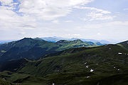
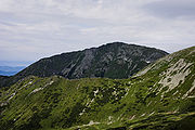
The Rodna Mountains have one of the longest continuous ridges in Romania, with over 50 km from west to east. The two highest points are Pietrosul Rodnei and Ineu
Ineu Peak
Ineu is a peak in the Rodna Mountains, Romania. Altitude: 2,279 m. It is actually the second peak as height after Pietrosu Peak . Altitude: 2,303m. It belongs to the Mixed Reservation "Ineu-Lala".- Routes :...
peaks, with 2,303 and 2,279 meters respectively.
The mountains are most suited for hiking in summer and skiing in winter, and are especially famous for having snow late into the summer months (skiing is possible well into June, sometimes even July).
While the ridge itself poses no difficulties, the challenge is the massive length of it, and the absence of drinkable water (except for a few puddles that are usually dry). A complete hike on the Rodnei main ridge takes between 3 and 5 days, depending on the weather and the endurance of the hiker.

Localization
The Rodna Mountains are in the region of MaramureşMaramures
Maramureș may refer to the following:*Maramureș, a geographical, historical, and ethno-cultural region in present-day Romania and Ukraine, that occupies the Maramureș Depression and Maramureș Mountains, a mountain range in North East Carpathians...
, in northern Romania
Romania
Romania is a country located at the crossroads of Central and Southeastern Europe, on the Lower Danube, within and outside the Carpathian arch, bordering on the Black Sea...
, near the Romanian-Ukrainian border
Border
Borders define geographic boundaries of political entities or legal jurisdictions, such as governments, sovereign states, federated states and other subnational entities. Some borders—such as a state's internal administrative borders, or inter-state borders within the Schengen Area—are open and...
. To the north lie the city of Borşa
Borsa
Borșa is a town in eastern Maramureş County, northern Romania, in the valley of the Vişeu River and near the Prislop Pass. Linking Transylvania to Bukovina, Prislop Pass is surrounded by the Rodna and Maramureş Mountains, both ranges of the Carpathians...
and the village Moisei
Moisei
Moisei is a commune in Maramureş County, Romania. Composed of a single village, Moisei, it is one of the oldest communes in Maramureş County, first attested in 1213...
. To the west the massif ends at the Setref-pass (817 m); to the east, the limits are the Prislop Pass
Prislop Pass
Prislop Pass is a mountain pass in northern Romania, connecting the historical regions of Maramureş and Bukovina over the Rodna Mountains, in the Eastern Carpathians.The Prislop Pass is situated at an altitude of 1,416 meters. The nearest city is Borşa....
(1,416 m) and the Rotunda Pass (1,271 m); to the south lie the villages of Rodna Veche, Şanţ, Maieru and Anieş, as well as the Someşul Mare River
Someşul Mare River
The Someșul Mare is a river in north-western Romania, originating in the Bistriţa-Năsăud County in the Rodna Mountains at the junction of two headwaters — the Preluci River/Pârâul Mariei) and the Zmeu River. The Someşul Mare flows west through Rodna, Năsăud and Beclean, until it meets the Someșul...
having its source in the Rodna Mountains.
The main ridge of the Rodna Mountains constitutes the natural border
Natural border
A natural border is a border between states which is composed of natural formations such as rivers, mountain ranges, or deserts.Having a natural border is strategically very useful, as invading armies can have a hard time crossing such a border...
between Bistriţa-Năsăud and Maramureş
Maramures
Maramureș may refer to the following:*Maramureș, a geographical, historical, and ethno-cultural region in present-day Romania and Ukraine, that occupies the Maramureș Depression and Maramureș Mountains, a mountain range in North East Carpathians...
counties.
Access
The most used access points to the mountain are:- Setref Pass, by car or train, from the Dealu Stefanitei train station
- Borşa city, by car or bus; from the center of the city there is a path to the Iezer weather station
Weather station
A weather station is a facility, either on land or sea, with instruments and equipment for observing atmospheric conditions to provide information for weather forecasts and to study the weather and climate. The measurements taken include temperature, barometric pressure, humidity, wind speed, wind...
and lake
- Borşa ski resort, by car or bus; access is made from the top of the ski slope, directly to the main ridge at "Saua Gargalau"
- Prislop Pass, by car; from the pass there is a marked path that meets the one from the top of the ski slope, also leading to "Saua Gargalau"
- Rodna Veche village, by train or car; from the village there are two marked paths leading to the main ridge, one of them going directly to the Ineu peak
Accommodation
There are a few resorts at the base of the mountain, notably Borşa ski resort, with a few hotels and many privately-run guesthouses, and also the new "Valea Blaznei" resort, completed in 2007, near the village Sant. It contains two notable places to check in, "Cabana Vio" at 1,100 m (6 km of village Sant), and a bit higher, "Cabana Diana" at 1,240 m which is a mountain refuge actually.Up on the ridge there is no accommodation whatsoever, so tourists should bring tents.

