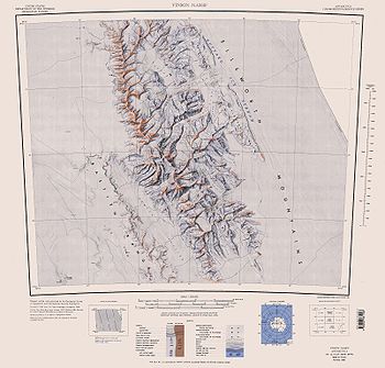
Rutford Ice Stream
Encyclopedia


Ice stream
An ice stream is a region of an ice sheet that moves significantly faster than the surrounding ice. Ice streams are a type of glacier. They are significant features of the Antarctic where they account for 10% of the volume of the ice...
, about 180 miles long and over 15 miles wide, which drains southeastward between the Sentinel Range
Sentinel Range
The Sentinel Range is a major mountain range situated northward of Minnesota Glacier and forming the northern half of the Ellsworth Mountains in Antarctica. The range trends NNW-SSE for about and is 24 to 48 km wide...
, Ellsworth Mountains
Ellsworth Mountains
The Ellsworth Mountains are the highest mountain ranges in Antarctica, forming a long and wide chain of mountains in a north to south configuration on the western margin of the Ronne Ice Shelf. They are bisected by Minnesota Glacier to form the northern Sentinel Range and the southern Heritage...
and Fletcher Ice Rise
Fletcher Ice Rise
Fletcher Ice Rise , or Fletcher Promontory, is a large ice rise, 100 miles long and 40 miles wide, at the southwest side of Ronne Ice Shelf. The feature is completely ice covered and rises between Rutford Ice Stream and Carlson Inlet. The ice rise was observed, photographed and roughly sketched by...
into the southwest part of Ronne Ice Shelf. Named by US-ACAN for geologist Robert Hoxie Rutford
Robert Hoxie Rutford
Robert Hoxie Rutford was a member of several United States Antarctic Program expeditions to Antarctica. He was the leader of the University of Minnesota Ellsworth Mountains Party, 1963–1964. Rutford served as Director of the Division of Polar Programs of the National Science Foundation from 1975...
, a member of several USARP expeditions to Antarctica; leader of the University of Minnesota Ellsworth Mountains Party, 1963-1964. Rutford served as Director of the Division of Polar Programs, National Science Foundation, 1975-1977.
The ice stream is situated in a deep trough which is a tectonic feature between the Ellsworth Mountains and the Fletcher Promontory. Because of this the ice stream position may have been stable for millions of years. The bed of the ice stream reaches 2000 m below sea level. Therefore between the bed of the ice stream and the height of the Ellsworth Mountains there is a vertical relief
Terrain
Terrain, or land relief, is the vertical and horizontal dimension of land surface. When relief is described underwater, the term bathymetry is used...
of 7 km over a distance of only 40 km. At the upper (inland) end of the ice stream the ice thickness reaches 3100 m falling to around 2300 m in the trough. Flow speed reaches a maximum of around 400 metres per year about 40 km inland from where the ice stream meets the Ronne Ice Shelf and starts to float on the sea.
The Rutford ice stream varies its speed by as much as 20% every two weeks, in response to variations in the tides.

