Shire of Tambellup
Encyclopedia
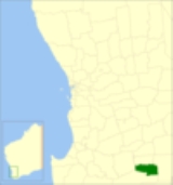
The Shire of Tambellup was a Local Government Area
in the Great Southern region of Western Australia
, about 40 kilometres (25 mi) south of Katanning
and about 330 kilometres (205 mi) south-southeast of the state capital, Perth
. The Shire covers an area of 1436 square kilometres (554 sq mi), and its seat of government was the town of Tambellup
.
The Tambellup Road Board was gazetted in 1905. On 1 July 1961, it became a Shire Council following changes to the Local Government Act. On 1 July 2008, after 10 months of planning and preparation, it merged with the neighbouring Shire of Broomehill
to form the Shire of Broomehill-Tambellup
.
Local Government Areas of Western Australia
The Australian state of Western Australia is divided into 141 local government areas...
in the Great Southern region of Western Australia
Western Australia
Western Australia is a state of Australia, occupying the entire western third of the Australian continent. It is bounded by the Indian Ocean to the north and west, the Great Australian Bight and Indian Ocean to the south, the Northern Territory to the north-east and South Australia to the south-east...
, about 40 kilometres (25 mi) south of Katanning
Katanning, Western Australia
Katanning is a town located 277 km south east of Perth, Western Australia on the Great Southern Highway. At the 2006 census, Katanning had a population of 3,808.-History:...
and about 330 kilometres (205 mi) south-southeast of the state capital, Perth
Perth, Western Australia
Perth is the capital and largest city of the Australian state of Western Australia and the fourth most populous city in Australia. The Perth metropolitan area has an estimated population of almost 1,700,000....
. The Shire covers an area of 1436 square kilometres (554 sq mi), and its seat of government was the town of Tambellup
Tambellup, Western Australia
The townsite of Tambellup is located in Western Australia's Great Southern Agricultural region, 317 km south-east of Perth on the Great Southern Highway where it crosses the Gordon River...
.
The Tambellup Road Board was gazetted in 1905. On 1 July 1961, it became a Shire Council following changes to the Local Government Act. On 1 July 2008, after 10 months of planning and preparation, it merged with the neighbouring Shire of Broomehill
Shire of Broomehill
The Shire of Broomehill was a Local Government Area in the Great Southern region of Western Australia, about south of Katanning and about south-southeast of the state capital, Perth. The Shire covered an area of , and its seat of government was the town of Broomehill.The Broomehill Road Board was...
to form the Shire of Broomehill-Tambellup
Shire of Broomehill-Tambellup
The Shire of Broomehill-Tambellup is a new Local Government Area in the Great Southern region of Western Australia, south-southeast of the state capital, Perth. The Shire covers an area of , and its seat of government is the town of Tambellup...
.
Wards
The shire was divided into 3 wards:- Stirling Ward (3 councillors)
- Toolbrunup Ward (3 councillors)
- Warrenup Ward (3 councillors)
Towns/Localities
- TambellupTambellup, Western AustraliaThe townsite of Tambellup is located in Western Australia's Great Southern Agricultural region, 317 km south-east of Perth on the Great Southern Highway where it crosses the Gordon River...
- Lake Toolbrunup
- TunneyTunney, Western AustraliaTunney is a town located along the Albany Highway between Kojonup and Cranbrook, in the Great Southern region of Western Australia.The district was first settled in the 1850s and by 1909 a new settler named J.A. Atcheson wrote to the government asking for assistance with establishing a school and...

