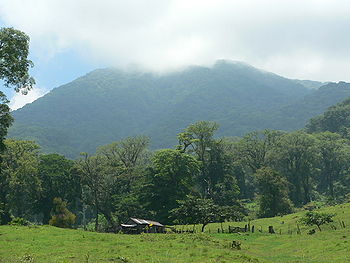
Sierra de los Tuxtlas
Encyclopedia

Volcanic belt
A volcanic belt is a large volcanically active region. Other terms are used for smaller areas of activity, such as volcanic fields. Volcanic belts are found above zones of unusually high temperature where magma is created by partial melting of solid material in the Earth's crust and upper mantle....
and mountain range
Mountain range
A mountain range is a single, large mass consisting of a succession of mountains or narrowly spaced mountain ridges, with or without peaks, closely related in position, direction, formation, and age; a component part of a mountain system or of a mountain chain...
along the southeastern Veracruz
Veracruz
Veracruz, formally Veracruz de Ignacio de la Llave officially Estado Libre y Soberano de Veracruz de Ignacio de la Llave , is one of the 31 states that, along with the Federal District, comprise the 32 federative entities of Mexico. It is divided in 212 municipalities and its capital city is...
Gulf coast
Gulf of Mexico
The Gulf of Mexico is a partially landlocked ocean basin largely surrounded by the North American continent and the island of Cuba. It is bounded on the northeast, north and northwest by the Gulf Coast of the United States, on the southwest and south by Mexico, and on the southeast by Cuba. In...
in southcentral Mexico
Mexico
The United Mexican States , commonly known as Mexico , is a federal constitutional republic in North America. It is bordered on the north by the United States; on the south and west by the Pacific Ocean; on the southeast by Guatemala, Belize, and the Caribbean Sea; and on the east by the Gulf of...
.
Peaks in this range include Volcano Santa Marta and Volcano San Martín Tuxtla, both rising above 1700 meters. San Martín Tuxtla is the only recently-active volcano in the belt, erupting in 1664 and again in May 1793. It is a broad alkaline shield volcano
Shield volcano
A shield volcano is a type of volcano usually built almost entirely of fluid lava flows. They are named for their large size and low profile, resembling a warrior's shield. This is caused by the highly fluid lava they erupt, which travels farther than lava erupted from more explosive volcanoes...
with a one kilometer wide summit. Hundreds of smaller cinder cone
Cinder cone
According to the , Cinder Cone is the proper name of 1 cinder cone in Canada and 7 cinder cones in the United States:In Canada: Cinder Cone In the United States:...
s are prevalent throughout the Sierra.
Other, extinct volcanoes include San Martin Pajapan (1,160 meters) and Cerro El Vigia (800 meters).
The Sierra de Los Tuxtlas volcanoes are an insular anomaly. The volcanoes are separated from the nearest volcano in the Trans-Mexican Volcanic Belt
Trans-Mexican volcanic belt
The Trans-Mexican Volcanic Belt also known as the Transvolcanic Belt and locally as the Sierra Nevada , is a volcanic belt that extends 900 km from west to east across central-southern Mexico...
to the west by about 150 miles (250 km), and from the Central American Volcanic Belt
Central American Volcanic Belt
The Central America Volcanic Arc is a chain of volcanoes which extends parallel to the Pacific coast line of the Central American Isthmus, from Guatemala, El Salvador, Honduras, Nicaragua, Costa Rica and down to northern Panama...
to the southeast by almost 200 miles (330 km).
These mountains were used as a basalt source for the Olmecs during the early formative period. Basalt was transported by raft through a network of rivers and then made into monuments including colossal heads.
Los Tuxtlas Biosphere Reserve
The upper flanks of the San Martin Tuxtla and Santa Marta volcanoes are covered with a neotropicNeotropic
In biogeography, the Neotropic or Neotropical zone is one of the eight terrestrial ecozones. This ecozone includes South and Central America, the Mexican lowlands, the Caribbean islands, and southern Florida, because these regions share a large number of plant and animal groups.It is sometimes used...
al rainforest
Tropical and subtropical moist broadleaf forests
Tropical and subtropical moist broadleaf forests , also known as tropical moist forests, are a tropical and subtropical forest biome....
, while the lower portions are covered with stunted pastures. The Sierra de Los Tuxtlas includes all of the Los Tuxtlas Biosphere Reserve .

