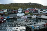
Skopun
Encyclopedia
Skopun is a town in the Faroe Islands situated on the northern coast of Sandoy, Sand Island. Skopun is the second largest town on the island.
Although the area has been inhabited since the Middle Ages
, Skopun was not founded until 1833. The people of Skopun did not possess any land. They subsisted on fishing so the houses are close to the water.
In 1897, Skopun's church was constructed out of timber taken from the old church of Vestmanna
. The Faroe Islands' first road was built on Sandoy in 1918, connecting Skopun with Sandur
, the island's main town, to the south. Skopun's harbor was built in 1926 and later extended. In 1982, the harbor was furnished with a gate which protects the dock from the sea. A 1988 hurricane destroyed the town's small forest.
A car ferry used to connect Skopun with the capital, Tórshavn
. Today, the ferry goes to the newly constructed port of Gamlarætt, located on the south coast of Streymoy
.
- Population: 499 (December 31, 2002)
- Postcode: FO 240
- MunicipalityMunicipalities of the Faroe IslandsThe Faroe Islands are administratively divided in 30 municipalities , with about 120 cities and villages. Until December 31, 2008, there were 34 municipalities, and until December 31, 2004, there were 48 municipalities...
: Skopunar kommuna (The Municipality Skopun consists only of the town of Skopun.)
Although the area has been inhabited since the Middle Ages
Middle Ages
The Middle Ages is a periodization of European history from the 5th century to the 15th century. The Middle Ages follows the fall of the Western Roman Empire in 476 and precedes the Early Modern Era. It is the middle period of a three-period division of Western history: Classic, Medieval and Modern...
, Skopun was not founded until 1833. The people of Skopun did not possess any land. They subsisted on fishing so the houses are close to the water.
In 1897, Skopun's church was constructed out of timber taken from the old church of Vestmanna
Vestmanna
Vestmanna is a town in the Faroe Islands on the west of the island of Streymoy. It was formerly a ferry port, until an undersea tunnel was built from Vágar to Kvívík and Stykkið. The cliffs west of Vestmanna, Vestmannabjørgini are very popular for excursions by boat.A 'Vestmann' was a "Westman",...
. The Faroe Islands' first road was built on Sandoy in 1918, connecting Skopun with Sandur
Sandur
A sandur is a glacial outwash plain formed of sediments deposited by meltwater at the terminus of a glacier.- Formation :Sandar are found in glaciated areas, such as Svalbard, Kerguelen Islands, and Iceland...
, the island's main town, to the south. Skopun's harbor was built in 1926 and later extended. In 1982, the harbor was furnished with a gate which protects the dock from the sea. A 1988 hurricane destroyed the town's small forest.
A car ferry used to connect Skopun with the capital, Tórshavn
Tórshavn
Tórshavn is the capital and largest town of the Faroe Islands. It is located in the southern part on the east coast of Streymoy. To the north west of the town lies the high mountain Húsareyn, and to the southwest, the high Kirkjubøreyn...
. Today, the ferry goes to the newly constructed port of Gamlarætt, located on the south coast of Streymoy
Streymoy
Streymoy is the largest and most populated island of the Faroe Islands. The capital, Tórshavn is located there. The name means "island of currents".- Geography :...
.
External links
- Faroeislands.dk: Skopun (information and pictures)
- official homepage (FaroeseFaroese languageFaroese , is an Insular Nordic language spoken by 48,000 people in the Faroe Islands and about 25,000 Faroese people in Denmark and elsewhere...
) - http://www.fallingrain.com/world/FO/0/Skopun.html (maps, airports, & weather for Skopun)

