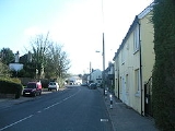
Small Dole
Encyclopedia
Small Dole is a village
in the Horsham District
of West Sussex
, in England
. It lies on the A2037 road two miles (3.2km) south of Henfield
.
In the late 1970s the Church of England
altered its ecclesiastical parish boundaries, transferring Small Dole from the parish of Upper Beeding
to the parish of Henfield. The civil parish
boundary continues to use the older ecclesiastical boundary. Thus Small Dole is part of the civil parish of Upper Beeding and the ecclesiastical parish of Henfield, adding to the local feeling of being torn between the two larger communities.
Village
A village is a clustered human settlement or community, larger than a hamlet with the population ranging from a few hundred to a few thousand , Though often located in rural areas, the term urban village is also applied to certain urban neighbourhoods, such as the West Village in Manhattan, New...
in the Horsham District
Horsham (district)
Horsham is a local government district in West Sussex, England. Its council is based in Horsham. The district borders those of Crawley, Mid Sussex, Mole Valley, Chichester, Arun and Adur....
of West Sussex
West Sussex
West Sussex is a county in the south of England, bordering onto East Sussex , Hampshire and Surrey. The county of Sussex has been divided into East and West since the 12th century, and obtained separate county councils in 1888, but it remained a single ceremonial county until 1974 and the coming...
, in England
England
England is a country that is part of the United Kingdom. It shares land borders with Scotland to the north and Wales to the west; the Irish Sea is to the north west, the Celtic Sea to the south west, with the North Sea to the east and the English Channel to the south separating it from continental...
. It lies on the A2037 road two miles (3.2km) south of Henfield
Henfield
Henfield is a large village and civil parish in the Horsham District of West Sussex, England. It lies south of London, northwest of Brighton, and east northeast of the county town of Chichester at the road junction of the A281 and A2037. The parish has a land area of . In the 2001 census 5,012...
.
In the late 1970s the Church of England
Church of England
The Church of England is the officially established Christian church in England and the Mother Church of the worldwide Anglican Communion. The church considers itself within the tradition of Western Christianity and dates its formal establishment principally to the mission to England by St...
altered its ecclesiastical parish boundaries, transferring Small Dole from the parish of Upper Beeding
Upper Beeding
Upper Beeding is a village and civil parish in the Horsham District of West Sussex, England. It is located at the northern end of the River Adur gap in the South Downs four miles north of Shoreham-by-Sea and has a land area of 1877 hectares...
to the parish of Henfield. The civil parish
Civil parish
In England, a civil parish is a territorial designation and, where they are found, the lowest tier of local government below districts and counties...
boundary continues to use the older ecclesiastical boundary. Thus Small Dole is part of the civil parish of Upper Beeding and the ecclesiastical parish of Henfield, adding to the local feeling of being torn between the two larger communities.

