Smith Mine disaster
Encyclopedia
The Smith Mine disaster was the worst coal mining
disaster in the State of Montana
, and the 43rd worst in the United States
, according to the National Institute for Occupational Safety and Health
(NIOSH).
 On February 27, 1943, at approximately 9:37 a.m., an explosion ripped through Smith Mine #3, a coal mine located between the towns of Bearcreek
and Washoe. Since it was a Saturday, there was a short crew in the mine. Of the 77 men working that day, only three got out of the mine alive, and one of the rescue workers died soon afterwards. The report from the United States Bureau of Mines
states that 30 of the men were killed instantly by the explosion, and the remainder died either through injuries sustained in the explosion, or through suffocation
from the carbon monoxide
and methane
gas in the mine. The explosion was deep underground, and was not even heard from the mouth of the mine, despite having enough power to knock a 20-ton locomotive off its tracks 1/4 mile from the blast origin.
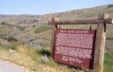
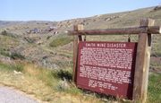
All of the bodies were removed from the mine. There is a highway plaque near the mouth of the mine, which was never reopened, and there are memorials in the cemeteries in Bearcreek
and nearby Red Lodge
, the county seat for Carbon County
.
The explosion was attributed to a buildup of methane gas in the mine. The cause of detonation is unknown, but various reports note than men were allowed to smoke in the mine, and that fuses for blasting were lit with matches.
The mine is located at coordinates 45°09′36"N 109°11′32"W.
Coal mining
The goal of coal mining is to obtain coal from the ground. Coal is valued for its energy content, and since the 1880s has been widely used to generate electricity. Steel and cement industries use coal as a fuel for extraction of iron from iron ore and for cement production. In the United States,...
disaster in the State of Montana
Montana
Montana is a state in the Western United States. The western third of Montana contains numerous mountain ranges. Smaller, "island ranges" are found in the central third of the state, for a total of 77 named ranges of the Rocky Mountains. This geographical fact is reflected in the state's name,...
, and the 43rd worst in the United States
United States
The United States of America is a federal constitutional republic comprising fifty states and a federal district...
, according to the National Institute for Occupational Safety and Health
National Institute for Occupational Safety and Health
The National Institute for Occupational Safety and Health is the United States’ federal agency responsible for conducting research and making recommendations for the prevention of work-related injury and illness. NIOSH is part of the Centers for Disease Control and Prevention within the U.S...
(NIOSH).

Bearcreek, Montana
Bearcreek is a town in Carbon County, Montana, United States. It is part of the Billings, Montana Metropolitan Statistical Area. The population was 83 at the 2000 census.The town of Bearcreek was named for Bear Creek, which runs through the middle of town...
and Washoe. Since it was a Saturday, there was a short crew in the mine. Of the 77 men working that day, only three got out of the mine alive, and one of the rescue workers died soon afterwards. The report from the United States Bureau of Mines
United States Bureau of Mines
For most of the 20th century, the U.S. Bureau of Mines was the primary United States Government agency conducting scientific research and disseminating information on the extraction, processing, use, and conservation of mineral resources.- Summary :...
states that 30 of the men were killed instantly by the explosion, and the remainder died either through injuries sustained in the explosion, or through suffocation
Suffocation
Suffocation is the process of Asphyxia.Suffocation may also refer to:* Suffocation , an American death metal band* "Suffocation", a song on Morbid Angel's debut album, Altars of Madness...
from the carbon monoxide
Carbon monoxide
Carbon monoxide , also called carbonous oxide, is a colorless, odorless, and tasteless gas that is slightly lighter than air. It is highly toxic to humans and animals in higher quantities, although it is also produced in normal animal metabolism in low quantities, and is thought to have some normal...
and methane
Methane
Methane is a chemical compound with the chemical formula . It is the simplest alkane, the principal component of natural gas, and probably the most abundant organic compound on earth. The relative abundance of methane makes it an attractive fuel...
gas in the mine. The explosion was deep underground, and was not even heard from the mouth of the mine, despite having enough power to knock a 20-ton locomotive off its tracks 1/4 mile from the blast origin.
All of the bodies were removed from the mine. There is a highway plaque near the mouth of the mine, which was never reopened, and there are memorials in the cemeteries in Bearcreek
Bearcreek, Montana
Bearcreek is a town in Carbon County, Montana, United States. It is part of the Billings, Montana Metropolitan Statistical Area. The population was 83 at the 2000 census.The town of Bearcreek was named for Bear Creek, which runs through the middle of town...
and nearby Red Lodge
Red Lodge, Montana
Red Lodge is a city in and the county seat of Carbon County, Montana, United States. It is part of the Billings, Montana Metropolitan Statistical Area...
, the county seat for Carbon County
Carbon County, Montana
-National protected areas:* Bighorn Canyon National Recreation Area * Custer National Forest * Gallatin National Forest -Economy:During the early history of Carbon County, coal mining was the predominant industry...
.
The explosion was attributed to a buildup of methane gas in the mine. The cause of detonation is unknown, but various reports note than men were allowed to smoke in the mine, and that fuses for blasting were lit with matches.
The mine is located at coordinates 45°09′36"N 109°11′32"W.

