Smithville, Ohio
Encyclopedia

Wayne County, Ohio
Wayne County is a county located in the state of Ohio, United States, and is named for General "Mad" Anthony Wayne. As of the 2010 census, the population was 114,520. Its county seat is Wooster....
, Ohio
Ohio
Ohio is a Midwestern state in the United States. The 34th largest state by area in the U.S.,it is the 7th‑most populous with over 11.5 million residents, containing several major American cities and seven metropolitan areas with populations of 500,000 or more.The state's capital is Columbus...
, United States
United States
The United States of America is a federal constitutional republic comprising fifty states and a federal district...
. The population was 1,333 at the 2000 census.
Smithville is home to the historic "Smithville Inn" and "The Barn" restaurants, as well as the Wayne County Schools Career Center. It is also part of the Green Local School District, which also includes the nearby Marshallville
Marshallville, Ohio
Marshallville is a village in Wayne County, Ohio, United States. The population was 826 at the 2000 census.-Geography:Marshallville is located at ....
.
Geography
Smithville is located at 40°51′48"N 81°51′31"W (40.863457, -81.858665), along Sugar CreekSugar Creek (Ohio)
Sugar Creek is a tributary of the Tuscarawas River in northeastern Ohio in the United States. It is 45 miles long. Via the Tuscarawas, Muskingum, and Ohio Rivers, it is part of the watershed of the Mississippi River, draining an area of 356 square miles on glaciated and unglaciated...
.
According to the United States Census Bureau
United States Census Bureau
The United States Census Bureau is the government agency that is responsible for the United States Census. It also gathers other national demographic and economic data...
, the village has a total area of 1.2 square miles (3.1 km²), all of it land.
Demographics
As of the censusCensus
A census is the procedure of systematically acquiring and recording information about the members of a given population. It is a regularly occurring and official count of a particular population. The term is used mostly in connection with national population and housing censuses; other common...
of 2000, there were 1,333 people, 545 households, and 395 families residing in the village. The population density
Population density
Population density is a measurement of population per unit area or unit volume. It is frequently applied to living organisms, and particularly to humans...
was 1,079.5 people per square mile (418.4/km²). There were 562 housing units at an average density of 455.1 per square mile (176.4/km²). The racial makeup of the village was 98.65% White, 0.15% African American, 0.23% Native American, 0.53% Asian, and 0.45% from two or more races. Hispanic or Latino of any race were 0.45% of the population.
There were 545 households out of which 31.7% had children under the age of 18 living with them, 59.1% were married couples
Marriage
Marriage is a social union or legal contract between people that creates kinship. It is an institution in which interpersonal relationships, usually intimate and sexual, are acknowledged in a variety of ways, depending on the culture or subculture in which it is found...
living together, 10.6% had a female householder with no husband present, and 27.5% were non-families. 26.8% of all households were made up of individuals and 11.6% had someone living alone who was 65 years of age or older. The average household size was 2.45 and the average family size was 2.93.
In the village the population was spread out with 25.0% under the age of 18, 8.3% from 18 to 24, 27.8% from 25 to 44, 22.1% from 45 to 64, and 16.7% who were 65 years of age or older. The median age was 38 years. For every 100 females there were 90.4 males. For every 100 females age 18 and over, there were 86.2 males.
The median income for a household in the village was $39,662, and the median income for a family was $47,109. Males had a median income of $32,500 versus $22,847 for females. The per capita income
Per capita income
Per capita income or income per person is a measure of mean income within an economic aggregate, such as a country or city. It is calculated by taking a measure of all sources of income in the aggregate and dividing it by the total population...
for the village was $18,329. About 5.2% of families and 5.9% of the population were below the poverty line, including 6.3% of those under age 18 and 7.1% of those age 65 or over.
Notable residents
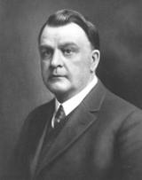
- Kirtland I. PerkyKirtland I. PerkyKirtland Irving Perky was a United States Senator from Idaho.-Biography:Born in Smithville, Ohio, he attended the public schools and graduated from Ohio Northern University at Ada in 1888. He studied law at the University of Iowa College of Law in Iowa City, and was admitted to the bar in 1890,...
- United States SenatorUnited States SenateThe United States Senate is the upper house of the bicameral legislature of the United States, and together with the United States House of Representatives comprises the United States Congress. The composition and powers of the Senate are established in Article One of the U.S. Constitution. Each...
from IdahoIdahoIdaho is a state in the Rocky Mountain area of the United States. The state's largest city and capital is Boise. Residents are called "Idahoans". Idaho was admitted to the Union on July 3, 1890, as the 43rd state.... - John Howard YoderJohn Howard YoderJohn Howard Yoder was a Christian theologian, ethicist, and Biblical scholar best known for his radical Christian pacifism, his mentoring of future theologians such as Stanley Hauerwas, his loyalty to his Mennonite faith, and his 1972 magnum opus, The Politics of Jesus.-Life:Yoder earned his...
- Prominent MennoniteMennoniteThe Mennonites are a group of Christian Anabaptist denominations named after the Frisian Menno Simons , who, through his writings, articulated and thereby formalized the teachings of earlier Swiss founders...
theologian and ethicist and Biblical scholar

