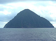
South Iwo Jima
Encyclopedia

Volcano Islands
The Volcano Islands is a group of three Japanese islands south of the Bonin Islands that belong to the municipality of Ogasawara...
group of the Ogasawara Islands
Ogasawara Islands
The Bonin Islands, known in Japan as the are an archipelago of over 30 subtropical and tropical islands, some directly south of Tokyo, Japan. Administratively, they are part of Ogasawara Municipality of Ogasawara Subprefecture, Tokyo...
, 60 km south of Iwo Jima
Iwo Jima
Iwo Jima, officially , is an island of the Japanese Volcano Islands chain, which lie south of the Ogasawara Islands and together with them form the Ogasawara Archipelago. The island is located south of mainland Tokyo and administered as part of Ogasawara, one of eight villages of Tokyo...
. It is 1300 km south of Tokyo, 330 km SSW of Chichijima. Its area is 3.4 km², shore length, 7.5 km, and highest point 916m, the highest in the Ogasawara Islands. It is administered as Ogasawara Village of Tokyo
Tokyo
, ; officially , is one of the 47 prefectures of Japan. Tokyo is the capital of Japan, the center of the Greater Tokyo Area, and the largest metropolitan area of Japan. It is the seat of the Japanese government and the Imperial Palace, and the home of the Japanese Imperial Family...
and is unpopulated. Its pronounced Japanese name was changed on June 18, 2007 to Minami-iōtō, the kanji
Kanji
Kanji are the adopted logographic Chinese characters hanzi that are used in the modern Japanese writing system along with hiragana , katakana , Indo Arabic numerals, and the occasional use of the Latin alphabet...
unchanged. The next southern island (geologically) is Farallon de Pajaros
Farallon de Pajaros
Farallón de Pájaros , also known as Urracas , is an uninhabited volcanic island, the northernmost island in the Northern Mariana Islands chain....
of the Northern Mariana Islands
Northern Mariana Islands
The Northern Mariana Islands, officially the Commonwealth of the Northern Mariana Islands , is a commonwealth in political union with the United States, occupying a strategic region of the western Pacific Ocean. It consists of 15 islands about three-quarters of the way from Hawaii to the Philippines...
.

