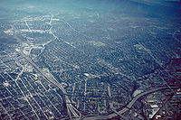
South San Jose
Encyclopedia

San Jose, California
San Jose is the third-largest city in California, the tenth-largest in the U.S., and the county seat of Santa Clara County which is located at the southern end of San Francisco Bay...
lying south of downtown. The name "South Side" refers to an area bounded roughly by Hillsdale Avenue to West Capitol Expressway on the north, Highway 101 and Senter Road on the east, the border with the city of Morgan Hill
Morgan Hill, California
Morgan Hill is a city located in the southern part of Santa Clara County, California, United States. Founded on November 10, 1906, the city was named after Hiram Morgan Hill, a San Franciscan who built a country retreat home there in 1884...
towards the south, and Camden Avenue to the west.
Neighborhoods
Neighborhoods in South San Jose include:- Almaden ValleyAlmaden Valley, San Jose, CaliforniaAlmaden Valley is an upper-class neighborhood of about 37,000 in the southwestern portion of San Jose, California, USA, roughly equivalent to the 95120 ZIP Code. The neighborhood is south east of the town of Los Gatos, west of the Santa Teresa neighborhood of San Jose and south of Coleman Ave...
- Blossom ValleyBlossom Valley, San Jose, CaliforniaBlossom Valley is a neighborhood in the southern region of San Jose, California northeast of the Los Capitancillos Ridge that separates it from Almaden Valley. It is located east of Cambrian and northeast of Almaden neighborhoods. It is just northeast of the Los Capitancillos Ridge and the Almaden...
- Coyote ValleyCoyote ValleyCoyote Valley is a large expanse of farmland, orchards and homes, approximately in size, located in a narrowing of the Santa Clara Valley, in the southernmost part of San Jose, California...
- Edenvale
- Santa TeresaSanta Teresa, San Jose, CaliforniaSanta Teresa is a neighborhood in the south of San Jose, California, USA. It is east of Almaden Valley, surrounding Santa Teresa Boulevard, with access to Highway 85...
- Seven TreesSeven Trees, CaliforniaSeven Trees was a census-designated place in South San Jose and it was previously an unincorporated pocket in Santa Clara County, California, completely surrounded by San Jose...
- Silver Creek ValleySilver Creek ValleySilver Creek Valley is a region located in southeast San Jose, California near the southern end of the city's Evergreen neighborhood.The neighborhood is bordered on the east by the Diablo Range foothills and is separated from the Edenvale and Blossom Valley neighborhoods by a small series of hills...
Light rail stations
- Capitol (VTA)Capitol (VTA)Capitol is a light rail station operated by Santa Clara Valley Transportation Authority . This station is served by VTA's Alum Rock–Santa Teresa line...
- Branham (VTA)Branham (VTA)Branham is a light rail station operated by Santa Clara Valley Transportation Authority . This station is served by VTA's Alum Rock-Santa Teresa line...
- Ohlone-Chynoweth (VTA)
- Almaden (VTA)Almaden (VTA)Almaden is a light rail station operated by Santa Clara Valley Transportation Authority . This station is the southern Terminus of VTA'sOhlone/Chynoweth–Almaden line, popularly known as the Almaden Shuttle.-Location:...
- Blossom Hill (VTA)Blossom Hill (VTA)Blossom Hill is a light rail station operated by Santa Clara Valley Transportation Authority . This station is served by VTA's Alum Rock–Santa Teresa line...
- Snell (VTA)Snell (VTA)Snell is a light rail station operated by Santa Clara Valley Transportation Authority . This station is served by VTA's Alum Rock–Santa Teresa line...
- Cottle (VTA)Cottle (VTA)Cottle is a light rail station operated by Santa Clara Valley Transportation Authority . This station is served by VTA's Alum Rock–Santa Teresa line...
- Santa Teresa (VTA)Santa Teresa (VTA)Santa Teresa is a light rail station operated by Santa Clara Valley Transportation Authority . This station is the southern terminus of VTA's Alum Rock-Santa Teresa line...
Parks and trails
- Guadalupe River TrailGuadalupe River TrailThe Guadalupe River Trail is an pedestrian and bicycle path in the city of San Jose, California. The path runs along the banks of the Guadalupe River. The trail is currently composed of two discontinuous segments...
- Almaden Quicksilver County ParkAlmaden Quicksilver County ParkAlmaden Quicksilver County Park is a 4,147 acres park that includes the grounds of former mercury mines adjacent to south San Jose, California, USA...
- Santa Teresa County ParkSanta Teresa County ParkSanta Teresa County Park is park in the hills of south San Jose, California, USA. Most of the park consists of non-native grassland and mixed oak woodland. Native wildflowers displays are common in late winter and early spring in the serpentine soil in the northwest and southern sections of the...
See also
- Oakridge MallWestfield OakridgeWestfield Oakridge, formerly known as Westfield Shoppingtown Oakridge and Oakridge Mall, is a shopping mall owned by The Westfield Group, located at the corner of Santa Teresa Boulevard and Blossom Hill Road in San Jose, California, United States...

