
Southern Carpathians
Encyclopedia
The Southern Carpathians or the Transylvanian Alps are a group of mountain range
s which divide central and southern Romania
, on one side, and Serbia
, on the other side. They cover part of the Carpathian Mountains
that is located between the Prahova River
in the east and the Timiș
and Cerna Rivers in the west. To the south they are bounded by the Balkan mountain range
in Serbia
.
 The Southern Carpathian group are the second highest group of mountains in the Carpathian Mountain range (after Tatra
), reaching heights of over 2,500m. Although considerably smaller than the Alps
, they are classified as having an alpine landscape. Their high mountain character, combined with great accessibility, makes them popular with tourist and scientists.
The highest peaks are:
In spite of the heights, some of the most accessible passings in the Carpathians in Romania are along the rivers who cross the mountain range (the Olt River
) or who form wide valleys (along the Prahova River
Valley or along the Jiu River
Valley).
The Supragetic, Getic Nappes as well as the Danubian Units represent units with both a metamorphic basement and a sedimentary cover, while the Severin Nappe includes only a sedimentary sequence. The Getic Nappe and the Danubian Units sediments include a Palaeozoic sequence (Upper Carboniferous, Lower Permian) and a Mesozoic
sequence (Lowermost Jurassic - Middle Cretaceous). The Supragetic Nappe comprises mainly metamorphosed rocks (gneisses, micashists), while the Severin Nappe includes only Upper Jurassic - Lower Cretaceous sediments.
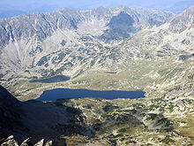
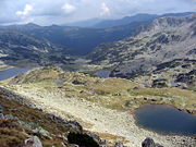
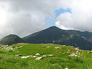

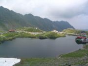
 From east to west, four mountain groups can be identified, separated by different river valleys.
The first two groups are steepest on the North side, and the last two are steepest on the South side.
Mountain range
A mountain range is a single, large mass consisting of a succession of mountains or narrowly spaced mountain ridges, with or without peaks, closely related in position, direction, formation, and age; a component part of a mountain system or of a mountain chain...
s which divide central and southern Romania
Romania
Romania is a country located at the crossroads of Central and Southeastern Europe, on the Lower Danube, within and outside the Carpathian arch, bordering on the Black Sea...
, on one side, and Serbia
Serbia
Serbia , officially the Republic of Serbia , is a landlocked country located at the crossroads of Central and Southeast Europe, covering the southern part of the Carpathian basin and the central part of the Balkans...
, on the other side. They cover part of the Carpathian Mountains
Carpathian Mountains
The Carpathian Mountains or Carpathians are a range of mountains forming an arc roughly long across Central and Eastern Europe, making them the second-longest mountain range in Europe...
that is located between the Prahova River
Prahova River
The Prahova River is a river of Southern Romania, which rises from the Bucegi Mountains, in the Southern Carpathians and flows into the Ialomiţa...
in the east and the Timiș
Timis River
The Timiş or Tamiš is a 359 km long river originating from Țarcu Mountains , southern Carpathian Mountains, Caraş-Severin County, Romania. It flows through the Banat region and flows into the Danube near Pančevo, in northern Serbia....
and Cerna Rivers in the west. To the south they are bounded by the Balkan mountain range
Balkan Mountains
The Balkan mountain range is a mountain range in the eastern part of the Balkan Peninsula. The Balkan range runs 560 km from the Vrashka Chuka Peak on the border between Bulgaria and eastern Serbia eastward through central Bulgaria to Cape Emine on the Black Sea...
in Serbia
Serbia
Serbia , officially the Republic of Serbia , is a landlocked country located at the crossroads of Central and Southeast Europe, covering the southern part of the Carpathian basin and the central part of the Balkans...
.
Heights

Tatra Mountains
The Tatra Mountains, Tatras or Tatra , are a mountain range which forms a natural border between Slovakia and Poland, and are the highest mountain range in the Carpathian Mountains...
), reaching heights of over 2,500m. Although considerably smaller than the Alps
Alps
The Alps is one of the great mountain range systems of Europe, stretching from Austria and Slovenia in the east through Italy, Switzerland, Liechtenstein and Germany to France in the west....
, they are classified as having an alpine landscape. Their high mountain character, combined with great accessibility, makes them popular with tourist and scientists.
The highest peaks are:
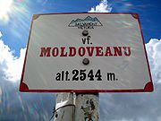
- Moldoveanu PeakMoldoveanu PeakMoldoveanu Peak , at 2544 m, is the highest mountain in Romania, located in Argeş County, in the Făgăraş Mountains of the Southern Carpathians....
, 2,544 metres - Făgăraș MountainsFagaras MountainsFăgăraș Mountains , are the highest mountains of the Southern Carpathians, in Romania. The highest peaks are Moldoveanu , Negoiu , Viștea Mare , Lespezi , Vânătoarea lui Buteanu , and Dara .They are bordered in the north by the Făgăraș Depression, through which the Olt river flows, and in the west... - NegoiuNegoiuNegoiu Peak is a mountain peak in the Făgăraş Mountains of the Southern Carpathians, being located in Argeş County, Romania, with an altitude of . It is the second highest peak in Romania after Moldoveanu Peak .-External links:*...
, 2,535 metres - Făgăraș Mountains - Parângu MareParângu MareParângu Mare is a peak located in Parâng Mountains at 2,519 m altitude and belongs to the Parâng Mountains group.-Mountains:* Parâng Mountains * Şureanu Mountains...
, 2,519 metres - Parâng MountainsParâng MountainsParâng Mountains are one of the highest mountain ridges in Romania and Southern Carpathians, with its highest peak Parângu Mare reaching 2,519 m.-Description:The Parâng mountains are located in the south-western part of the Central-Meridional Carpathians... - PeleagaPeleagaThe Retezat Mountains are some of the highest massifs in Romania, being part of the Southern Carpathians. The highest peak is Peleaga , at an altitude of 2,509 metres...
, 2,509 metres - Retezat MountainsRetezat MountainsThe Retezat Mountains are one of the highest massifs in Romania, being part of the Southern Carpathians. The highest peak is Peleaga , at an altitude of 2509 metres... - Omu (mountain) 2,507 metres - Bucegi MountainsBucegi MountainsThe Bucegi Mountains are located in central Romania, south of the city Braşov. They are part of the Southern Carpathians group of the Carpathian Mountains....
In spite of the heights, some of the most accessible passings in the Carpathians in Romania are along the rivers who cross the mountain range (the Olt River
Olt River
The Olt River is a river in Romania. It is the longest river flowing exclusively through Romania. Its source is in the Hăşmaş Mountains of the eastern Carpathian Mountains, near the village Bălan. It flows through the Romanian counties Harghita, Covasna, Braşov, Sibiu, Vâlcea and Olt...
) or who form wide valleys (along the Prahova River
Prahova River
The Prahova River is a river of Southern Romania, which rises from the Bucegi Mountains, in the Southern Carpathians and flows into the Ialomiţa...
Valley or along the Jiu River
Jiu River
Jiu is a river of southern Romania. It is formed near Petroşani by the junction of headwaters Jiul de Vest and Jiul de Est.It flows southward through the Romanian counties Hunedoara, Gorj and Dolj before flowing into the Danube a few kilometers upstream from the Bulgarian city of Oryahovo, 331...
Valley).
Geology
The South Carpathians represent an intricate pile of tectonic nappes, overthrusted from west eastwards during the Austrian (Middle Cretaceous) and Laramian paroxysmal phases, corresponding to various plate fragments. The napes are (from west eastwards): the Supragetic, Getic, Severin and Danubian Units. The Getic Nappe was identified by Murgoci (1905), while the general understanding over the Alpine structure of the South Carpathians was later refined by Codarcea (1940), Codarcea et al. (1961), Năstăseanu et al. (1981), Săndulescu (1984), Săndulescu and Dimitrescu (2004), and Mutihac (1990). The first to apply the global tectonics concepts for the Romanian Carpathians were Rădulescu and Săndulescu (1973).The Supragetic, Getic Nappes as well as the Danubian Units represent units with both a metamorphic basement and a sedimentary cover, while the Severin Nappe includes only a sedimentary sequence. The Getic Nappe and the Danubian Units sediments include a Palaeozoic sequence (Upper Carboniferous, Lower Permian) and a Mesozoic
Mesozoic
The Mesozoic era is an interval of geological time from about 250 million years ago to about 65 million years ago. It is often referred to as the age of reptiles because reptiles, namely dinosaurs, were the dominant terrestrial and marine vertebrates of the time...
sequence (Lowermost Jurassic - Middle Cretaceous). The Supragetic Nappe comprises mainly metamorphosed rocks (gneisses, micashists), while the Severin Nappe includes only Upper Jurassic - Lower Cretaceous sediments.
Mountain ranges


- Bucegi Mountains group - between the Prahova and Dâmboviţa RiverDâmbovita RiverDâmbovița is a river in Romania. It has its sources in the Făgăraş Mountains, on the Curmătura Oticu. The upper reach of the rivers, upstream of the confluence with the Boarcăşu River is also known as Izvorul Oticului River or Oticu River....
s.- Bucegi MountainsBucegi MountainsThe Bucegi Mountains are located in central Romania, south of the city Braşov. They are part of the Southern Carpathians group of the Carpathian Mountains....
(Munții Bucegi) - Leaotă MountainsLeaota MountainsThe Leaota Mountains are located in central Romania, north of the city Târgovişte. They are part of the Southern Carpathians group of the Carpathian Mountains, and have as neighbours the Bucegi Mountains to the east and Piatra Craiului to the west....
(Munții Leaotă)
- Bucegi Mountains
- Făgăraş Mountains groupFagaras Mountains groupThe Făgăraş mountain group is a subgroup of mountains in the Southern Carpathians. It is named after the highest of the mountains in the group, the Făgăraş Mountains.-Boundaries:The Făgăraş group is bounded:*in the west, by the Olt River...
- between the Dâmbovița River and the Olt River.- Făgăraş MountainsFagaras MountainsFăgăraș Mountains , are the highest mountains of the Southern Carpathians, in Romania. The highest peaks are Moldoveanu , Negoiu , Viștea Mare , Lespezi , Vânătoarea lui Buteanu , and Dara .They are bordered in the north by the Făgăraș Depression, through which the Olt river flows, and in the west...
(Munții Făgărașului) - Iezer Mountains (Munții Iezer; literally: "Mountains of the Deep Lake")
- Piatra Craiului (literally: "Rock of the King")
- Cozia Mountains (Munții Cozia)
- Făgăraş Mountains
- Parâng Mountains groupParâng Mountains groupThe Parâng mountain group is a subgroup of mountains in the Southern Carpathians. It is named after the highest of the mountains in the group, the Parâng Mountains.-Boundaries:The Parâng group is bounded:*in the east, by the Olt River...
- between the Olt River and the Jiu River.- Parâng MountainsParâng MountainsParâng Mountains are one of the highest mountain ridges in Romania and Southern Carpathians, with its highest peak Parângu Mare reaching 2,519 m.-Description:The Parâng mountains are located in the south-western part of the Central-Meridional Carpathians...
(Munții Parâng) - Şureanu MountainsŞureanu MountainsThe Şurianu Mountains, , Suriano in Italian, belong to Romania's Parâng range in the Southern Carpathians, with peaks frequently exceeding 2,000 metres....
(Munții Șureanu/M. Sebeșului) - Cindrel MountainsCindrel MountainsCindrel Mountains are a group of mountains in central Romania in the centre of the Southern Carpathians, in the North-East of the Parâng Mountains group....
(Munții Cindrel/M. Cibinului) - Lotru MountainsLotru MountainsLotru Mountains are a group of mountains that are part of the Southern Carpathians, in Romania. The highest peak is Steflesti Peak .-External links:* * *...
(Munții Lotrului; literally: "Mountains of the Thief") - Căpăţână Mountains (Munții Căpățânii; literally: "Mountains of the Skull")
- Parâng Mountains
- Retezat-Godeanu Mountains groupRetezat-Godeanu Mountains groupThe Retezat-Godeanu mountain group is a subgroup of mountains in the Southern Carpathians. It is named after the highest of the mountains in the group, the Retezat Mountains.-Boundaries:The Retezat-Godeanu group is bounded:*in the east, by the Jiu River;...
- between the Jiu River and the Timiș and Cerna Rivers.- Retezat MountainsRetezat MountainsThe Retezat Mountains are one of the highest massifs in Romania, being part of the Southern Carpathians. The highest peak is Peleaga , at an altitude of 2509 metres...
(Munții Retezat; literally: "Hewed Mountains") - Godeanu Mountains (Munții Godeanu)
- Vâlcan MountainsVâlcan MountainsThe Vâlcan Mountains are a chain of mountains in the southern Carpathians in Romania. They are part of the Retezat-Godeanu Mountains group. They run for approximately 54 km and the highest peak is 1946 m high...
(Munții Vâlcan) - Mehedinţi Mountains (Munții Mehendinți)
- Cerna Mountains (Munții Cernei)
- Ţarcu MountainsTarcu MountainsThe Ţarcu Mountains are a mountain range in the southwestern Romania, at the western edge of the Southern Carpathians. They are located between the Bistra Valley , Timiş River , Godeanu Mountains and Râul Mare Valley , the last one being a natural barrier between them and the Retezat Mountains.The...
(Munții Țarcu; literally: "Pen Mountains").
- Retezat Mountains
The first two groups are steepest on the North side, and the last two are steepest on the South side.
See also
- Divisions of the CarpathiansDivisions of the CarpathiansDivisions of the Carpathians is categorization of the Carpathian mountains system.Below is a detailed overview of the major subdivisions and ranges of the Carpathian Mountains. The Carpathians are a "subsystem" of a bigger Alps-Himalaya System that stretches from the western Europe all the way to...
- Iron Gates, at the South-Western end
- Prahova ValleyPrahova ValleyPrahova Valley is the valley where the Prahova river makes its way between the Bucegi and the Baiu Mountains, in the Carpathian Mountains, Romania. It is a tourist region, situated about 100 km north of the capital city of Bucharest.Geographically, the Prahova river separates the Eastern...
, at the Eastern end

