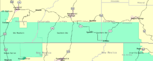
Southern Ute Indian Reservation
Encyclopedia

Colorado
Colorado is a U.S. state that encompasses much of the Rocky Mountains as well as the northeastern portion of the Colorado Plateau and the western edge of the Great Plains...
, USA, along the northern border of New Mexico
New Mexico
New Mexico is a state located in the southwest and western regions of the United States. New Mexico is also usually considered one of the Mountain States. With a population density of 16 per square mile, New Mexico is the sixth-most sparsely inhabited U.S...
. Its territory consists of land from three counties; in descending order of surface area they are La Plata
La Plata County, Colorado
La Plata County is the fourteenth most populous of the 64 counties of the State of Colorado of the United States. The county was named for the La Plata River and the La Plata Mountains. "La plata" is the Spanish language word for "silver". The United States Census Bureau estimated that the...
, Archuleta
Archuleta County, Colorado
Archuleta County is one of the 64 counties of the state of Colorado of the United States. The United States Census Bureau estimates that the county population was 12,386 in 2006, a 25.14% increase since U.S. Census 2000...
, and Montezuma Counties
Montezuma County, Colorado
Montezuma County is the southwesternmost of the 64 counties of the state of Colorado of the United States. The county population was 23,830 at U.S. Census 2000...
. The reservation has a land area of 1,058.785 sq mi (2,742.24 km²) and a population of 11,259 as of the 2000 census
United States Census, 2000
The Twenty-second United States Census, known as Census 2000 and conducted by the Census Bureau, determined the resident population of the United States on April 1, 2000, to be 281,421,906, an increase of 13.2% over the 248,709,873 persons enumerated during the 1990 Census...
. Its largest communities are Ignacio
Ignacio, Colorado
The Town of Ignacio is a Statutory Town located in La Plata County, Colorado, United States. The population was 669 at the 2000 census.Located within the boundaries of the Southern Ute Indian Reservation, the town is the capital of the Southern Ute Indian tribe. It was named for their...
and Arboles
Arboles, Colorado
Arboles is a census-designated place in Archuleta County, Colorado, United States. The population was 280 at the 2010 census. The Arboles Post Office has the ZIP Code 81121...
.
Established in 1873, it is the reservation of the Southern Ute Indian Tribe, a federally recognized Ute tribe. Government is organized under the Indian Reorganization Act of 1934
Indian Reorganization Act
The Indian Reorganization Act of June 18, 1934 the Indian New Deal, was U.S. federal legislation that secured certain rights to Native Americans, including Alaska Natives...
and is led by a tribal council with a chairman as head of the executive. For decades at the end of the 20th century, Clement Frost had been the tribes chairman. In 2008 a new chairman, Matthew Box
Matthew Box
Matthew J. Box is chairman of the Southern Ute Indian Tribe in southwestern Colorado, USA. He was elected in 2008 for a three year term and assumed the chairmanship on 21 December 2008...
was elected.
The 1990 Ute population was 1044.

