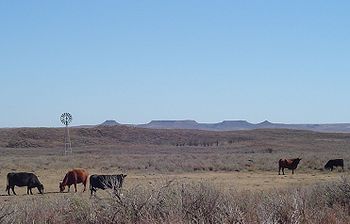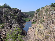
Southwestern Oklahoma
Encyclopedia

Oklahoma
Oklahoma is a state located in the South Central region of the United States of America. With an estimated 3,751,351 residents as of the 2010 census and a land area of 68,667 square miles , Oklahoma is the 28th most populous and 20th-largest state...
, typically considered to be south of the Canadian River
Canadian River
The Canadian River is the longest tributary of the Arkansas River. It is about long, starting in Colorado and traveling through New Mexico, the Texas Panhandle, and most of Oklahoma....
, extending eastward from the Texas
Texas
Texas is the second largest U.S. state by both area and population, and the largest state by area in the contiguous United States.The name, based on the Caddo word "Tejas" meaning "friends" or "allies", was applied by the Spanish to the Caddo themselves and to the region of their settlement in...
border to a line roughly from Weatherford
Weatherford, Oklahoma
Weatherford is a city in Custer County, Oklahoma, United States. The population was 10,833 at the 2010 census.-Geography:Weatherford is located at , elevation 1,647 feet ....
, to Anadarko
Anadarko, Oklahoma
Anadarko is a city in Caddo County, Oklahoma, United States. The population was 6,645 at the 2000 census. It is the county seat of Caddo County.-Early History:Anadarko got its name when its post office was established in 1873...
, to Duncan
Duncan, Oklahoma
Duncan is a city in Stephens County, Oklahoma, United States. The population was 23,431 at the 2010 census. It is the county seat of Stephens County.The official birthdate of the town is considered to be when the first train arrived there on June 27, 1892...
. The region has an official designation created for tourism purposes, Great Plains Country.

Lawton, Oklahoma
The city of Lawton is the county seat of Comanche County, in the U.S. state of Oklahoma. Located in the southwestern region of Oklahoma approximately southwest of Oklahoma City, it is the principal city of the Lawton Oklahoma Metropolitan Statistical Area...
, its largest city, Southwest Oklahoma's other important urban centers include Elk City
Elk City, Oklahoma
Elk City is a city in Beckham County, Oklahoma, United States. The population was 11,693 at the 2010 census. Elk City is located on Interstate 40 and Historic U.S. Route 66 in Western Oklahoma, approximately west of Oklahoma City and east of Amarillo....
, Clinton
Clinton, Oklahoma
Clinton is a city in Custer and Washita counties in the U.S. state of Oklahoma. The population was 9,033 at the 2010 census.-History:The community began in 1899 when two men, J.L. Avant and E.E...
, Weatherford
Weatherford, Oklahoma
Weatherford is a city in Custer County, Oklahoma, United States. The population was 10,833 at the 2010 census.-Geography:Weatherford is located at , elevation 1,647 feet ....
, Walters
Walters, Oklahoma
Walters is a city in Cotton County, Oklahoma, United States. The population was 2,657 at the 2000 census. The city, nestled in between twin creeks, is the county seat of Cotton County...
, Altus
Altus, Oklahoma
Altus is a city in Jackson County, Oklahoma, United States. The population was 19,813 at the 2010 census. It is the county seat of Jackson County....
, and Duncan
Duncan, Oklahoma
Duncan is a city in Stephens County, Oklahoma, United States. The population was 23,431 at the 2010 census. It is the county seat of Stephens County.The official birthdate of the town is considered to be when the first train arrived there on June 27, 1892...
.
History
One section of the 1890 Organic Act established that a lawsuit should be filed to clarify the boundary between Oklahoma and Texas. The U.S. Supreme Court ruled in 1896 that what had been considered part of Texas would now be part of Oklahoma Territory. The area makes up the southwestern corner of Oklahoma and today consists of Beckham CountyBeckham County, Oklahoma
Beckham County is a county located in the U.S. state of Oklahoma. As of 2000, the population was 19,799. Its county seat is Sayre.Founded upon statehood in 1907, Beckham County was named for J. C. W...
, Harmon County
Harmon County, Oklahoma
Harmon County is a county located in the U.S. state of Oklahoma. As of 2010, the population was 2,992. In population, it is the second smallest county in Oklahoma, only Cimarron County, according to the 2010 census, having fewer inhabitants. The county seat is Hollis.-Geography:According to the...
, Jackson County
Jackson County, Oklahoma
Jackson County is a county located in the U.S. state of Oklahoma. As of 2000, the population was 28,439. Its county seat is Altus.-Geography:According to the U.S. Census Bureau, the county has a total area of , of which is land and is water....
, and Greer County
Greer County, Oklahoma
Greer County is a county located in the U.S. state of Oklahoma. As of 2000, the population was 6,061. Its county seat is Mangum. From 1860 to 1896, the state of Texas claimed an area known as Greer County, Texas, which included present-day Greer County along with neighboring...
.
Another portion of Southwestern Oklahoma was opened up through the Land Run of 1892
Land Run of 1892
The Land Run of 1892 was the opening of the Cheyenne-Arapaho reservation to settlement in the U.S. state of Oklahoma. One of seven in Oklahoma, it occurred on April 19, 1892, and opened up land that would become Blaine, Custer, Dewey, Washita, and Rogers Mills counties...
. Land formerly owned by the Cheyenne and Arapaho tribes became Oklahoma Territory
Oklahoma Territory
The Territory of Oklahoma was an organized incorporated territory of the United States that existed from May 2, 1890, until November 16, 1907, when it was joined with the Indian Territory under a new constitution and admitted to the Union as the State of Oklahoma.-Organization:Oklahoma Territory's...
and today includes Blaine County
Blaine County, Oklahoma
Blaine County is a county located in the U.S. state of Oklahoma. As of 2000, the population is 11,976. Its county seat is Watonga. Blaine County is the birthplace of voice actor Clarence Nash, the voice of Donald Duck....
, Dewey County
Dewey County, Oklahoma
Dewey County is a county located in the U.S. state of Oklahoma. As of 2000, the population was 4,743. Its county seat is Taloga.-Geography:According to the U.S. Census Bureau, the county has a total area of , of which is land and is water....
, Custer County
Custer County, Oklahoma
Custer County is a county located in the U.S. state of Oklahoma. It was named in honor of General George Armstrong Custer. As of 2000, the population was 26,142. Its county seat is Arapaho.-Geography:...
, and Roger Mills County
Roger Mills County, Oklahoma
Roger Mills County is a county located in the U.S. state of Oklahoma. As of 2000, the population was 3,436. Its county seat is Cheyenne.-History:Roger Mills County takes its name from Roger Q. Mills, a prominent American politician from Texas...
and Washita County
Washita County, Oklahoma
Washita County is a county located in the U.S. state of Oklahoma. As of 2000, the population was 11,508. Its county seat is New Cordell. It was formerly located in Cloud Chief, Oklahoma....
.
The area's regional college was established in 1901 as a normal school in Weatherford, Oklahoma
Weatherford, Oklahoma
Weatherford is a city in Custer County, Oklahoma, United States. The population was 10,833 at the 2010 census.-Geography:Weatherford is located at , elevation 1,647 feet ....
. The school became Southwestern State Teachers College in 1920 and established a pharmacy department in 1939. In 1974, the institution was renamed Southwestern Oklahoma State University
Southwestern Oklahoma State University
Southwestern Oklahoma State University is a public university in Weatherford and Sayre, Oklahoma. It is one of seven state regional universities in the state of Oklahoma.The current president of SWOSU is Randy Beutler.-History:...
.
Geography
Consisting of mainly flat grassland and gently rolling hills, Southwest Oklahoma is typical of the Great PlainsGreat Plains
The Great Plains are a broad expanse of flat land, much of it covered in prairie, steppe and grassland, which lies west of the Mississippi River and east of the Rocky Mountains in the United States and Canada. This area covers parts of the U.S...
region of the United States, although it is less dry than adjacent West Texas
West Texas
West Texas is a vernacular term applied to a region in the southwestern quadrant of the United States that primarily encompasses the arid and semi-arid lands in the western portion of the state of Texas....
. The area has a humid subtropical climate
Humid subtropical climate
A humid subtropical climate is a climate zone characterized by hot, humid summers and mild to cool winters...
, receiving anywhere from about 20 inches of precipitation annually in the far west, to 35 inches annually in the eastern section. Monsoon-like rains are common in the spring months, while periods of drought can occur throughout other parts of the year.
The region has several small mountain ranges, the largest of which being the Wichita Mountains
Wichita Mountains
The Wichita Mountains are located in the southwestern portion of the U.S. state of Oklahoma. The mountains are a northwest-southeast trending series of rocky promontories, many capped by 540 million-year old granite. These were exposed and rounded by weathering during the Permian Period...
, considered by geologists to be one of the oldest mountain ranges in the world.
Significant geographic landmarks include the Black Kettle National Grassland, the Wichita Mountains
Wichita Mountains
The Wichita Mountains are located in the southwestern portion of the U.S. state of Oklahoma. The mountains are a northwest-southeast trending series of rocky promontories, many capped by 540 million-year old granite. These were exposed and rounded by weathering during the Permian Period...
, the Antelope Hills
Antelope Hills (Oklahoma)
The Antelope Hills in Roger Mills County, Oklahoma are a series of low hills in the bend of the Canadian River. They were a major landmark for the Plains Indians and travelers on what is now the western plains of Oklahoma. The hills are on the National Register of Historic Places.-External links:*...
, and the Quartz Mountains
Quartz Mountains
The Quartz Mountains are an extension of the Wichita Mountains in the far southwestern part of the state of Oklahoma. The section extends west and northwest of the main Wichita range separated by a plain dotted with smaller foothills. The tallest mountain in the range is Quartz Mountain at 2,040 feet...
.

