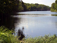
.gif)
Spring River (Missouri)
Encyclopedia

Missouri
Missouri is a US state located in the Midwestern United States, bordered by Iowa, Illinois, Kentucky, Tennessee, Arkansas, Oklahoma, Kansas and Nebraska. With a 2010 population of 5,988,927, Missouri is the 18th most populous state in the nation and the fifth most populous in the Midwest. It...
, southeastern Kansas
Kansas
Kansas is a US state located in the Midwestern United States. It is named after the Kansas River which flows through it, which in turn was named after the Kansa Native American tribe, which inhabited the area. The tribe's name is often said to mean "people of the wind" or "people of the south...
, and northeastern Oklahoma
Oklahoma
Oklahoma is a state located in the South Central region of the United States of America. With an estimated 3,751,351 residents as of the 2010 census and a land area of 68,667 square miles , Oklahoma is the 28th most populous and 20th-largest state...
. It begins in northern Barry County, Missouri
Barry County, Missouri
Barry County is a county located in the U.S. state of Missouri. As of 2010, the population was 35,597. Its county seat is Cassville. The county was organized in 1835 and named after William Taylor Barry from Kentucky, a United States Postmaster General....
south of Aurora
Aurora, Missouri
Aurora is a city in Lawrence County, Missouri, United States. The population was 7,014 at the 2000 census.-History:Between 1911 and 1920, the virulently Anti-Catholic newspaper The Menace was published in Aurora by W. F Phelps and Earl McClure...
, flows north of Verona
Verona, Missouri
Verona is a city in Lawrence County, Missouri, United States. The population was 714 at the 2000 census, at which time it was a town.-Geography:Verona is located at ....
and turns west across Lawrence and Jasper
Jasper County, Missouri
Jasper County is a county located in the US state of Missouri. It is included in the Joplin, Missouri Metropolitan Statistical Area. The 2010 total population of Jasper County was 117,404. It is the ninth most populous county in Missouri. Its county seat is Carthage, making it one of the few...
counties, passing through Carthage
Carthage, Missouri
Carthage is a city in Jasper County, Missouri, United States. The population was 14,378 at the 2010 census. It is the county seat of Jasper County and is nicknamed "America's Maple Leaf City."...
, before crossing into Cherokee County, Kansas
Cherokee County, Kansas
Cherokee County is a county located in Southeast Kansas, in the Central United States. As of the 2010 census, the county population was 21,603. Its county seat is Columbus, and its most populous city is Baxter Springs...
, where it widens considerably. It flows past the east sides of Riverton
Riverton, Kansas
Riverton is a small unincorporated community at the junction of K-66 and U.S. Route 69 Alternate and U.S. Route 400 in Cherokee County, Kansas, United States. It is located near the Spring River and has a population of 600. It is one of only three towns in Kansas on U.S...
and Baxter Springs
Baxter Springs, Kansas
Baxter Springs is a town situated along the Spring River in the extreme southeastern part of Cherokee County, located in southeast Kansas, in the Central United States. As of the 2010 census, the city population was 4,238...
before emptying into the Grand Lake o' the Cherokees
Grand Lake o' the Cherokees
Grand Lake o' the Cherokees is situated in Northeast Oklahoma, nestled in the foothills of the Ozark Mountain Range. The "o'" in the name of the lake stands for of not over. Grand Lake Of the Cherokees is the official name. It is often simply called Grand Lake...
in Ottawa County, Oklahoma
Ottawa County, Oklahoma
Ottawa County is a county located in the U.S. state of Oklahoma. As of 2000, the population was 33,194. Its county seat is Miami. It was named for the Ottawa Tribe of Oklahoma.Ottawa County was established in 1907.-Geography:...
.
The Spring River takes its name from the many seeps and springs that provide its baseflow
Baseflow
Baseflow is the portion of streamflow that comes from "the sum of deep subsurface flow and delayed shallow subsurface flow"...
. Big Spring in Lawrence County is the largest spring in the Spring River basin discharging 12.3 million gallons of water per day. The spring flows from the base of a high bluff of Burlington Keokuk limestone known as Baptist Hill and enters the Spring River about 200 feet away. The river forms the western boundary of the Ozarks in southwest Missouri and southeast Kansas. All of the Ozark area in southeast Kansas is contained within the Spring River basin.
The river was important to settlers in Lawrence and Jasper County
Jasper County, Missouri
Jasper County is a county located in the US state of Missouri. It is included in the Joplin, Missouri Metropolitan Statistical Area. The 2010 total population of Jasper County was 117,404. It is the ninth most populous county in Missouri. Its county seat is Carthage, making it one of the few...
, especially around Carthage
Carthage, Missouri
Carthage is a city in Jasper County, Missouri, United States. The population was 14,378 at the 2010 census. It is the county seat of Jasper County and is nicknamed "America's Maple Leaf City."...
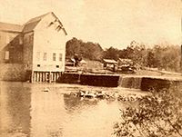
, where it was not yet too wide to dam. Scores of grist and sawmills established on the river in those counties beginning as early as the 1840s. A dam erected northeast of Carthage in 1875 provided water power to mills and other industry through a mile-long millrace that fed into an industrial basin on north Main street. The concentration of industry there continues to impact water quality in the river.
Spring River was one of the "Seven Bulls," a term used by Native American tribes to describe the rivers of southwest Missouri.


