.gif)
State Highway 130 (Oklahoma)
Encyclopedia
State Highway 130, also known as SH-130 or OK-130, is a 3 mile (4.8 km) highway maintained by the U.S.
state of Oklahoma
. It is entirely within McClain County
. It does not have any lettered spur routes.
north of Blanchard
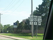
to a traffic light on US-62/277 in the southwest part of Newcastle
. The speed limit is 55 MPH (88 km/h) for most of the route, though on the east end of the highway the speed limit falls to 45 MPH (72 km/h).
SH-130 is also signed as Fox Lane by the city of Newcastle.
map, which was also the first to show SH-76's extension to Newcastle (previously, SH-76 ended in Blanchard
).. From 1957 to 1964, it was composed of gravel. The route was apparently decommissioned
in either 1964 or early 1965, as it appears on the 1964 map but not the 1965 edition. SH-130 was brought back fourteen years later, reappearing on the 1979 map as a paved highway. No changes have been made to the highway since then.

United States
The United States of America is a federal constitutional republic comprising fifty states and a federal district...
state of Oklahoma
Oklahoma
Oklahoma is a state located in the South Central region of the United States of America. With an estimated 3,751,351 residents as of the 2010 census and a land area of 68,667 square miles , Oklahoma is the 28th most populous and 20th-largest state...
. It is entirely within McClain County
McClain County, Oklahoma
McClain County is a county located in the U.S. state of Oklahoma. The population was 27,740 at the 2000 census. Its county seat is Purcell. McClain County is part of the Oklahoma City Metropolitan Statistical Area, and is in the top 3 fastest growing counties in Oklahoma with a growth rate of...
. It does not have any lettered spur routes.
Route description
It runs between SH-76State Highway 76 (Oklahoma)
State Highway 76, also referred to as SH-76 or OK-76, is a highway maintained by the U.S. state of Oklahoma. It is 110.7 miles long. It runs north–south through central Oklahoma, beginning at Jimtown Road just north of the Red River and ending north of Newcastle at SH-37...
north of Blanchard
Blanchard, Oklahoma
Blanchard is a city in Grady and McClain counties in the U.S. state of Oklahoma. The population was 7,670 at the 2010 census. Blanchard is part of a rapidly growing area of northern McClain and Grady Counties known as the "Tri-City Area" with Newcastle and Tuttle.-Early history:Blanchard is...
to a traffic light on US-62/277 in the southwest part of Newcastle
Newcastle, Oklahoma
Newcastle is the largest city in McClain County, Oklahoma, United States, and a part of the Oklahoma City Metropolitan Area. The population was 7,685 at the 2010 census.-Geography:Newcastle is located at ....
. The speed limit is 55 MPH (88 km/h) for most of the route, though on the east end of the highway the speed limit falls to 45 MPH (72 km/h).
SH-130 is also signed as Fox Lane by the city of Newcastle.
History
SH-130 first appeared on the 1957 ODOTOklahoma Department of Transportation
The Oklahoma Department of Transportation is an agency of the government of Oklahoma responsible for the construction, maintenance, and regulation the use of the state's transportation infrastructure...
map, which was also the first to show SH-76's extension to Newcastle (previously, SH-76 ended in Blanchard
Blanchard, Oklahoma
Blanchard is a city in Grady and McClain counties in the U.S. state of Oklahoma. The population was 7,670 at the 2010 census. Blanchard is part of a rapidly growing area of northern McClain and Grady Counties known as the "Tri-City Area" with Newcastle and Tuttle.-Early history:Blanchard is...
).. From 1957 to 1964, it was composed of gravel. The route was apparently decommissioned
Decommissioned highway
A decommissioned highway is a highway that has been removed from service, shut down or has had its authorization as a federal or state highway removed. Decommissioning can include the complete or partial demolition or abandonment of an old highway structure because the old roadway has lost its...
in either 1964 or early 1965, as it appears on the 1964 map but not the 1965 edition. SH-130 was brought back fourteen years later, reappearing on the 1979 map as a paved highway. No changes have been made to the highway since then.
Junction list


