.gif)
State Highway 150 (Oklahoma)
Encyclopedia
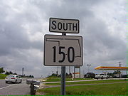
State Highway 150 is a state highway
in McIntosh County
, Oklahoma
, in the United States
. It is 8.77 miles (14.1 km) long, running from U.S. Highway 69 north of Eufaula
to Interstate 40 west of Checotah
. It runs diagonally from southeast to northwest, providing access to Lake Eufaula
and Lake Eufaula State Park
. SH-150 has no lettered spur routes.
 State Highway 150 begins at an interchange with U.S. 69 north of Eufaula. East of the freeway, the roadbed continues as Texanna
Road. From the interchange, SH-150 angles northeast, crossing the Deep Fork River
arm of Eufaula Lake. Upon reaching the shore, the highway enters Lake Eufaula State Park and turns due north. The highway provides access to Fountainhead Lodge Airpark, then curves around to the west. A sharp turn shortly thereafter turns the highway back to the north. SH-150 then passes through Brush Hill and leaves the state park. The highway turns northwest to avoid the lake, then turns back to the north before coming to an end at Interstate 40 exit 259.
State highway
State highway, state road or state route can refer to one of three related concepts, two of them related to a state or provincial government in a country that is divided into states or provinces :#A...
in McIntosh County
McIntosh County, Oklahoma
McIntosh County is a county located in the U.S. state of Oklahoma. As of 2000, the population was 19,456. Its county seat is Eufaula.-Geography:...
, Oklahoma
Oklahoma
Oklahoma is a state located in the South Central region of the United States of America. With an estimated 3,751,351 residents as of the 2010 census and a land area of 68,667 square miles , Oklahoma is the 28th most populous and 20th-largest state...
, in the United States
United States
The United States of America is a federal constitutional republic comprising fifty states and a federal district...
. It is 8.77 miles (14.1 km) long, running from U.S. Highway 69 north of Eufaula
Eufaula, Oklahoma
Eufaula is a city in McIntosh County, Oklahoma, United States. The population was 2,639 at the 2000 census. It is the county seat of McIntosh County.-Geography:Eufaula is located at ....
to Interstate 40 west of Checotah
Checotah, Oklahoma
Checotah is a city in McIntosh County, Oklahoma, United States. It was named for Samuel Checote, the first chief of the Creek Nation elected after the Civil War. The population was 3,481 at the 2000 census....
. It runs diagonally from southeast to northwest, providing access to Lake Eufaula
Lake Eufaula
Lake Eufaula may refer to:*Eufaula Lake, an artificial lake on the Canadian River in Oklahoma, USA*Walter F. George Lake, an artificial lake on the Chattahoochee River between Alabama and Georgia, USA that is also known known as Lake Eufaula, from the town of Eufaula, Alabama on its western banks...
and Lake Eufaula State Park
Lake Eufaula State Park
Lake Eufaula State Park is a Oklahoma state park located in McIntosh County, Oklahoma.The park was formerly known as Fountainhead State Park.The park has a swimming area with a beach, and multiple boat ramps...
. SH-150 has no lettered spur routes.
Route description

Texanna, Oklahoma
Texanna is a census-designated place in McIntosh County, Oklahoma, United States. The population was 2,083 at the 2000 census.Established in District 12 of the old Indian Territory, its post office existed from June 27, 1888, until July 16, 1940. Texanna's population in the 1905 Territorial Census...
Road. From the interchange, SH-150 angles northeast, crossing the Deep Fork River
Deep Fork River
Deep Fork River is an Oklahoma tributary of the North Canadian River. The headwaters flow from north Oklahoma City and the river empties into the North Canadian at Lake Eufaula about away....
arm of Eufaula Lake. Upon reaching the shore, the highway enters Lake Eufaula State Park and turns due north. The highway provides access to Fountainhead Lodge Airpark, then curves around to the west. A sharp turn shortly thereafter turns the highway back to the north. SH-150 then passes through Brush Hill and leaves the state park. The highway turns northwest to avoid the lake, then turns back to the north before coming to an end at Interstate 40 exit 259.

