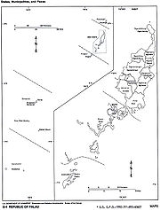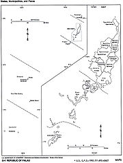
States of Palau
Encyclopedia
Palau
is divided into sixteen administrative regions, called states (the still separately listed Rock Islands did originally not belong to any state, but now belong to the state of Koror).

Palau
Palau , officially the Republic of Palau , is an island nation in the Pacific Ocean, east of the Philippines and south of Tokyo. In 1978, after three decades as being part of the United Nations trusteeship, Palau chose independence instead of becoming part of the Federated States of Micronesia, a...
is divided into sixteen administrative regions, called states (the still separately listed Rock Islands did originally not belong to any state, but now belong to the state of Koror).
| State | Capital | Area(km²) | Population(Census 2005) |
|---|---|---|---|
| North of Babeldaob Babeldaob Babeldaob is the largest island in the island nation of Palau. Its area, 331 km² , makes up over 70% of the area of the entire country, and about 30% of the population, with about 6,000 people living there... |
|||
| Kayangel Kayangel Kayangel is the northernmost state of Palau north of Koror. The land area is about . The population is 138 . The state consists of three atolls in different states of development:-Kayangel Atoll:... |
Kayangel Kayangel Kayangel is the northernmost state of Palau north of Koror. The land area is about . The population is 138 . The state consists of three atolls in different states of development:-Kayangel Atoll:... |
3 | 188 |
| Babeldaob Babeldaob Babeldaob is the largest island in the island nation of Palau. Its area, 331 km² , makes up over 70% of the area of the entire country, and about 30% of the population, with about 6,000 people living there... |
|||
| Aimeliik Aimeliik Aimeliik is an administrative division of the island country of Palau. It is one of the Republic of Palau's 16 states. It has an area of 52 km² and a population of 270 . State capital is the village of Mongami.... |
Mongami | 52 | 270 |
| Airai Airai Airai, located on the southern coast of Babeldaob island, is the second-most populous state of Palau. It contains the country's chief airport, Airai International Airport, and is connected by the Koror-Babeldaob Bridge to nearby Koror Island.... |
Ngetkib Ngetkib Ngetkib is a village in Palau, and the capital of the state of Airai. It has a population of 62.... |
44 | 2 723 |
| Melekeok Melekeok Melekeok is a town in the State of Melekeok . It is located on the east coast of Palau's largest island, Babeldaob... |
Melekeok | 28 | 391 |
| Ngaraard Ngaraard Ngaraard is the eighth state of the Republic of Palau, and was originally named Kerradel. Ngaraard is located on the northern tip of Babeldaob directly adjacent to Ngarchelong state. There are five hamlets in Ngaraard, including Choll, Elab, Ngebuked, Ngkeklau and the state capital, Ulimang,... |
Ulimang Ulimang The village of Ulimang is where the Ngaraard State Office is located. Note: Another state office branch is located in Meketii, Koror. Ngaraard Elementary school is located here.... |
36 | 581 |
| Ngarchelong Ngarchelong Ngarchelong is the name of state of the country of Palau. Ngarchelong is at the northern most tip of the island of Babeldaob. Only the state of Kayangel is farther north. Ngarchelong is an important historical site and has undergone archeological excavation.... |
Mengellang Mengellang Mengellang is a village in Palau, and the capital of the state of Ngarchelong.... |
10 | 488 |
| Ngardmau Ngardmau Ngardmau is one of Palau's sixteen states and is located on the west side of Babeldaob between the states of Ngaraard and Ngeremlengui. Its total area is . According to the last census, 221 persons live in Ngardmau. Their 46 households are situated in three hamlets: Ngetbong, Ngerutoi and Urdmau... |
Urdmang | 47 | 166 |
| Ngaremlengui Ngaremlengui Ngeremlengui is one of Palau's sixteen states. It has a population of about 317 people and is just west of Melekeok state, where Palau's capital village is . The capital of the state of Ngeremlengui is Imeong. Ngeremlengui is on the western side of Babeldaob, which is the largest Island in Palau... |
Imeong Imeong Imeong is a village in Palau, and the capital of the state of Ngaremlengui. The population is 132 .... |
65 | 317 |
| Ngatpang Ngatpang Ngatpang is one of Palau's sixteen states. It comprises an area of around 47 square kilometers in the west of Palau's largest island, Babeldaob, facing onto Ngeremeduu Bay. The state capital is Oikuul. It has a population of 464, making it Palau's 5th largest state in population.-External links:*... |
Ngereklmadel | 47 | 464 |
| Ngchesar Ngchesar Ngchesar is one of the sixteen states of the small pacific island nation of Palau. There are about 300 inhabitants, and its capital is Ngersuul... |
Ngersuul | 41 | 254 |
| Ngiwal Ngiwal Ngiwal is one of the sixteen states of Palau. It has a population of 223 and an area of 26 km². The administrative center is Ngerkeai.... |
Ngerkeai | 26 | 223 |
| Southwest of Babeldaob Babeldaob Babeldaob is the largest island in the island nation of Palau. Its area, 331 km² , makes up over 70% of the area of the entire country, and about 30% of the population, with about 6,000 people living there... |
|||
| Angaur Angaur Angaur or Ngeaur is an island in the island nation of Palau. The island, which forms its own state, has an area of 8 km² . Its population is 188 . State capital is the village of Ngeremasch on the western side... |
Ngaramasch | 8 | 320 |
| Koror Koror Koror is the state comprising the main commercial centre of the Republic of Palau. It consists of several islands, the most prominent being Koror Island .... |
Koror Koror Koror is the state comprising the main commercial centre of the Republic of Palau. It consists of several islands, the most prominent being Koror Island .... |
18 | 12 676 |
| Peleliu Peleliu Peleliu is an island in the island nation of Palau. Peleliu forms, along with two small islands to its northeast, one of the sixteen states of Palau. It is located northeast of Angaur and southwest of Koror.... |
Kloulklubed Kloulklubed Kloulklubed is the main settlement on the Palau island of Peleliu. it is situated at the northern end of the island, close to North beach. The village was a centre of Japanese operations during World War II, and the remains of the Japanese communications centre is still standing in the village... |
13 | 702 |
| Rock Islands, (also called Chelbacheb) Rock Islands (Palau) The Rock Islands of Palau, also called Chelbacheb, are a small collection of limestone or coral uprises, ancient relics of coral reefs that violently surfaced to form Islands in Palau's Southern Lagoon, between Koror and Peleliu, and are now an incorporated part of Koror State... |
– | 47 | – |
| Southwest Islands Southwest Islands (Palau) The Southwest Islands of Palau are several small islands spread across the Pacific Ocean, about 600 km from the main island chain of Palau. The nearshore islands to the southwest of the main island of Palau , which belong to the states of Koror, Peleliu and Angaur and to the unincorporated Rock... |
|||
| Hatohobei Hatohobei Tobi Island, or Hatohobei , is the southernmost of Palau's sixteen states, consisting of Tobi Island and uninhabited Helen Reef. The total land area is about 0.88 km²... |
Hatohobei Hatohobei Tobi Island, or Hatohobei , is the southernmost of Palau's sixteen states, consisting of Tobi Island and uninhabited Helen Reef. The total land area is about 0.88 km²... |
3 | 44 |
| Sonsorol Sonsorol Sonsorol is one of the sixteen states of Palau. The administrative center is Dongosaru on Sonsorol island. The inhabitants speak Sonsorolese, a local Trukic language, and Palauan.... |
Dongosaru Dongosaru Dongosaru is a village in Palau, and the capital of the state of Sonsorol. The population as of 2009 was about 30... |
3 | 100 |
| Palau Palau Palau , officially the Republic of Palau , is an island nation in the Pacific Ocean, east of the Philippines and south of Tokyo. In 1978, after three decades as being part of the United Nations trusteeship, Palau chose independence instead of becoming part of the Federated States of Micronesia, a... |
|||
| Palau Palau Palau , officially the Republic of Palau , is an island nation in the Pacific Ocean, east of the Philippines and south of Tokyo. In 1978, after three decades as being part of the United Nations trusteeship, Palau chose independence instead of becoming part of the Federated States of Micronesia, a... |
Ngerulmud Ngerulmud Ngerulmud, a settlement in the State of Melekeok, is where the offices of the government of Palau are. The official capital is Melekeok. On 7 October 2006, government officials moved their offices in the former capital of Koror to Ngerulmud.... 1 |
488 | 19 907 |
| 1 The national capital of Palau Palau Palau , officially the Republic of Palau , is an island nation in the Pacific Ocean, east of the Philippines and south of Tokyo. In 1978, after three decades as being part of the United Nations trusteeship, Palau chose independence instead of becoming part of the Federated States of Micronesia, a... was movedfrom Koror Koror Koror is the state comprising the main commercial centre of the Republic of Palau. It consists of several islands, the most prominent being Koror Island .... to Ngerulmud Ngerulmud Ngerulmud, a settlement in the State of Melekeok, is where the offices of the government of Palau are. The official capital is Melekeok. On 7 October 2006, government officials moved their offices in the former capital of Koror to Ngerulmud.... on October 7, 2006. |
|||


