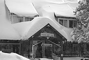
Strawberry, El Dorado County, California
Encyclopedia

Unincorporated area
In law, an unincorporated area is a region of land that is not a part of any municipality.To "incorporate" in this context means to form a municipal corporation, a city, town, or village with its own government. An unincorporated community is usually not subject to or taxed by a municipal government...
on the South Fork American River
American River
The American River is a California watercourse noted as the site of Sutter's Mill, northwest of Placerville, California, where gold was found in 1848, leading to the California Gold Rush...
, 3.25 miles (5 km) south-southwest of Pyramid Peak
Pyramid Peak (California)
Pyramid Peak is a mountain in the California's Sierra Nevada within the Crystal Range and to the west of Lake Tahoe. It is the highest point in the Desolation Wilderness. With an elevation gain of almost , the Rocky Canyon route is the mountain's most popular approach although it is very arduous....
, along U.S. Route 50
U.S. Route 50
U.S. Route 50 is a major east–west route of the U.S. Highway system, stretching just over from Ocean City, Maryland on the Atlantic Ocean to West Sacramento, California. Until 1972, when it was replaced by Interstate Highways west of the Sacramento area, it extended to San Francisco, near...
in the foothills of the Sierra Nevada. The sign on the highway reads population 50.

