Sunk Island
Encyclopedia
Sunk Island is a Crown Estate
village
and civil parish in the East Riding of Yorkshire
, England
. It lies 3.5 miles (5.6 km) south of Ottringham
and 1 miles (1.6 km) to the north of the Humber Estuary. The Greenwich Meridian passes through the east of the parish.
According to the 2001 UK census
, Sunk Island parish had a population of 224.
 Sunk Island originated as a sand bank in the Humber Estuary, by the reign of Charles I of England
, it was said to form a seven acre
island
, one-and-a-half mile from the mainland. From 1663, the land around it was gradually drained, and by the mid-18th century, the channel separating it from the shore had entirely silted up. It was parish
ed in 1831.
A fort was built at the outbreak of World War I
.
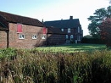
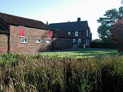
Today, the settlement consists of a church, a few houses and various farm
s. Cottages were built 1855-7 by Samuel Sanders Teulon
.
The parish church of Holy Trinity, designed by Ewan Christian
in the 1870s, is a Grade II listed building.

Crown Estate
In the United Kingdom, the Crown Estate is a property portfolio owned by the Crown. Although still belonging to the monarch and inherent with the accession of the throne, it is no longer the private property of the reigning monarch and cannot be sold by him/her, nor do the revenues from it belong...
village
Village
A village is a clustered human settlement or community, larger than a hamlet with the population ranging from a few hundred to a few thousand , Though often located in rural areas, the term urban village is also applied to certain urban neighbourhoods, such as the West Village in Manhattan, New...
and civil parish in the East Riding of Yorkshire
East Riding of Yorkshire
The East Riding of Yorkshire, or simply East Yorkshire, is a local government district with unitary authority status, and a ceremonial county of England. For ceremonial purposes the county also includes the city of Kingston upon Hull, which is a separate unitary authority...
, England
England
England is a country that is part of the United Kingdom. It shares land borders with Scotland to the north and Wales to the west; the Irish Sea is to the north west, the Celtic Sea to the south west, with the North Sea to the east and the English Channel to the south separating it from continental...
. It lies 3.5 miles (5.6 km) south of Ottringham
Ottringham
Ottringham is a village and civil parish in the East Riding of Yorkshire, England in an area known as Holderness. It is situated approximately to the east of Hull city centre and south west of Withernsea...
and 1 miles (1.6 km) to the north of the Humber Estuary. The Greenwich Meridian passes through the east of the parish.
According to the 2001 UK census
United Kingdom Census 2001
A nationwide census, known as Census 2001, was conducted in the United Kingdom on Sunday, 29 April 2001. This was the 20th UK Census and recorded a resident population of 58,789,194....
, Sunk Island parish had a population of 224.
History

Charles I of England
Charles I was King of England, King of Scotland, and King of Ireland from 27 March 1625 until his execution in 1649. Charles engaged in a struggle for power with the Parliament of England, attempting to obtain royal revenue whilst Parliament sought to curb his Royal prerogative which Charles...
, it was said to form a seven acre
Acre
The acre is a unit of area in a number of different systems, including the imperial and U.S. customary systems. The most commonly used acres today are the international acre and, in the United States, the survey acre. The most common use of the acre is to measure tracts of land.The acre is related...
island
Island
An island or isle is any piece of sub-continental land that is surrounded by water. Very small islands such as emergent land features on atolls can be called islets, cays or keys. An island in a river or lake may be called an eyot , or holm...
, one-and-a-half mile from the mainland. From 1663, the land around it was gradually drained, and by the mid-18th century, the channel separating it from the shore had entirely silted up. It was parish
Parish
A parish is a territorial unit historically under the pastoral care and clerical jurisdiction of one parish priest, who might be assisted in his pastoral duties by a curate or curates - also priests but not the parish priest - from a more or less central parish church with its associated organization...
ed in 1831.
A fort was built at the outbreak of World War I
World War I
World War I , which was predominantly called the World War or the Great War from its occurrence until 1939, and the First World War or World War I thereafter, was a major war centred in Europe that began on 28 July 1914 and lasted until 11 November 1918...
.
Today, the settlement consists of a church, a few houses and various farm
Farm
A farm is an area of land, or, for aquaculture, lake, river or sea, including various structures, devoted primarily to the practice of producing and managing food , fibres and, increasingly, fuel. It is the basic production facility in food production. Farms may be owned and operated by a single...
s. Cottages were built 1855-7 by Samuel Sanders Teulon
Samuel Sanders Teulon
Samuel Sanders Teulon was a notable 19th century English Gothic Revival architect.-Family:Teulon was born in Greenwich in south-east London, the son of a cabinet-maker from a French Huguenot family. His younger brother William Milford Teulon also became an architect...
.
The parish church of Holy Trinity, designed by Ewan Christian
Ewan Christian
Ewan Christian was a British architect. He is most notable for the restoration of Carlisle Cathedral, the alterations to Christ Church, Spitalfields in 1866, and the extension to the National Gallery that created the National Portrait Gallery. He was architect to the Ecclesiastical Commissioners...
in the 1870s, is a Grade II listed building.


