Swift Ditch
Encyclopedia


River Thames
The River Thames flows through southern England. It is the longest river entirely in England and the second longest in the United Kingdom. While it is best known because its lower reaches flow through central London, the river flows alongside several other towns and cities, including Oxford,...
in England, which was formerly the primary navigation channel. With the main river, it creates the large island of Andersey Island
Andersey Island
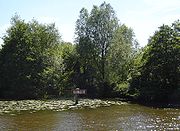
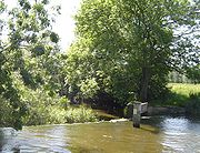
Andersey Island is a large island in the River Thames in England near Abingdon, Oxfordshire on the reach above Culham Lock.The island is created by a division in the stream of the river between the main navigation channel and the Swift Ditch backwater. The Swift Ditch used to be the main course of...
near Abingdon, Oxfordshire
Abingdon, Oxfordshire
Abingdon or archaically Abingdon-on-Thames is a market town and civil parish in Oxfordshire, England. It is the seat of the Vale of White Horse district. Previously the county town of Berkshire, Abingdon is one of several places that claim to be Britain's oldest continuously occupied town, with...
.
As early as 955 to 963 AD, the monks of Abingdon Priory built a canal to the Abbey from the direction of Swift Ditch. There is also evidence that the current course of the river to the confluence had been built by 1060. However the Swift Ditch remained the faster route (hence the name), and a pound lock was built at its head by the Oxford-Burcot Commission
Oxford-Burcot Commission
The Oxford-Burcot Commission was the first Commission concerned with the management of the River Thames, appointed by an Act of Parliament of 1605 by James I to make the stretch of river from Burcot to Oxford navigable. The Commission took responsibility for the management of the River Thames...
in 1624. In 1788 several citizens of Abingdon wanted to divert navigation back to the current course and as a result Abingdon Lock
Abingdon Lock
Abingdon Lock is a lock on the River Thames in England, less than 1 mile east and upstream of Abingdon, Oxfordshire on the opposite bank of the river...
was built near the town. Within ten years, the Wilts & Berks Canal connected to the current navigation channel at Abingdon.
Culham Bridges
The Swift Ditch is crossed by three bridges. The original Culham BridgeCulham Bridge
Culham Bridge is a mediaeval bridge crossing a present backwater of the River Thames in England at Culham, Oxfordshire, near the town of Abingdon. The bridge crosses Swift Ditch which was at one time the main navigation channel of the River Thames until Abingdon Lock was built in 1790...
was built about the same time as the Abingdon Bridge
Abingdon Bridge
Abingdon Bridge consists of a pair of bridges across the River Thames at the town of Abingdon, Oxfordshire, England. It carries the A415 road from Abingdon to Dorchester, Oxfordshire – and crosses the Thames on the reach above Culham Lock, just below Abingdon Lock.The bridge is actually two...
s across the site of a ford. It has been replaced by a more modern bridge carrying the A415 road beside it. A wooden footbridge further downstream carries the Thames Path
Thames Path
The Thames Path is a National Trail, opened in 1996, following the length of the River Thames from its source near Kemble in Gloucestershire to the Thames Barrier at Charlton. It is about long....
.

