Sør-Varanger
Encyclopedia
Sør-Varanger is a municipality
in Finnmark
county
, Norway
. The administrative centre of the municipality is the town of Kirkenes
. Sør-Varanger was separated from the municipality of Vadsø
on 1 July 1858.
, (Old Norse
: Ver(j)angr). The first part is ver meaning "fishing village" and the last part is angr which means "fjord". It was first probably used for the narrow fjord on the inside of Angsnes which now is called "Meskfjorden" and leads in to Varangerbotn. Sør means "south". Prior to 1918, the name was spelled Sydvaranger. Until 1964 there also was a municipality named Nord-Varanger
.
is from modern times. They were granted on 16 April 1982. The arms show three flame
s in gold/orange. The division of the shield symbolizes the importance of the number three: The three main sources of income are agriculture, mining, and fishing; the municipality has three river
s (Neiden
, Pasvikelva and Jakobselva
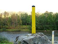
) that form the borders of Norway, Russia
, and Finland
; and there are three cultures in the municipality: Norwegians, Finns, and Sami
.

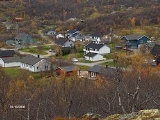
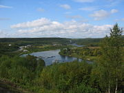
 Sør-Varanger is a vast area of some 3700 square kilometre, situated between Finland and Russia. Most of the area is low-lying forest
of pine
and birch
, with barren sections facing the Barents Sea
.
The centre of Sør-Varanger is the town of Kirkenes. Other settlements include Bugøynes, Neiden, and little hamlets along the river of Pasvikelva. The local airport is called Høybuktmoen
which is also a military camp. Garnisonen i Sør-Varanger
(GSV) is based at Høybuktmoen.
The flora of the area is a part of the Russian and Siberia
n taiga
, including a few hundred spruce
trees of the Russian variety. Bear
s also inhabit the upper valley, notably in the Øvre Pasvik National Park
.
. This Sami group migrated between coast and inland in present Norwegian, Finnish, and Russian territory long before any borders existed. In the 16th century, they were converted to the Russian Orthodox faith, and still today the chapel of Saint George at Neiden, dating from 1565, is a reminder of eastern influence. In 1826, the previously disputed areas were divided between Norway and Russia
, causing great difficulties for the Sami
. The Norwegian state also invited Norwegian settlers to come to the area, building Lutheran churches to counterbalance the Orthodox heritage. During the 19th century Finnish settlers (Kven) arrived to the valleys, and from 1906 Norwegians came in numbers because of the iron
mining starting up in Kirkenes. After the Treaty of Tartu
the area of Petsamo
was ceded to Finland, and Sør-Varanger (and Norway) no longer bordered Russia, until Finland had to cede it back to the Soviet Union in 1944.
In 1906, Sydvaranger
opened the Bjørnevatn Mine at Bjørnevatn
and four years later the mine was connected to the port
in Kirkenes by Kirkenes-Bjørnevatnbanen, the world's most northery railway. The mine was closed in 1996.
in Grense Jakobselv
on the Russian border (built in 1869 to mark the border) and prehistoric labyrinth
constructions in the area, probably used for religious purposes.
Popular leisure activities include salmon fishing
in one of the numerous rivers, hunting for elk
and grouse
, and snowmobile
driving. Many inhabitants also own and frequently use a cabin
located in more remote parts of the municipality.
Municipalities of Norway
Norway is divided into 19 administrative regions, called counties , and 430 municipalities...
in Finnmark
Finnmark
or Finnmárku is a county in the extreme northeast of Norway. By land it borders Troms county to the west, Finland to the south and Russia to the east, and by water, the Norwegian Sea to the northwest, and the Barents Sea to the north and northeast.The county was formerly known as Finmarkens...
county
Counties of Norway
Norway is divided into 19 administrative regions, called counties . The counties form the primary first-level subdivisions of Norway and are further divided into 430 municipalities...
, Norway
Norway
Norway , officially the Kingdom of Norway, is a Nordic unitary constitutional monarchy whose territory comprises the western portion of the Scandinavian Peninsula, Jan Mayen, and the Arctic archipelago of Svalbard and Bouvet Island. Norway has a total area of and a population of about 4.9 million...
. The administrative centre of the municipality is the town of Kirkenes
Kirkenes
is a town in the municipality of Sør-Varanger in the county of Finnmark in the far northeast of Norway...
. Sør-Varanger was separated from the municipality of Vadsø
Vadsø
is a city and municipality in Finnmark county, Norway. The city is the administrative centre of the municipality and the county of Finnmark....
on 1 July 1858.
Name
The meaning of the name Sør-Varanger is originally the name of a fjordFjord
Geologically, a fjord is a long, narrow inlet with steep sides or cliffs, created in a valley carved by glacial activity.-Formation:A fjord is formed when a glacier cuts a U-shaped valley by abrasion of the surrounding bedrock. Glacial melting is accompanied by rebound of Earth's crust as the ice...
, (Old Norse
Old Norse
Old Norse is a North Germanic language that was spoken by inhabitants of Scandinavia and inhabitants of their overseas settlements during the Viking Age, until about 1300....
: Ver(j)angr). The first part is ver meaning "fishing village" and the last part is angr which means "fjord". It was first probably used for the narrow fjord on the inside of Angsnes which now is called "Meskfjorden" and leads in to Varangerbotn. Sør means "south". Prior to 1918, the name was spelled Sydvaranger. Until 1964 there also was a municipality named Nord-Varanger
Nord-Varanger
Nord-Varanger is a former municipality in Finnmark county in Norway. It is located in the present-day municipality of Vadsø on the southern half of the Varanger Peninsula along the Varangerfjord.-Name:...
.
Coat-of-arms
The coat-of-armsCoat of arms
A coat of arms is a unique heraldic design on a shield or escutcheon or on a surcoat or tabard used to cover and protect armour and to identify the wearer. Thus the term is often stated as "coat-armour", because it was anciently displayed on the front of a coat of cloth...
is from modern times. They were granted on 16 April 1982. The arms show three flame
Flame
A flame is the visible , gaseous part of a fire. It is caused by a highly exothermic reaction taking place in a thin zone...
s in gold/orange. The division of the shield symbolizes the importance of the number three: The three main sources of income are agriculture, mining, and fishing; the municipality has three river
River
A river is a natural watercourse, usually freshwater, flowing towards an ocean, a lake, a sea, or another river. In a few cases, a river simply flows into the ground or dries up completely before reaching another body of water. Small rivers may also be called by several other names, including...
s (Neiden
Neiden
Neiden is a settlement in Lapland with approx. 250 inhabitants. Neiden, situated at the Neiden River, actually consists of two villages separated by the border between Norway and Finland, one side in the municipality of Sør-Varanger of Finnmark county in Norway and the other side in the...
, Pasvikelva and Jakobselva
Jakobselva (Sør-Varanger)
The Jakobselva is a river on the border of Sør-Varanger municipality in Finnmark, Norway, and Murmansk Oblast in Russia.The river is also known as the Grense Jakobselv River...
) that form the borders of Norway, Russia
Russia
Russia or , officially known as both Russia and the Russian Federation , is a country in northern Eurasia. It is a federal semi-presidential republic, comprising 83 federal subjects...
, and Finland
Finland
Finland , officially the Republic of Finland, is a Nordic country situated in the Fennoscandian region of Northern Europe. It is bordered by Sweden in the west, Norway in the north and Russia in the east, while Estonia lies to its south across the Gulf of Finland.Around 5.4 million people reside...
; and there are three cultures in the municipality: Norwegians, Finns, and Sami
Sami people
The Sami people, also spelled Sámi, or Saami, are the arctic indigenous people inhabiting Sápmi, which today encompasses parts of far northern Sweden, Norway, Finland, the Kola Peninsula of Russia, and the border area between south and middle Sweden and Norway. The Sámi are Europe’s northernmost...
.
Geography


Forest
A forest, also referred to as a wood or the woods, is an area with a high density of trees. As with cities, depending where you are in the world, what is considered a forest may vary significantly in size and have various classification according to how and what of the forest is composed...
of pine
Pine
Pines are trees in the genus Pinus ,in the family Pinaceae. They make up the monotypic subfamily Pinoideae. There are about 115 species of pine, although different authorities accept between 105 and 125 species.-Etymology:...
and birch
Birch
Birch is a tree or shrub of the genus Betula , in the family Betulaceae, closely related to the beech/oak family, Fagaceae. The Betula genus contains 30–60 known taxa...
, with barren sections facing the Barents Sea
Barents Sea
The Barents Sea is a marginal sea of the Arctic Ocean, located north of Norway and Russia. Known in the Middle Ages as the Murman Sea, the sea takes its current name from the Dutch navigator Willem Barents...
.
The centre of Sør-Varanger is the town of Kirkenes. Other settlements include Bugøynes, Neiden, and little hamlets along the river of Pasvikelva. The local airport is called Høybuktmoen
Kirkenes Airport, Høybuktmoen
Kirkenes Airport, Høybuktmoen is the airport serving Kirkenes in eastern Finnmark, Norway. Høybuktmoen is located west of Kirkenes, at the base of a peninsula jutting into Varangerfjord...
which is also a military camp. Garnisonen i Sør-Varanger
Garnisonen i Sør-Varanger
The Sør-Varanger Garrison is a military camp located next to Høybuktmoen Airport near Kirkenes in Sør-Varanger, Norway. The Garrison is under the control of the Norwegian Army and is organized as a battalion. The garrison...
(GSV) is based at Høybuktmoen.
The flora of the area is a part of the Russian and Siberia
Siberia
Siberia is an extensive region constituting almost all of Northern Asia. Comprising the central and eastern portion of the Russian Federation, it was part of the Soviet Union from its beginning, as its predecessor states, the Tsardom of Russia and the Russian Empire, conquered it during the 16th...
n taiga
Taiga
Taiga , also known as the boreal forest, is a biome characterized by coniferous forests.Taiga is the world's largest terrestrial biome. In North America it covers most of inland Canada and Alaska as well as parts of the extreme northern continental United States and is known as the Northwoods...
, including a few hundred spruce
Spruce
A spruce is a tree of the genus Picea , a genus of about 35 species of coniferous evergreen trees in the Family Pinaceae, found in the northern temperate and boreal regions of the earth. Spruces are large trees, from tall when mature, and can be distinguished by their whorled branches and conical...
trees of the Russian variety. Bear
Bear
Bears are mammals of the family Ursidae. Bears are classified as caniforms, or doglike carnivorans, with the pinnipeds being their closest living relatives. Although there are only eight living species of bear, they are widespread, appearing in a wide variety of habitats throughout the Northern...
s also inhabit the upper valley, notably in the Øvre Pasvik National Park
Øvre Pasvik National Park
Øvre Pasvik National Park lies in Sør-Varanger municipality in Finnmark county, Norway. The park was opened in 1970 and was originally 63 km². In 2003 the park size was increased to 119 km², at the same time that the adjacent Øvre Pasvik landskapsvernområde, a national protected area, was opened...
.
History
The original inhabitants of the area are the Skolt SamiSkolts
The Skolt Sámi or Skolts are a visible Orthodox ethnic group in Lapland, Finland. They currently live in and around the villages of Sevettijärvi, Keväjärvi, Nellim in the municipality of Inari and also in the village of Neiden in the municipality of and Sør-Varanger, Norway...
. This Sami group migrated between coast and inland in present Norwegian, Finnish, and Russian territory long before any borders existed. In the 16th century, they were converted to the Russian Orthodox faith, and still today the chapel of Saint George at Neiden, dating from 1565, is a reminder of eastern influence. In 1826, the previously disputed areas were divided between Norway and Russia
Russia
Russia or , officially known as both Russia and the Russian Federation , is a country in northern Eurasia. It is a federal semi-presidential republic, comprising 83 federal subjects...
, causing great difficulties for the Sami
Sami people
The Sami people, also spelled Sámi, or Saami, are the arctic indigenous people inhabiting Sápmi, which today encompasses parts of far northern Sweden, Norway, Finland, the Kola Peninsula of Russia, and the border area between south and middle Sweden and Norway. The Sámi are Europe’s northernmost...
. The Norwegian state also invited Norwegian settlers to come to the area, building Lutheran churches to counterbalance the Orthodox heritage. During the 19th century Finnish settlers (Kven) arrived to the valleys, and from 1906 Norwegians came in numbers because of the iron
Iron
Iron is a chemical element with the symbol Fe and atomic number 26. It is a metal in the first transition series. It is the most common element forming the planet Earth as a whole, forming much of Earth's outer and inner core. It is the fourth most common element in the Earth's crust...
mining starting up in Kirkenes. After the Treaty of Tartu
Treaty of Tartu (Russian–Finnish)
The Treaty of Tartu between Finland and Soviet Russia was signed on 14 October 1920 after negotiations that lasted for four months. The treaty confirmed the border between Finland and Soviet Russia after the Finnish civil war and Finnish volunteer expeditions in Russian East Karelia. Ratifications...
the area of Petsamo
Petsamo
Petsamo may refer to:*A former area of Finland, which is now Pechengsky District and part of Kolsky District of Russia*Finnish name for the urban-type settlement of Pechenga, Russia...
was ceded to Finland, and Sør-Varanger (and Norway) no longer bordered Russia, until Finland had to cede it back to the Soviet Union in 1944.
In 1906, Sydvaranger
Sydvaranger
Sydvaranger was the company that operated the Bjørnevatn Mine in Kirkenes, Norway between the start in 1906 until 1996. Since then the company has mainly been concerned with cleaning up the industrial areas and business development...
opened the Bjørnevatn Mine at Bjørnevatn
Bjørnevatn
Bjørnevatn is a village in the municipality of Sør-Varanger, Norway. Its population is 2,392....
and four years later the mine was connected to the port
Port
A port is a location on a coast or shore containing one or more harbors where ships can dock and transfer people or cargo to or from land....
in Kirkenes by Kirkenes-Bjørnevatnbanen, the world's most northery railway. The mine was closed in 1996.
Attractions
The attractions in the area include the Orthodox chapel of Saint George in Neiden, the chapel of King Oscar IIOscar II of Sweden
Oscar II , baptised Oscar Fredrik was King of Sweden from 1872 until his death and King of Norway from 1872 until 1905. The third son of King Oscar I of Sweden and Josephine of Leuchtenberg, he was a descendant of Gustav I of Sweden through his mother.-Early life:At his birth in Stockholm, Oscar...
in Grense Jakobselv
Grense Jakobselv
Grense Jakobselv is a small settlement on the Barents Sea at the mouth of the Jakobselva river, in Finnmark, Norway. It lies 54 km by road east of Kirkenes....
on the Russian border (built in 1869 to mark the border) and prehistoric labyrinth
Labyrinth
In Greek mythology, the Labyrinth was an elaborate structure designed and built by the legendary artificer Daedalus for King Minos of Crete at Knossos...
constructions in the area, probably used for religious purposes.
Popular leisure activities include salmon fishing
Fishing
Fishing is the activity of trying to catch wild fish. Fish are normally caught in the wild. Techniques for catching fish include hand gathering, spearing, netting, angling and trapping....
in one of the numerous rivers, hunting for elk
Moose
The moose or Eurasian elk is the largest extant species in the deer family. Moose are distinguished by the palmate antlers of the males; other members of the family have antlers with a dendritic configuration...
and grouse
Grouse
Grouse are a group of birds from the order Galliformes. They are sometimes considered a family Tetraonidae, though the American Ornithologists' Union and many others include grouse as a subfamily Tetraoninae in the family Phasianidae...
, and snowmobile
Snowmobile
A snowmobile, also known in some places as a snowmachine, or sled,is a land vehicle for winter travel on snow. Designed to be operated on snow and ice, they require no road or trail. Design variations enable some machines to operate in deep snow or forests; most are used on open terrain, including...
driving. Many inhabitants also own and frequently use a cabin
Cottage
__toc__In modern usage, a cottage is usually a modest, often cozy dwelling, typically in a rural or semi-rural location. However there are cottage-style dwellings in cities, and in places such as Canada the term exists with no connotations of size at all...
located in more remote parts of the municipality.

