Kirkenes
Encyclopedia
is a town in the municipality
of Sør-Varanger
in the county
of Finnmark
in the far northeast of Norway
. The town has a population of about 3,300, which expands to approximately 7,300 if the neighbouring suburban areas of Hesseng, Sandnes and Bjørnevatn are included.
 The area around Kirkenes was a common Norwegian–Russian district until 1826, when the present border was settled. The original name of the headland was Piselvnes, but this was changed to Kirkenes (meaning "church headland") after the church was built in 1862.
, Kirkenes was one of the many bases for the German Kriegsmarine
and the Luftwaffe
's Jagdgeschwader 5
, and apart from that, the area served as a main base for supplies to the Murmansk
front (see Lapland War
). Reportedly Kirkenes is second after Malta
on a list of European towns experiencing air-raid alarms and attacks, with more than 1,000 alarms and 320 air attacks. The town was taken over by the Red Army
on October 25, 1944 as the German Wehrmacht
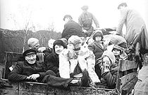
was pushed out and fled the area after having destroyed most of the remaining infrastructure. Only 13 houses survived the war. Close to the town there is a memorial to 11 freedom fighters who helped the partisans collect information about the German occupation. In the summer of 1943 their activities were discovered and many of them were sent to a prisoner-of-war camp near Kirkenes. Following a Court Martial the 11 were sentenced to death and were killed near the memorial spot on 18 August 1943. When the common grave was opened in 1946 it was found that the men had been beaten to death. Following the post mortem and memorial service the bodies were returned to their homesteads.

. Others are originally from Finland, either members of the Kven population or of a newer influx of more or less recent Finnish
immigrants. Also, some 500 are relatively recent Russia
n immigrants.
near the Russian–Norwegian border. The town is situated about 240 miles (400 km) north of the Arctic Circle
.
The midnight sun
shines from May 17 to July 21. The corresponding winter darkness extends from November 21 to January 21. Despite its location at the coast, Kirkenes exhibits a more continental climate
. The mean temperature is −11.5°C (11.3°F) in January, and 12.6°C (54.6°F) in July, with an annual precipitation of 450 mm (17.7 in). The record low was measured at −41°C (−41.8°F) and the record high was measured at 32.7°C (90.8°F). July 2004 was the warmest month on record, with a mean temperature of 16.9°C (62.4°F) [1]).
 The secretariat of the Barents Region
is located in Kirkenes. One of its tasks is to create cross-border cultural, educational and business relations in the Barents Region. There is now substantial optimism in the town as a consequence of the increased petroleum-drilling activity in the Barents Sea (including Russian activity). Bøkfjorden, an excellent harbour, has attracted interest from several large companies.
Norway's and Russia's Foreign Ministers signed an agreement on 2 November 2010 which will make it much easier for 9,000 Norwegians and 45,000 Russians to visit each other.
Tourist attractions include Grenselandsmuseet (The Border Country Museum), which shows the history of war and peace along the Norwegian–Russian border, Sami
art exhibitions by the artist John Savio
(1902–1938) and a history of the mining
industry in the area. The museum has a small shop and café. Almost every last Thursday of each month the Russian Market takes place on the central square where traders from Murmansk
sell their merchandise. Here you can find everything from matryoshkas
, linen cloths and handicrafts, to Russian crystal and porcelain dishes.
Just outside of Kirkenes is a military base called Høybuktmoen. Connected to this base are six border stations along the Russian border. This base and these border stations are there to protect against illegal immigrants as well as other illegal activities across the border.
In the city centre of Kirkenes is Andersgrotta, a vast underground bunker built during WWII which provided shelter to the town's 9,000 residents. Tours of the bunker are available.
Kirkenes is also one end of the route of Hurtigruten
, which cruises daily up and down the Norway coast to and from Bergen. Kirkenes is served by Kirkenes Airport, Høybuktmoen
. There are non-stop flights to Oslo
and Tromsø
.
Kirkenes is the terminus
of Kirkenes-Bjørnevatnbanen, the world's second most northerly railway, used to transport ore
from the mines at Bjørnevatn
to the port at Kirkenes.
 Unlike the vast majority of Norway, Kirkenes is located east of the neighbouring country of Finland. Because of this, travelling directly west from Kirkenes actually changes the timezone forward instead of backward, as it usually does. Travelling directly east from Kirkenes (into Russia) changes the timezone forward by two hours (three in winter) instead of one.
One can drive 100 km south, and walk 10 km, into the Øvre Pasvik National Park
, reaching the border point of the three countries, where the three timezones meet. There are only a few such places in the world. It is forbidden, according to both Norwegian and Russian law, to walk around the marker, as the only legal way to cross the Norwegian–Russian border is at the border control at Storskog
.
Sister City: Nikel
Nikel
, Russia.
Municipalities of Norway
Norway is divided into 19 administrative regions, called counties , and 430 municipalities...
of Sør-Varanger
Sør-Varanger
Sør-Varanger is a municipality in Finnmark county, Norway. The administrative centre of the municipality is the town of Kirkenes. Sør-Varanger was separated from the municipality of Vadsø on 1 July 1858.-Name:...
in the county
Counties of Norway
Norway is divided into 19 administrative regions, called counties . The counties form the primary first-level subdivisions of Norway and are further divided into 430 municipalities...
of Finnmark
Finnmark
or Finnmárku is a county in the extreme northeast of Norway. By land it borders Troms county to the west, Finland to the south and Russia to the east, and by water, the Norwegian Sea to the northwest, and the Barents Sea to the north and northeast.The county was formerly known as Finmarkens...
in the far northeast of Norway
Norway
Norway , officially the Kingdom of Norway, is a Nordic unitary constitutional monarchy whose territory comprises the western portion of the Scandinavian Peninsula, Jan Mayen, and the Arctic archipelago of Svalbard and Bouvet Island. Norway has a total area of and a population of about 4.9 million...
. The town has a population of about 3,300, which expands to approximately 7,300 if the neighbouring suburban areas of Hesseng, Sandnes and Bjørnevatn are included.
History

World War II
During the occupation of Norway by Nazi GermanyOccupation of Norway by Nazi Germany
The occupation of Norway by Nazi Germany started with the German invasion of Norway on April 9, 1940, and ended on May 8, 1945, after the capitulation of German forces in Europe. Throughout this period, Norway was continuously occupied by the Wehrmacht...
, Kirkenes was one of the many bases for the German Kriegsmarine
Kriegsmarine
The Kriegsmarine was the name of the German Navy during the Nazi regime . It superseded the Kaiserliche Marine of World War I and the post-war Reichsmarine. The Kriegsmarine was one of three official branches of the Wehrmacht, the unified armed forces of Nazi Germany.The Kriegsmarine grew rapidly...
and the Luftwaffe
Luftwaffe
Luftwaffe is a generic German term for an air force. It is also the official name for two of the four historic German air forces, the Wehrmacht air arm founded in 1935 and disbanded in 1946; and the current Bundeswehr air arm founded in 1956....
's Jagdgeschwader 5
Jagdgeschwader 5
Jagdgeschwader 5 Eismeer was a Luftwaffe fighter Wing that served during World War II. As the name Eismeer implies, it was created to operate in the far North of Europe, namely Norway, Scandinavia and northern parts of Finland, all nearest the Arctic Ocean...
, and apart from that, the area served as a main base for supplies to the Murmansk
Murmansk
Murmansk is a city and the administrative center of Murmansk Oblast, Russia. It serves as a seaport and is located in the extreme northwest part of Russia, on the Kola Bay, from the Barents Sea on the northern shore of the Kola Peninsula, not far from Russia's borders with Norway and Finland...
front (see Lapland War
Lapland War
The Lapland War were the hostilities between Finland and Nazi Germany between September 1944 and April 1945, fought in Finland's northernmost Lapland Province. While the Finns saw this as a separate conflict much like the Continuation War, German forces considered their actions to be part of the...
). Reportedly Kirkenes is second after Malta
Malta
Malta , officially known as the Republic of Malta , is a Southern European country consisting of an archipelago situated in the centre of the Mediterranean, south of Sicily, east of Tunisia and north of Libya, with Gibraltar to the west and Alexandria to the east.Malta covers just over in...
on a list of European towns experiencing air-raid alarms and attacks, with more than 1,000 alarms and 320 air attacks. The town was taken over by the Red Army
Red Army
The Workers' and Peasants' Red Army started out as the Soviet Union's revolutionary communist combat groups during the Russian Civil War of 1918-1922. It grew into the national army of the Soviet Union. By the 1930s the Red Army was among the largest armies in history.The "Red Army" name refers to...
on October 25, 1944 as the German Wehrmacht
Wehrmacht
The Wehrmacht – from , to defend and , the might/power) were the unified armed forces of Nazi Germany from 1935 to 1945. It consisted of the Heer , the Kriegsmarine and the Luftwaffe .-Origin and use of the term:...
was pushed out and fled the area after having destroyed most of the remaining infrastructure. Only 13 houses survived the war. Close to the town there is a memorial to 11 freedom fighters who helped the partisans collect information about the German occupation. In the summer of 1943 their activities were discovered and many of them were sent to a prisoner-of-war camp near Kirkenes. Following a Court Martial the 11 were sentenced to death and were killed near the memorial spot on 18 August 1943. When the common grave was opened in 1946 it was found that the men had been beaten to death. Following the post mortem and memorial service the bodies were returned to their homesteads.

People
The majority of the approximately 7,000 inhabitants of Kirkenes are of a Norwegian background, and a minority is SamiSami people
The Sami people, also spelled Sámi, or Saami, are the arctic indigenous people inhabiting Sápmi, which today encompasses parts of far northern Sweden, Norway, Finland, the Kola Peninsula of Russia, and the border area between south and middle Sweden and Norway. The Sámi are Europe’s northernmost...
. Others are originally from Finland, either members of the Kven population or of a newer influx of more or less recent Finnish
Finland
Finland , officially the Republic of Finland, is a Nordic country situated in the Fennoscandian region of Northern Europe. It is bordered by Sweden in the west, Norway in the north and Russia in the east, while Estonia lies to its south across the Gulf of Finland.Around 5.4 million people reside...
immigrants. Also, some 500 are relatively recent Russia
Russia
Russia or , officially known as both Russia and the Russian Federation , is a country in northern Eurasia. It is a federal semi-presidential republic, comprising 83 federal subjects...
n immigrants.
Geography and climate
Kirkenes is located in the extreme northeastern part of Norway on the Bøkfjorden, a branch of the Varanger Fjord, which is a vast bay connected to the Barents SeaBarents Sea
The Barents Sea is a marginal sea of the Arctic Ocean, located north of Norway and Russia. Known in the Middle Ages as the Murman Sea, the sea takes its current name from the Dutch navigator Willem Barents...
near the Russian–Norwegian border. The town is situated about 240 miles (400 km) north of the Arctic Circle
Arctic Circle
The Arctic Circle is one of the five major circles of latitude that mark maps of the Earth. For Epoch 2011, it is the parallel of latitude that runs north of the Equator....
.
The midnight sun
Midnight sun
The midnight sun is a natural phenomenon occurring in summer months at latitudes north and nearby to the south of the Arctic Circle, and south and nearby to the north of the Antarctic Circle where the sun remains visible at the local midnight. Given fair weather, the sun is visible for a continuous...
shines from May 17 to July 21. The corresponding winter darkness extends from November 21 to January 21. Despite its location at the coast, Kirkenes exhibits a more continental climate
Continental climate
Continental climate is a climate characterized by important annual variation in temperature due to the lack of significant bodies of water nearby...
. The mean temperature is −11.5°C (11.3°F) in January, and 12.6°C (54.6°F) in July, with an annual precipitation of 450 mm (17.7 in). The record low was measured at −41°C (−41.8°F) and the record high was measured at 32.7°C (90.8°F). July 2004 was the warmest month on record, with a mean temperature of 16.9°C (62.4°F) [1]).
Economy and tourism

Barents Region
The Barents Region is a name given, by political ambition to establish international cooperation after the fall of the Soviet Union, to the land along the coast of the Barents Sea, from Nordland in Norway to the Kola Peninsula in Russia and beyond all the way to the Ural Mountains and Novaya...
is located in Kirkenes. One of its tasks is to create cross-border cultural, educational and business relations in the Barents Region. There is now substantial optimism in the town as a consequence of the increased petroleum-drilling activity in the Barents Sea (including Russian activity). Bøkfjorden, an excellent harbour, has attracted interest from several large companies.
Norway's and Russia's Foreign Ministers signed an agreement on 2 November 2010 which will make it much easier for 9,000 Norwegians and 45,000 Russians to visit each other.
Tourist attractions include Grenselandsmuseet (The Border Country Museum), which shows the history of war and peace along the Norwegian–Russian border, Sami
Sami people
The Sami people, also spelled Sámi, or Saami, are the arctic indigenous people inhabiting Sápmi, which today encompasses parts of far northern Sweden, Norway, Finland, the Kola Peninsula of Russia, and the border area between south and middle Sweden and Norway. The Sámi are Europe’s northernmost...
art exhibitions by the artist John Savio
John Savio
John Andreas Savio was a Norwegian artist, known for his woodcuts, of Sami and Kven descent. He is thought to have been autodidact as artist.Savio was born in Bugøyfjord in Sør-Varanger in Finnmark, Norway...
(1902–1938) and a history of the mining
Mining
Mining is the extraction of valuable minerals or other geological materials from the earth, from an ore body, vein or seam. The term also includes the removal of soil. Materials recovered by mining include base metals, precious metals, iron, uranium, coal, diamonds, limestone, oil shale, rock...
industry in the area. The museum has a small shop and café. Almost every last Thursday of each month the Russian Market takes place on the central square where traders from Murmansk
Murmansk
Murmansk is a city and the administrative center of Murmansk Oblast, Russia. It serves as a seaport and is located in the extreme northwest part of Russia, on the Kola Bay, from the Barents Sea on the northern shore of the Kola Peninsula, not far from Russia's borders with Norway and Finland...
sell their merchandise. Here you can find everything from matryoshkas
Matryoshka doll
A matryoshka doll is a Russian nesting doll which is a set of wooden dolls of decreasing size placed one inside the other. The first Russian nested doll set was carved in 1890 by Vasily Zvyozdochkin from a design by Sergey Malyutin, who was a folk crafts painter at Abramtsevo...
, linen cloths and handicrafts, to Russian crystal and porcelain dishes.
Just outside of Kirkenes is a military base called Høybuktmoen. Connected to this base are six border stations along the Russian border. This base and these border stations are there to protect against illegal immigrants as well as other illegal activities across the border.
In the city centre of Kirkenes is Andersgrotta, a vast underground bunker built during WWII which provided shelter to the town's 9,000 residents. Tours of the bunker are available.
Kirkenes is also one end of the route of Hurtigruten
Hurtigruten
Hurtigruten or Hurtigruta is a Norwegian passenger and freight line with daily sailings along Norway's western and northern coast. Sometimes referred to in English as Norwegian Coastal Express, Hurtigruten ships sail almost the entire length of the country, completing the roundtrip journey in 11...
, which cruises daily up and down the Norway coast to and from Bergen. Kirkenes is served by Kirkenes Airport, Høybuktmoen
Kirkenes Airport, Høybuktmoen
Kirkenes Airport, Høybuktmoen is the airport serving Kirkenes in eastern Finnmark, Norway. Høybuktmoen is located west of Kirkenes, at the base of a peninsula jutting into Varangerfjord...
. There are non-stop flights to Oslo
Oslo
Oslo is a municipality, as well as the capital and most populous city in Norway. As a municipality , it was established on 1 January 1838. Founded around 1048 by King Harald III of Norway, the city was largely destroyed by fire in 1624. The city was moved under the reign of Denmark–Norway's King...
and Tromsø
Tromsø
Tromsø is a city and municipality in Troms county, Norway. The administrative centre of the municipality is the city of Tromsø.Tromsø city is the ninth largest urban area in Norway by population, and the seventh largest city in Norway by population...
.
Kirkenes is the terminus
Terminal Station
Terminal Station is a 1953 film by Italian director Vittorio De Sica. It tells the story of the love affair between an Italian man and an American woman. The film was entered into the 1953 Cannes Film Festival.-Production:...
of Kirkenes-Bjørnevatnbanen, the world's second most northerly railway, used to transport ore
Ore
An ore is a type of rock that contains minerals with important elements including metals. The ores are extracted through mining; these are then refined to extract the valuable element....
from the mines at Bjørnevatn
Bjørnevatn
Bjørnevatn is a village in the municipality of Sør-Varanger, Norway. Its population is 2,392....
to the port at Kirkenes.
Trivia

One can drive 100 km south, and walk 10 km, into the Øvre Pasvik National Park
Øvre Pasvik National Park
Øvre Pasvik National Park lies in Sør-Varanger municipality in Finnmark county, Norway. The park was opened in 1970 and was originally 63 km². In 2003 the park size was increased to 119 km², at the same time that the adjacent Øvre Pasvik landskapsvernområde, a national protected area, was opened...
, reaching the border point of the three countries, where the three timezones meet. There are only a few such places in the world. It is forbidden, according to both Norwegian and Russian law, to walk around the marker, as the only legal way to cross the Norwegian–Russian border is at the border control at Storskog
Storskog
Storskog is a place in Sør-Varanger municipality, Finnmark, Norway, where there is the only legal land border crossing from Norway to Russia. It lies on the E105 road, 16 km east of Kirkenes....
.
Sister City:
 Nikel
NikelNikel
Nikel is an urban locality and the administrative center of Pechengsky District of Murmansk Oblast, Russia, located on the shores of Lake Kuets-Yarvi northwest of Murmansk and from the Norwegian border. Population: 18,000 .-History:In the 1920 Treaty of Tartu, Soviet Russia ceded the area of...
, Russia.
External links
- Kirkenesinfo (Norwegian, English, German)
- Sør Varanger municipality: http://www.sor-varanger.kommune.no/
- Sør-Varanger climate statistics from met.no.

