Teliamura
Encyclopedia

Nagar Panchayat
A nagar palika or nagar panchayat is a form of an urban political unit in India comparable to a municipality.An urban centre with more than 30,000 and less than 100,000 inhabitants is classified as a nagar panchayat....
in West Tripura district in the India
India
India , officially the Republic of India , is a country in South Asia. It is the seventh-largest country by geographical area, the second-most populous country with over 1.2 billion people, and the most populous democracy in the world...
n state
States and territories of India
India is a federal union of states comprising twenty-eight states and seven union territories. The states and territories are further subdivided into districts and so on.-List of states and territories:...
of Tripura
Tripura
Tripura is a state in North-East India, with an area of . It is the third smallest state of India, according to area. Tripura is surrounded by Bangladesh on the north, south, and west. The Indian states of Assam and Mizoram lie to the east. The capital is Agartala and the main languages spoken are...
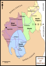
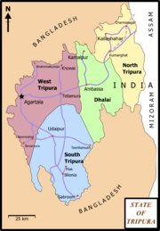
. It is on the National Highway No. 44 of India. It is also the head-quarters of the recently included sub-division of Teliamura. It is located 45 km from Agartala, Capital of Tripura, 35 km from Khowai
Khowai
Khowai is a town and a nagar panchayat in West Tripura district in the Indian state of Tripura. It is named after the Khowai river passing by the town. It is near the bangladesh border.-Demographics:...
and 42 km from Ambassa
Ambassa
Ambassa is a census town and the headquarters of the Dhalai district of the Indian state of Tripura.-Demographics: India census, Ambassa had a population of 6052. Males constitute 54% of the population and females 46%. Ambassa has an average literacy rate of 70%, higher than the national average of...
.
Demographics
India censusCensus
A census is the procedure of systematically acquiring and recording information about the members of a given population. It is a regularly occurring and official count of a particular population. The term is used mostly in connection with national population and housing censuses; other common...
GOI Teliamura has a population of 19,605. Males constitute 51% of the population and females 49%. Teliamura has an average literacy rate of 81%, higher than the national average of 59.5%: male literacy is 85%, and female literacy is 78%. In Teliamura, 10% of the population is under 6 years of age.
Education
SchoolsTransport
TrainIt is well connected by Railways. Teliamura Railway Station is situated at Trishabari distance from 3 km away from Teliamura main Town.
Road
National Highway 44 connects Teliamura to Assam and the rest of India by road. It is also connected to Khowai, Amarpur by Road.

