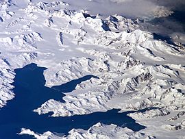
Thatcher Peninsula
Encyclopedia

Cove
A cove is a small type of bay or coastal inlet. They usually have narrow, restricted entrances, are often circular or oval, and are often inside a larger bay. Small, narrow, sheltered bays, inlets, creeks, or recesses in a coast are often considered coves...
in north-central South Georgia terminating to the north in Mai Point
Mai Point
Mai Point is a point marking the east side of the entrance to Maiviken, a small bay in Cumberland West Bay, South Georgia. Charted by the Swedish Antarctic Expedition, 1901–04, under Nordenskjold. The name derives from association with Maiviken....
, rising between Cumberland West Bay
Cumberland West Bay
Cumberland West Bay is a bay forming the western arm of Cumberland Bay, South Georgia. It is entered southward of Larsen Point, where it is wide, and extends in a southwest direction. This feature was surveyed by the Swedish Antarctic Expedition, 1901–04, who named it West Bay. It was remapped...
to the west, and Cumberland East Bay
Cumberland East Bay
Cumberland East Bay is a bay forming the eastern arm of Cumberland Bay, South Georgia. It is entered between Sappho Point and Barff Point, where it is nearly 3 miles wide, and extends 8 miles in a southeast direction. This feature was surveyed by the Swedish Antarctic Expedition, 1901-04, who...
and Moraine Fjord
Moraine Fjord
Moraine Fjord is an inlet 3.5 miles long with a reef extending across its entrance, forming the west head of Cumberland East Bay, South Georgia. Charted by the Swedish Antarctic Expedition under Nordenskjold, 1901-04, who so named it because of the large glacial moraine at its entrance....
to the east; bounded to the southwest and south by Lyell Glacier
Lyell Glacier, South Georgia
For the glacier located on Mount Lyell in California, see Lyell GlacierLyell Glacier is a glacier flowing in a north direction to Harpon Bay at the southeast head of Cumberland West Bay, South Georgia...
and Hamberg Glacier
Hamberg Glacier
Hamberg Glacier is a glacier which flows in an east-northeast direction from the northeast side of Mount Sugartop to the west side of the head of Moraine Fjord, South Georgia. Charted by the Swedish Antarctic Expedition, 1901-04, under Nordenskjold, who named it for Axel Hamberg, Swedish...
. King Edward Cove
King Edward Cove
King Edward Cove is a sheltered cove immediately southwest of Mount Duse, in the west side of Cumberland East Bay, South Georgia. This cove, frequented by early sealers at South Georgia, was charted by the Swedish Antarctic Expedition, 1901-04, under Nordenskjold. It was named in about 1906 for...
on the east side of the peninsula is the site of the British Antarctic Survey
British Antarctic Survey
The British Antarctic Survey is the United Kingdom's national Antarctic operation and has an active role in Antarctic affairs. BAS is part of the Natural Environment Research Council and has over 400 staff. It operates five research stations, two ships and five aircraft in and around Antarctica....
(BAS) Grytviken
Grytviken
Grytviken is the principal settlement in the British territory of South Georgia in the South Atlantic. It was so named in 1902 by the Swedish surveyor Johan Gunnar Andersson who found old English try pots used to render seal oil at the site. It is the best harbour on the island, consisting of a...
station and the disused whaling station of the same name.
Thatcher Peninsula was named by the United Kingdom Antarctic Place-Names Committee (UK-APC) in 1991, at the suggestion of members of the Royal Geographical Society
Royal Geographical Society
The Royal Geographical Society is a British learned society founded in 1830 for the advancement of geographical sciences...
, after Margaret Thatcher
Margaret Thatcher
Margaret Hilda Thatcher, Baroness Thatcher, was Prime Minister of the United Kingdom from 1979 to 1990...
, British Prime Minister, 1979-1990. She was described by Sir Vivian Fuchs
Vivian Fuchs
Sir Vivian Ernest Fuchs FRS was an English explorer whose expeditionary team completed the first overland crossing of Antarctica in 1958.- Biography :...
, chair of the Foreign Office's Antarctic Place Names Committee, as 'a major figure in the history of South Georgia', for her role in the Falklands War
Falklands War
The Falklands War , also called the Falklands Conflict or Falklands Crisis, was fought in 1982 between Argentina and the United Kingdom over the disputed Falkland Islands and South Georgia and the South Sandwich Islands...
: 'The geographical tribute appropriately encompasses the spot where the first troops from the Task Force landed in April 1982.' Thatcher was, according to friends, 'flattered and amused' by the honour.

