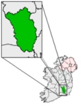
The Rower
Encyclopedia
Rower or The Rower is a small village in County Kilkenny
, Ireland. The Rower is on the R705
regional road
, roughly 30 km from both Waterford
and Kilkenny
. It is within the parish of the same name, which is about five miles (8 km) in length from north to south, by about three miles in breadth.
It lies on the slopes of Brandon Hill
and Cullintra Hill. It has a primary school, two churches, a GAA
field and community hall. The ruined castle of Coolkill, said to have belonged to the Butler family, is nearby; and there are several broken dolmen
s in the vicinity of Ballynabarna.
. Within its limits was Ringwood, the seat of Lord Clifden, and an ancient residence of the Bolger family. The parish comprised 10,508 statute acres, as applotted under the tithe act, of which about 1000 acres (4 km²) consist of mountain, and a small portion of bog.
County Kilkenny
County Kilkenny is a county in Ireland. It is part of the South-East Region and is also located in the province of Leinster. It is named after the city of Kilkenny. The territory of the county was the core part of the ancient Irish Kingdom of Osraige which in turn was the core of the Diocese of...
, Ireland. The Rower is on the R705
R705 road
The R705 road is a regional road in Ireland which runs north-south from the M9 at Leighlinbridge in County Carlow and through Muine Bheag before crossing into County Kilkenny....
regional road
Regional road
A regional road in Ireland is a class of road not forming a major route , but nevertheless forming a link in the national route network. There are over 11,600 kilometres of regional roads. Regional roads are numbered with three digit route numbers, prefixed by "R" A regional road in Ireland is a...
, roughly 30 km from both Waterford
Waterford
Waterford is a city in the South-East Region of Ireland. It is the oldest city in the country and fifth largest by population. Waterford City Council is the local government authority for the city and its immediate hinterland...
and Kilkenny
Kilkenny
Kilkenny is a city and is the county town of the eponymous County Kilkenny in Ireland. It is situated on both banks of the River Nore in the province of Leinster, in the south-east of Ireland...
. It is within the parish of the same name, which is about five miles (8 km) in length from north to south, by about three miles in breadth.
It lies on the slopes of Brandon Hill
Brandon Hill
Brandon Hill is the highest mountain in County Kilkenny, Ireland. It has an elevation of . It is situated 7 miles east of Thomastown, in the south of County Kilkenny. Brandon Hill is in the barony of Gowran and in the province of Leinster...
and Cullintra Hill. It has a primary school, two churches, a GAA
Gaelic Athletic Association
The Gaelic Athletic Association is an amateur Irish and international cultural and sporting organisation focused primarily on promoting Gaelic games, which include the traditional Irish sports of hurling, camogie, Gaelic football, handball and rounders...
field and community hall. The ruined castle of Coolkill, said to have belonged to the Butler family, is nearby; and there are several broken dolmen
Dolmen
A dolmen—also known as a portal tomb, portal grave, dolmain , cromlech , anta , Hünengrab/Hünenbett , Adamra , Ispun , Hunebed , dös , goindol or quoit—is a type of single-chamber megalithic tomb, usually consisting of...
s in the vicinity of Ballynabarna.
History
Older spellings of the name include Roar, Rowar and Tamplerowar. Rower was a parish in the historical Barony of IdaBarony of Ida
A Barony in the south-eastern part of Kilkenny. Named for the three Ossory tribal lands in this area, described as Ida, Igrinn and Iberchon which later merged into the Barony of Ida.-See also:*...
. Within its limits was Ringwood, the seat of Lord Clifden, and an ancient residence of the Bolger family. The parish comprised 10,508 statute acres, as applotted under the tithe act, of which about 1000 acres (4 km²) consist of mountain, and a small portion of bog.
See also
- List of towns and villages in Ireland

