Uncompahgre Wilderness
Encyclopedia
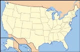
The Uncompahgre Wilderness (formally called the Big Blue Wilderness) is a U.S. Wilderness Area in southwest Colorado
comprising 102,721 acres (415 km2). Elevation in the Wilderness ranges from 8400 feet (2,560.3 m) to 14309 feet (4,361.4 m), at the summit of Uncompahgre Peak.
Managed by the Uncompahgre National Forest
, it is located approximately 5 miles (8 km) northwest of the town of Lake City
and some 10 miles (16 km) east of the town of Ouray
.
The area is named for Uncompahgre Peak
(14,309 ft / 4361 m), the highest peak in the San Juan Mountains
. The Wilderness includes one other prominent fourteener, Wetterhorn Peak
(14,015 ft / 4271 m).
, Colorado. Marjorie Miller’s father staked the claims in 1938, more than 50 years before the land was designated Wilderness, and was preserved by the General Mining Act of 1872
. The Forest Service has established requirements that would lessen mining impacts, such as reducing motorized vehicle use and night lighting. The Millers say workers will use picks and shovels to extract ore, haul it out with mule teams over existing trails, and use helicopters to deliver larger equipment to avoid the impacts of truck use. Environmental groups have expressed concern that acid mine drainage
and the human footprint created by mining activities will degrade the Wilderness.
Colorado
Colorado is a U.S. state that encompasses much of the Rocky Mountains as well as the northeastern portion of the Colorado Plateau and the western edge of the Great Plains...
comprising 102,721 acres (415 km2). Elevation in the Wilderness ranges from 8400 feet (2,560.3 m) to 14309 feet (4,361.4 m), at the summit of Uncompahgre Peak.
Managed by the Uncompahgre National Forest
Uncompahgre National Forest
Uncompahgre National Forest is a U.S. National Forest covering 955,229 acres in parts of Montrose, Mesa, San Miguel, Ouray, Gunnison, San Juan, and Delta Counties in western Colorado...
, it is located approximately 5 miles (8 km) northwest of the town of Lake City
Lake City, Colorado
The Town of Lake City is a Statutory Town that is the county seat of, and the only incorporated municipality in, Hinsdale County, Colorado, United States. The town population was 375 at the U.S. Census 2000...
and some 10 miles (16 km) east of the town of Ouray
Ouray, Colorado
The historic City of Ouray is a Home Rule Municipality that is the county seat and the most populous city of Ouray County, Colorado, United States. The city population was 813 at the U.S. Census 2000 and 1,000 as of the U.S. Census 2010...
.
The area is named for Uncompahgre Peak
Uncompahgre Peak
Uncompahgre Peak is the sixth highest mountain peak in the U.S. state of Colorado and is the highest peak of the San Juan Mountains. It is located in the Uncompahgre Wilderness in the northern San Juans, in northern Hinsdale County approximately 7 miles west of the town of Lake City.Uncompahgre...
(14,309 ft / 4361 m), the highest peak in the San Juan Mountains
San Juan Mountains
The San Juan Mountains are a high and rugged mountain range in the Rocky Mountains in southwestern Colorado. The area is highly mineralized and figured in the gold and silver mining industry of early Colorado. Major towns, all old mining camps, include Creede, Lake City, Silverton, Ouray, and...
. The Wilderness includes one other prominent fourteener, Wetterhorn Peak
Wetterhorn Peak
Wetterhorn Peak is a fourteen thousand foot mountain peak in the U.S. state of Colorado. It is located in the Uncompahgre Wilderness of the northern San Juan Mountains, in northwestern Hinsdale County and southeastern Ouray County, east of the town of Ouray...
(14,015 ft / 4271 m).
Mining claim
Located within the Uncompahgre Wilderness is the Robin Redbreast Gold Mine, owned by Robert and Marjorie Miller of MontroseMontrose, Colorado
The City of Montrose is a Home Rule Municipality that is the county seat and the most populous city of Montrose County, Colorado, United States. The United States Census Bureau estimates that the city population was 15,479 in 2005. The main road that leads in and out of Montrose is U.S...
, Colorado. Marjorie Miller’s father staked the claims in 1938, more than 50 years before the land was designated Wilderness, and was preserved by the General Mining Act of 1872
General Mining Act of 1872
The General Mining Act of 1872 is a United States federal law that authorizes and governs prospecting and mining for economic minerals, such as gold, platinum, and silver, on federal public lands...
. The Forest Service has established requirements that would lessen mining impacts, such as reducing motorized vehicle use and night lighting. The Millers say workers will use picks and shovels to extract ore, haul it out with mule teams over existing trails, and use helicopters to deliver larger equipment to avoid the impacts of truck use. Environmental groups have expressed concern that acid mine drainage
Acid mine drainage
Acid mine drainage , or acid rock drainage , refers to the outflow of acidic water from metal mines or coal mines. However, other areas where the earth has been disturbed may also contribute acid rock drainage to the environment...
and the human footprint created by mining activities will degrade the Wilderness.
External links
- Wilderness Areas - Grand Mesa, Uncompahgre and Gunnison National Forests
- Uncompahgre Wilderness - Wilderness.net
- Uncompahgre Wilderness Area - ColoradoWilderness.com
- Uncompahgre Wilderness, Colorado - GORP

