Vesdre
Encyclopedia


French language
French is a Romance language spoken as a first language in France, the Romandy region in Switzerland, Wallonia and Brussels in Belgium, Monaco, the regions of Quebec and Acadia in Canada, and by various communities elsewhere. Second-language speakers of French are distributed throughout many parts...
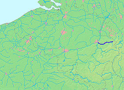
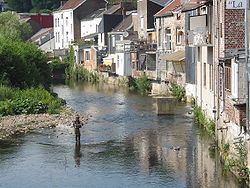
) is a river in eastern Belgium
Belgium
Belgium , officially the Kingdom of Belgium, is a federal state in Western Europe. It is a founding member of the European Union and hosts the EU's headquarters, and those of several other major international organisations such as NATO.Belgium is also a member of, or affiliated to, many...
, in the province of Liège
Liège (province)
Liège is the easternmost province of Belgium and belongs to the Walloon Region. It is an area of French and German ethnicity. It borders on the Netherlands, Germany, Luxembourg, and in Belgium the provinces of Luxembourg, Namur, Walloon Brabant , and those of Flemish Brabant and Limburg . Its...
, and is a right tributary to the river Ourthe
Ourthe
The Ourthe is a 165 km long river in the Ardennes in Wallonia . It is a right tributary to the river Meuse. The Ourthe is formed at the confluence of the Ourthe Occidentale and the Ourthe Orientale , west of Houffalize.The source of the Ourthe Occidentale is near Libramont-Chevigny, in the...
. Its source lies in the High Fens
High Fens
The High Fens , which were declared a nature reserve in 1957, are an upland area, a plateau region in the province of Liège, in the east of Belgium and nearby parts of Germany, lying between the Ardennes and the Eifel highlands. It is the largest nature reserve or park in Belgium, with an area of ;...
(Hohes Venn, Hautes Fagnes), close to the border with Germany
Germany
Germany , officially the Federal Republic of Germany , is a federal parliamentary republic in Europe. The country consists of 16 states while the capital and largest city is Berlin. Germany covers an area of 357,021 km2 and has a largely temperate seasonal climate...
near Monschau
Monschau
Monschau is a small resort town in the Eifel region of western Germany, located in the district Aachen, North Rhine-Westphalia.-Geography:The town is located in the hills of the North Eifel, within the Hohes Venn – Eifel Nature Park in the narrow valley of the Rur river.The historic town center...
. It flows through an artificial lake (:fr:Barrage de la Vesdre), and then through the towns Eupen
Eupen
Eupen is a municipality in the Belgian province of Liège, from the German border , from the Dutch border and from the "High Fens" nature reserve...
, Verviers
Verviers
Verviers is a Walloon city and municipality located in the Belgian province of Liège. The Verviers municipality includes the old communes of Ensival, Lambermont, Petit-Rechain, Stembert, and Heusy...
, Pepinster
Pepinster
Pepinster is a Walloon municipality of Belgium in Province of Liege. On January 1, 2006 Pepinster had a total population of 9,560. The total area is 24.79 km² which gives a population density of 386 inhabitants per km²...
and Chaudfontaine
Chaudfontaine
Chaudfontaine is a Walloon municipality located in the Belgian province of Liège. On January 1, 2006 Chaudfontaine had a total population of 21,012. The total area is 25.52 km² which gives a population density of 823 inhabitants per km²....
. The Vesdre flows into the Ourthe a few kilometers from Liège. Its total length is approximately 60 kilometers.
The water of the Vesdre has a high acidity (due to the Hautes Fagnes bog
Bog
A bog, quagmire or mire is a wetland that accumulates acidic peat, a deposit of dead plant material—often mosses or, in Arctic climates, lichens....
s), which made it very suitable for the textiles industry around Verviers
Verviers
Verviers is a Walloon city and municipality located in the Belgian province of Liège. The Verviers municipality includes the old communes of Ensival, Lambermont, Petit-Rechain, Stembert, and Heusy...
. The Vesdre was the far eastern end of the sillon industriel
Sillon industriel
The sillon industriel is the former industrial backbone of Wallonia and thus of Belgium. It runs across Wallonia, passing from Dour, in Borinage, in the west, to Verviers in the east, through Mons, La Louvière, Charleroi, Namur, Huy, and Liège, following the valleys of the rivers Haine, Sambre,...
, the backbone of Walloon industry. Nowadays, the water of the Vesdre is mainly used as drinking water.

