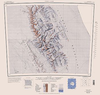
Vinson Plateau
Encyclopedia

Vinson Massif
Vinson Massif is the highest mountain of Antarctica, lying in the Sentinel Range of the Ellsworth Mountains, which stand above the Ronne Ice Shelf near the base of the Antarctic Peninsula. The massif is located about from the South Pole and is about long and wide. At the highest point is Mount...
, Sentinel Range
Sentinel Range
The Sentinel Range is a major mountain range situated northward of Minnesota Glacier and forming the northern half of the Ellsworth Mountains in Antarctica. The range trends NNW-SSE for about and is 24 to 48 km wide...
in Ellsworth Mountains
Ellsworth Mountains
The Ellsworth Mountains are the highest mountain ranges in Antarctica, forming a long and wide chain of mountains in a north to south configuration on the western margin of the Ronne Ice Shelf. They are bisected by Minnesota Glacier to form the northern Sentinel Range and the southern Heritage...
, Antarctica. It extends for 9 km between Goodge Col
Goodge Col
Goodge Col is a broad ice-covered col at 3600 m elevation between the south side of Mount Shinn and the Vinson Massif in the Sentinel Range, Ellsworth Mountains in Antarctica. The col is relatively level, 1.5 miles wide, and is easily identified from positions east and west of the range...
and Hammer Col
Hammer Col
Hammer Col is a broad ice-covered col at 3800 m elevation between the south part of Vinson Massif and the Craddock Massif in the Sentinel Range, Ellsworth Mountains...
linking it to the north-central part of Sentinel Range
Sentinel Range
The Sentinel Range is a major mountain range situated northward of Minnesota Glacier and forming the northern half of the Ellsworth Mountains in Antarctica. The range trends NNW-SSE for about and is 24 to 48 km wide...
to the north-northwest and to Craddock Massif
Craddock Massif
Craddock Massif is a mountain massif in the Sentinel Range of the Ellsworth Mountains, in the Chilean claim of West Antarctica.-Location and highest point:...
to the south-southeast respectively, and 4.5 km wide between Branscomb Peak and Silverstein Peak
Silverstein Peak
Silverstein Peak is a prominent high peak on the west edge of the ice-covered Vinson Plateau in the Sentinel Range of Ellsworth Mountains, Antarctica....
to the west and Schoening Peak and Marts Peak to the east. Elevation from 4000 m to 4600 m above sea level. Rising from the plateau is the summit of Antarctica Mount Vinson (4892 m), and several other peaks higher than 4700 m, albeit of modest prominence: Clinch Peak (4841 m), Corbet Peak (4822 m), Silverstein Peak
Silverstein Peak
Silverstein Peak is a prominent high peak on the west edge of the ice-covered Vinson Plateau in the Sentinel Range of Ellsworth Mountains, Antarctica....
(4790 m), Schoening Peak (4743 m) and Hollister Peak (4729 m). The central part of the plateau is drained by Roché Glacier
Roché Glacier
Roché Glacier is the 5.8 km long and 2 km wide glacier draining the central part of Vinson Plateau in Sentinel Range, Ellsworth Mountains in Antarctica...
and a tributary glacier in Jacobsen Valley
Jacobsen Valley
Jacobsen Valley is the shallow valley in Vinson Massif, Sentinel Range in Ellsworth Mountains, descending northwards from the summit of Antarctica Mount Vinson . It is 3.5 km long and 1.2 km wide, and is bounded to the west by Branscomb Peak and Galicia Peak, and to the east by a minor ridge...
, with both of them joining Branscomb Glacier
Branscomb Glacier
The Branscomb Glacier is an Antarctic glacier, 9.5 km long, flowing west from the north-west side of Vinson Massif into Nimitz Glacier, in the Sentinel Range of the Ellsworth Mountains...
.
The plateau takes its name from Vinson Massif, honouring the US statesman Carl Vinson
Carl Vinson
Carl Vinson was a United States Representative from Georgia. He was a Democrat and the first person to serve for more than 50 years in the United States House of Representatives...
(1883-1981).
Location
Vinson Plateau is centred at 78°32′00"S 85°35′00"W. US mapping in 1961, 1988 and 2007.Maps
- Vinson Massif. Scale 1:250 000 topographic map. Reston, Virginia: US Geological Survey, 1988.
- D. Gildea and C. Rada. Vinson Massif and the Sentinel Range. Scale 1:50 000 topographic map. Omega Foundation, 2007.

